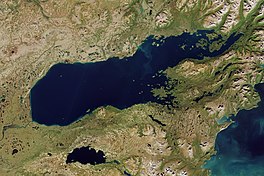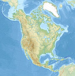
The Kenai Peninsula is a large peninsula jutting from the coast of Southcentral Alaska. The name Kenai is derived from the word "Kenaitze" or "Kenaitze Indian Tribe", the name of the Native Athabascan Alaskan tribe, the Kahtnuht’ana Dena’ina, who historically inhabited the area. They called the Kenai Peninsula Yaghanen.

Lake Clark National Park and Preserve is a United States national park and preserve in southwest Alaska, about 100 miles (160 km) southwest of Anchorage. The park was first proclaimed a national monument in 1978, then established as a national park and preserve in 1980 by the Alaska National Interest Lands Conservation Act. The park includes many streams and lakes vital to the Bristol Bay salmon fishery, including its namesake Lake Clark. A wide variety of recreational activities may be pursued in the park and preserve year-round. The park protects rainforests along the coastline of Cook Inlet, alpine tundra, glaciers, glacial lakes, major salmon-bearing rivers, and two volcanoes, Mount Redoubt and Mount Iliamna. Mount Redoubt is active, erupting in 1989 and 2009. The wide variety of ecosystems in the park mean that virtually all major Alaskan animals, terrestrial and marine, may be seen in and around the park. Salmon, particularly sockeye salmon, play a major role in the ecosystem and the local economy. Large populations of brown bears are attracted to feed on the spawning salmon in the Kijik River and at Silver Salmon Creek. Bear watching is a common activity in the park.
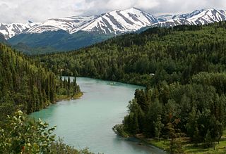
The Kenai River called Kahtnu in the Dena'ina language, is the longest river in the Kenai Peninsula of southcentral Alaska. It runs 82 miles (132 km) westward from Kenai Lake in the Kenai Mountains, through the Kenai National Wildlife Refuge and Skilak Lake to its outlet into the Cook Inlet of the Pacific Ocean near Kenai and Soldotna.
The Swanson River (Dena'ina: Yaghetnu) is a stream, 40 miles (64 km) long, on the Kenai Peninsula of south-central Alaska in the United States. Beginning at Gene Lake in the Swanson Lakes district, it flows southwest then north to Number Three Bay on the Gompertz Channel of Cook Inlet.
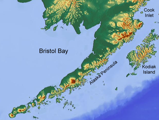
Bristol Bay is the easternmost arm of the Bering Sea, at 57° to 59° North 157° to 162° West in Southwest Alaska. Bristol Bay is 400 km (250 mi) long and 290 km (180 mi) wide at its mouth. A number of rivers flow into the bay, including the Cinder, Egegik, Igushik, Kvichak, Meshik, Nushagak, Naknek, Togiak, and Ugashik.
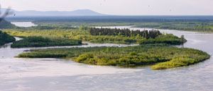
The Nushagak River is a river in southwest Alaska, United States. It begins in the Alaska Range and flows southwest 450 km (280 mi) to Nushagak Bay, an inlet of Bristol Bay, east of Dillingham, Alaska.

The Kvichak River is a large river, about 50 miles (80 km) long, in southwestern Alaska in the United States. It flows southwest from Lake Iliamna to Kvichak Bay, an arm of Bristol Bay, on the Alaska Peninsula. The communities of Igiugig and Levelock lie along the Kvichak River. The Kvichak is navigable along its entire length, and is used as a short cut by boats getting between Cook Inlet and Bristol Bay via the Lake Iliamna portage.

Naknek River is a stream, 35 miles (56 km) long, in the Bristol Bay Borough of the U.S. state of Alaska. It flows west from Naknek Lake to empty into Kvichak Bay, an arm of Bristol Bay. The river and lake are both known for their sockeye and other salmon.

Naknek Lake is a lake in southern Alaska, near the base of the Alaska Peninsula. Located in Katmai National Park and Preserve, the lake is 40 miles (64 km) long and three to eight miles wide, the largest lake in the park. The lake drains west into Bristol Bay through the Naknek River. The elevation of the lake has lowered over the past 5,000 years as it has cut through a glacial moraine, separating Naknek Lake and Brooks Lake and creating Brooks Falls about 3500 years ago.
The Newhalen River is a 22-mile (35 km) stream in the Lake and Peninsula Borough of the U.S. state of Alaska. Beginning at Six Mile Lake, the Newhalen flows south to enter Iliamna Lake about 3 miles (5 km) south of Iliamna.

Lake Clark is a lake in southwest Alaska. It drains through Six Mile Lake and the Newhalen River into Iliamna Lake. The lake is about 64 km (40 mi) long and about 8 km (5.0 mi) wide.

The Alagnak River is a 64-mile (103 km) tributary of the Kvichak River in the U.S. state of Alaska. It has a catchment area of approximately 1400 square mi (3600 km2). It is located in central Lake and Peninsula Borough.

The Denaʼina, or formerly Tanaina, are an Alaska Native Athabaskan people. They are the original inhabitants of the south central Alaska region ranging from Seldovia in the south to Chickaloon in the northeast, Talkeetna in the north, Lime Village in the northwest and Pedro Bay in the southwest. The Denaʼina homeland is more than 41,000 sq mi (110,000 km2) in area. They arrived in the south-central Alaska sometime between 1,000 and 1,500 years ago. They were the only Alaskan Athabaskan group to live on the coast. The Denaʼina have a hunter-gatherer culture and a matrilineal system. The Iditarod Trail's antecedents were the native trails of the Denaʼina and Deg Hitʼan Athabaskan Native Alaskans and the Inupiaq Inuit.
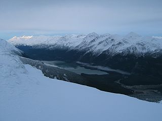
The Chilkoot Lake, in the Tlingit Indians region of Alaska, is also spelt Chilcoot Lake. Its other local names are the Akha Lake and Tschilkut S(ee), meaning "Chilkoot Lake". It is in Haines Borough, Alaska. Chilkoot also means "big fish". The lake has a ‘Recreation Site’ at its southern end near the outlet to the Chilkoot River, which is set amidst the Sitka spruce trees. Chilkoot River flows from the lake for a short length and debouches into the Lutak Channel at the head of the Chilkoot inlet near Haines. Chilkoot village, a settlement of Chilkoot Indians existed at the outlet of the lake, which was called Tschilkut or Tananel or Chilcoot; the lake is named after this village. This village is now a camping area developed by the State Parks and Outdoor Recreation Division of the Alaska Department of Natural Resources. The lake is a popular location for Kayaking.

Southwest Alaska is a region of the U.S. state of Alaska. The area is not exactly defined by any governmental administrative region(s); nor does it always have a clear geographic boundary.
The Chakachatna River is a stream, 36 miles (58 km) long, in northwestern Kenai Peninsula Borough in the U.S. state of Alaska. It flows from Chakachamna Lake southeastward into the McArthur River, which flows into the Gompertz Channel of Cook Inlet. The river mouth is about 3 miles (5 km) north of Trading Bay and 32 miles (51 km) northwest of Kenai.

The Egegik River is a waterway in the U.S. state of Alaska. A biological survey was conducted at the base of the Alaska Peninsula in 1902 by Wilfred Hudson Osgood, which included the Egegik River.

Pebble Mine is the common name of a proposed copper-gold-molybdenum mining project in the Bristol Bay region of Southwest Alaska, near Lake Iliamna and Lake Clark. It was discovered in 1987, optioned by Northern Dynasty Minerals in 2001, explored in 2002, and drilled from 2002-2013 with discovery in 2005. Preparing for the permitting process began and administrative review lasted over 13 years.

Iliamna Bay is a bay along the southeastern coast of the Alaska Peninsula. It is below the Chigmit Mountains. Old Iliamna is miles away and the Iliamna River are north of it. Cottonwood Bay borders it to the west and Cook Inlet to the south. Augustine Volcano, an island, is south of it.
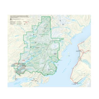
The Iliamna River is a river in Alaska that flows into Iliamna Lake. Old Iliamna was located near the confluence. Guth's Lodge is located along the river. The Chigmit Mountains are to the northeast. The river is by Lonesome Point, Old Iliamna and Pile Bay Village.
