Related Research Articles

The Monpa or Mönpa is a major tribe of Arunachal Pradesh in northeastern India. The Tawang Monpas have a migration history from Changrelung. The Monpa are believed to be the only nomadic tribe in Northeast India - they are totally dependent on animals like sheep, cow, yak, goats and horses. The Monpa have a very close affinity with the Sharchops of Bhutan. Their languages are Tibeto-Burman languages written with the Tibetan alphabet.
The Siliguri Corridor is a stretch of land in Eastern South Asia, 22 kilometres (14 mi) at the narrowest section, located around the city of Siliguri in West Bengal, India. This geo-political and geo-economical corridor or isthmus connects the seven states of northeast India to the rest of India. The countries of Nepal and Bangladesh lie on each side of the corridor and the Kingdom of Bhutan lies at the northern end of the corridor. The Kingdom of Sikkim formerly lay on the northern side of the corridor, until its merging with India in 1975.

Walong is an administrative town and the headquarters of eponymous circle in the Anjaw district in eastern-most part of Arunachal Pradesh state in India. It also has a small cantonment of the Indian Army. Walong is on banks of Lohit River, which enters India 35 km north of Walong at India-China LAC at Kaho pass.
The Ministry of Development of North Eastern Region is a Government of India ministry, established in September 2001, which functions as the nodal Department of the Central Government to deal with matters related to the socio-economic development of the eight States of Northeast India: Arunachal Pradesh, Assam, Manipur, Meghalaya, Mizoram, Nagaland, Tripura and Sikkim. It acts as a facilitator between the Central Ministries/ Departments and the State Governments of the North Eastern Region in the economic development including removal of infrastructural bottlenecks, provision of basic minimum services, creating an environment for private investment and to remove impediments to lasting peace and security in the North Eastern Region.
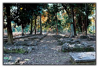
Jairampur cemetery is a World War II cemetery in Arunachal Pradesh, India. It is located 7 km from Jairampur, Changlang district, and 25 km from Pangsau Pass, the Indo-Myanmar Border on the road to Ledo. It was discovered in 1997.
The Trans-Arunachal Highway (TAH), which includes an existing 1,811 km (1,125 mi) route comprising NH-13 and parts of NH-15, NH-215 and SH-25, is an under-construction 2-lane more than 2,407 km (1,496 mi) long highway passing through 16 districts in Arunachal Pradesh state in India. It runs from LAC in Tawang in northwest to Kanubari in southeast at tri-junction of Assam-Nagaland-Arunachal Pradesh. It connects at least 16 districts of Arunachal Pradesh.
Tuting is a town on the bank of Brahmaputra at a distance of 34 km south of McMahon Line and 170 kilometres north of Yingkiong in Upper Siang district in the north-eastern state of Arunachal Pradesh in India. It is where the panchayat, assembly constituency, and Indian Military headquarters is. Since Tuting lies near the Line of Actual Control (LAC), an area disputed by India-China, the border area was in spotlight in January 2018 due to Chinese People's Liberation Army incursion and attempted construction of roads inside Indian territory.

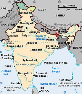
Arunachal Pradesh is primarily a hilly tract nestled in the foothills of the Himalayas in northeast India. It is spread over an area of 83,743 km2 (32,333 sq mi). 98% of the geographical area is land out of which 80% is forest cover; 2% is water. River systems in the region, including those from the higher Himalayas and Patkoi and Arakan Ranges, eventually drain into the Brahmaputra River.
Unified Payments Interface (UPI) is an instant real-time payment system developed by National Payments Corporation of India (NPCI) facilitating inter-bank peer-to-peer (P2P) and person-to-merchant (P2M) transactions. NPCI is umbrella organisation for all digital payments. The interface is regulated by the Reserve Bank of India (RBI) and works by instantly transferring funds between two bank accounts on a mobile platform. As of January 2022, there are 297 banks available on UPI with a monthly volume of 461 crore transactions and a value of ₹8.31 lakh crore (US$110 billion). UPI witnessed 6,800 crore transactions till November 2021. The mobile-only payment system helped transact a total of ₹34.95 lakh crore (US$460 billion) during the 67 months of operation starting from 2016. As of May 2021, the platform has 15 crore monthly active users in India with plans to achieve 50 crore (500 million) by 2025. IIT Madras is also working to integrate voice command feature that can support English and Indian vernacular languages in the future. The proportion of UPI transactions in total volume of digital transactions grew from 23% in 2018-19 to 55% in 2020-21 with an average value of ₹1,849 per transaction. Digital transactions worth ₹8.31 lakh crore in January 2022 with UPI

Beginning on 5 May 2020, Chinese and Indian troops engaged in aggressive melee, face-offs, and skirmishes at locations along the Sino-Indian border, including near the disputed Pangong Lake in Ladakh and the Tibet Autonomous Region, and near the border between Sikkim and the Tibet Autonomous Region. Additional clashes also took place at locations in eastern Ladakh along the Line of Actual Control (LAC).
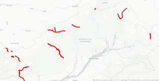
India-China Border Roads is a Government of India project for developing infrastructure along the Sino-Indian border by constructing strategic roads, including bridges and tunnels. The ICBR project is largely in response to Chinese infrastructure development along the borderlands with India.
In early May 2020, troops of the People's Liberation Army and Indian Army engaged in melee at locations along the notional Line of Actual Control (LAC), the disputed boundary between China and India. It escalated on 15/16 June 2020 resulting in deaths on both sides. Indian sources reported the deaths of 20 Indian soldiers and casualties of at least 45 Chinese soldiers. China reported 4 deaths. On 7 September, for the first time in 45 years, shots were fired along the LAC, with both sides blaming each other for the firing. Indian media also reported that Indian troops fired warning shots at the PLA on 30 August.

Zemithang or Zimithang, also called Pangchen, is a village and the headquarters of an eponymous circle in the Tawang district of Indian state of Arunachal Pradesh. It is on the bank of the Nyamjang Chu river, which originates in Tibet and enters India from the north near the locality called Khinzemane.
Gelemo or Gelomo (full name: Gelomoring) is a border village in the Upper Subansiri district, Arunachal Pradesh, India. It is on the bank of the Tsari Chu river before its confluence with the Subansiri River, at a distance of "two days march" from the Indian claimed border at Longju. The present Line of Actual Control between China and India is at roughly half that distance.
Kepang La or Kapang La is a mountain pass on the Indo-Tibetan border or Line of Actual Control. The Yarlung Tsangpo enters India just south-east of the pass from where it is called the Siang River. The pass is located at a distance of about 4 kilometers from Gelling under Tuting in the Upper Siang district of India's Arunachal Pradesh. On the Chinese side, it is located at a distance of 6 kilometers from Xirang Village (西让村), which falls under Beibeng Township, Mêdog County. Before the 1962 war, the pass facilitated barter trade between the locals on both sides. In 1962 the pass was used by People's Liberation Army troops to cross over into Indian administered territory. In August 2018, Kepang La was designated as a prospective border personnel meeting (BPM) point.

Border disputes of Northeast India mainly include inter-state conflict between Assam–Mizoram, Assam–Arunachal Pradesh, Assam–Nagaland and Assam–Meghalaya. The disputes, including clashes between rival police forces, have resulted in the loss of life, livelihood and property. The border disputes in some cases are part of the larger national (separatist), sub-regional and ethnic conflicts, as well as criminal enterprise fuelled. This internal land conflict in the districts of the northeast are part of the 322 districts affected by ongoing land conflicts out of a total of 703 districts in India.
Vartak, also known as Project VARTAK is a project of the Border Roads Organisation under the Ministry of Defence of India. It was formed on 7 May 1960 as a provision of the 2nd Border Roads Development Board Meeting with the then Prime Minister of India Jawahar Lal Nehru as Project Tusker, which was later renamed to Project Vartak in 1963. The initial task of this project was to construct and maintain roads between Bhalukpong and Tenga. It is the first established project of Border Roads Organisation. Its task was later expanded to construct and maintain roads in Arunachal Pradesh and adjoining districts of Assam. Major General O.M Mani was the first Chief Engineer of the project.
References
- Notes
- Citations
- ↑ Kurian 2014, p. Closing the Infrastructure Gap.
- ↑ Rajagopalan 2013, p. 13.
- ↑ Mukherjee 2019, Chapter 6.
- ↑ Som, Vishnu (20 November 2020). "China Sets Up Village Within Bhutan, 9 Km From Doklam Face-Off Site". NDTV.com. Retrieved 2021-11-22.
{{cite web}}: CS1 maint: url-status (link) - ↑ Griffiths, James; Suri, Manveena (25 November 2020). "Satellite images appear to show China developing area along disputed border with India and Bhutan". CNN. Retrieved 2020-11-24.
{{cite web}}: CS1 maint: url-status (link) - ↑ Som, Vishnu (18 January 2021). "Exclusive: China Has Built Village In Arunachal, Show Satellite Images". NDTV.com. Retrieved 2021-11-22.
{{cite web}}: CS1 maint: url-status (link) - ↑ Som, Vishnu (18 November 2021). "Second China-Constructed Enclave In Arunachal, Show New Satellite Images". NDTV.com. Retrieved 2021-11-22.
{{cite web}}: CS1 maint: url-status (link) - 1 2 Ranade, Jayadeva (12 February 2022). "China digging in for long haul in Ladakh". Rediff. Retrieved 2022-02-15.
- 1 2 Panag, Lt Gen (Retd) H S (2021-11-11). "China's Land Border Law is more sinister than it lets on. India needs a course correction". ThePrint. Retrieved 2022-02-15.
- ↑ "Come clean on Arunachal situation". Deccan Herald. 2021-11-15. Retrieved 2022-02-15.
- ↑ "680 thriving Chinese villages along Indian borders cause of concern, says expert". Tribune India. 26 September 2021. Retrieved 2022-02-15.
- ↑ Pundir, Pallavi (11 December 2020). "Latest Satellite Images Show New Village Very Close to Indian Borders". Vice. Retrieved 2022-02-15.
- ↑ Gupta, Shishir (2020-11-20). "Spotlight on Ladakh, China secretly made moves in central, Sikkim and eastern sectors". Hindustan Times. Retrieved 2022-02-15.
- 1 2 3 Singh, Vijaita (2020-06-03). "India to boost infrastructure in areas along China border". The Hindu. ISSN 0971-751X . Retrieved 2021-01-19.
- ↑ NITI Aayog 2015, p. 5.
- 1 2 3 Border Area Development Programme in Arunachal Pradesh . Status on October 2009. Department of Planning, Government of Arunachal Pradesh. Retrieved on 19 January 2021.
- ↑ NITI Aayog 2015, p. 42.
- Sources
- Kurian, Nimmi (2014). India-China Borderlands: Conversations beyond the Centre. SAGE Publishing India. ISBN 9789351504320.
- Mukherjee, Kunal (2019). Conflict in India and China's Contested Borderlands: A Comparative Study. Routledge. ISBN 9780429677625.
- Rajagopalan, Rajeswari Pillai; Prakash, Rahul (May 2013). Sino-Indian Border Infrastructure: An Update (PDF) (Report). Observer Research Foundation. Retrieved 25 November 2020.
- NITI Aayog (June 2015). Evaluation Study on Border Area Development Programme (BADP) (PDF) (Report). NITI Aayog, Programme Evaluation Organisation, Government of India.