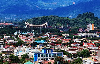
Padang is the capital and largest city of the Indonesian province of West Sumatra. With a Census population of 1,015,000 as of 2022, it is the 16th most populous city in Indonesia and the most populous city on the west coast of Sumatra. The Padang metropolitan area is the third most populous metropolitan area in Sumatra with a population of over 1.4 million. Padang is widely known for its Minangkabau culture, cuisine, and sunset beaches.

The National Transportation Safety Committee is an Indonesian government agency charged with the investigation of air, land, rail, and marine transportation safety deficiencies.
Indonesian National Route 3 is the major road in Java Island, Indonesia. It passes through five provinces, namely Banten, West Java, Central Java, Yogyakarta, and East Java. In parts it runs close to the south coast of Java. It connects Cilegon and Ketapang.

Indonesian National Route 14 starts from Semarang on the north coast of Java and ends at Yogyakarta to the south.
Indonesian National Route 2 connects Jakarta and Cibadak, Sukabumi. It runs from north to south. It passes two provinces, namely Jakarta and West Java.
Indonesian National Route 4 is a road stretching from Cikampek to Padalarang. It was more frequently used before the Cipularang Toll Road was built. It connects Cikampek and Padalarang.
Indonesian National Route 6 is a main road in Java Island which connects Tegal and Cilacap.
Indonesian National Route 7 connects Lohbener and Cirebon. It goes parallel with Indonesian National Route 1.

Indonesian National Route 9 is a main road which connects Ajibarang and Secang. The route is a middle route which passes Dieng Plateau and located in Central Java.
Indonesian National Route 20 is a major road in East Java, Indonesia. It passes through 4 regencies in East Java.

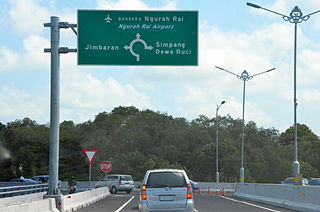
Road signs in Indonesia are standardized road signs similar to those used in other nations but with certain distinctions. As a former Dutch colony, until the 1970s road signs in Indonesia closely followed The Netherlands rules on road signs. Nowadays, Indonesian road sign design are a mix of European, US MUTCD, Australia, New Zealand and Japanese road sign features. According to the 2014 Minister of Transport's Regulation No. 13 concerning Traffic Signs, the official typeface for road signs in Indonesia is Clearview. Indonesia formerly used FHWA Series fonts as the designated typeface though the rules are not being implemented properly.
Indonesian National Route 5 is a road in the national route system that completely lies in the West Java province, and links the Cileunyi subdistrict, located near the city of Bandung in Bandung Regency, West Java, to the subdistrict of Palimanan, located near the city of Cirebon, in Cirebon Regency, West Java.
Indonesian National Route 8 is a road in the national route system that completely lies in the Central Java province, and links an area called Gumillir, North Cilacap, Cilacap, to the town of Purwokerto.

Indonesian National Route 11 is a road in the national route system that is located in the Banten and West Java province, and connects Labuhan, Pandeglang Regency, Banten on the western end, and Cianjur, Cianjur Regency, West Java in the eastern end.
Indonesian National Route 10 is a relatively short road in the national route system that completely lies in the Central Java province, and connects Banyumas on the northern end, with Buntu in the southern end.
Indonesian National Route 12 is a relatively short, yet heavily used road in the national route system. It serves as one of the major arteries in the Jabodetabek region, as the road spans through areas considered as part of the metropolitan area itself. Despite its location, it spans through three provinces, that is Jakarta, Banten, and West Java, as the road itself connects Senayan, South Jakarta, Jakarta on the northern end, with Bogor, Bogor Regency, West Java in its southern end.
Margomulyo is a district in Bojonegoro Regency, East Java, Indonesia. It is located in the southwest of the regency and borders Ngraho District to the north, Tambakrejo District to the east, Ngawi Regency to the south, and Central Java Province to the west. The followers of Saminism Movement live in this district and are still practising their belief.
Gayam is a district in Bojonegoro Regency, East Java, Indonesia. It was created in 2012 from the merger of 12 villages that previously were parts of Ngasem and Kalitidu districts. Gayam becomes a new focus of attention as Banyu Urip oil field, the petroleum exploration site of ExxonMobil under the Cepu Block contract area, is located in this district.

The Sea Toll Program, sometimes called the Sea Highway Program, is a program initiated by Indonesian president Joko Widodo. Its aim is to reduce price disparity between the main islands of Indonesia and smaller isolated islands, especially those in East Indonesia. It was launched in 2015, and has legal basis under Presidential Decree Number 106 of 2015 & Decree from Ministry of Transportation Number 4 of 2016. The program consists of the construction of new container ports in smaller regions and regularly scheduled highly subsidized ship routes from main ports of Indonesia to smaller and more isolated ports.


