
Route 128, known as the Yankee Division Highway, is an expressway in the U.S. state of Massachusetts maintained by the Highway Division of the Massachusetts Department of Transportation (MassDOT). Spanning 57 miles (92 km), it is one of two beltways around Boston, and is known as the "inner" beltway, especially around areas where it is 15 miles (25 km) or less outside of Boston. The route's current southern terminus is at the junction of I-95 and I-93 in Canton, and it is concurrent with I-95 around Boston for 37.5 miles (60.4 km) before it leaves the Interstate and continues on its own in a northeasterly direction towards Cape Ann. The northern terminus lies in Gloucester a few hundred feet from the Atlantic Ocean. All but the northernmost three miles (4.8 km) are a freeway, with the remainder being an expressway. Its concurrency with I-95 makes up most of its length.

Interstate 91 (I-91) is an Interstate Highway in the New England region of the United States. It is the primary north–south thoroughfare in the western part of the region. Its southern terminus is in New Haven, Connecticut, at I-95, while the northern terminus is in Derby Line, Vermont, at the Canada–United States border. Past the Derby Line–Rock Island Border Crossing, the road continues into Canada as Quebec Autoroute 55. I-91 is the longest of three Interstate highways whose entire route is located within the New England states and is also the only primary (two-digit) Interstate Highway in New England to intersect all five of the other highways that run through the region. The largest cities along its route, from south to north, are New Haven, Connecticut; Hartford, Connecticut; Springfield, Massachusetts; Northampton, Massachusetts; Greenfield, Massachusetts; Brattleboro, Vermont; White River Junction, Vermont; St. Johnsbury, Vermont; and Newport, Vermont.

Interstate 93 (I-93) is an Interstate Highway in the New England states of Massachusetts, New Hampshire, and Vermont in the United States. Spanning approximately 190 miles (310 km) along a north–south axis, it is one of three primary Interstate Highways located entirely within New England; the other two are I-89 and I-91. The largest cities along the route are Boston, and Manchester, New Hampshire; it also travels through the New Hampshire state capital of Concord.

U.S. Route 3 (US 3) is a United States Numbered Highway running 277.90 miles (447.24 km) from Cambridge, Massachusetts, through New Hampshire, to the Canada–United States border near Third Connecticut Lake, where it connects to Quebec Route 257.

Route 2 is a 142.29-mile-long (228.99 km) major east–west state highway in Massachusetts, United States. Along with Route 9 and U.S. Route 20 to the south, these highways are the main alternatives to the Massachusetts Turnpike/I-90 toll highway. Route 2 runs the entire length of the northern tier of Massachusetts, beginning at the New York border, where it connects with New York State Route 2, and ending near Boston Common in Boston. Older alignments of Route 2 are known as Route 2A.

Interstate 295 (I-295), sometimes called the Providence Beltway, is an auxiliary Interstate Highway in the US states of Rhode Island and Massachusetts. It is maintained by the Rhode Island Department of Transportation (RIDOT) and the Massachusetts Department of Transportation (MassDOT). Spanning nearly 27 miles (43 km), it forms a western beltway around Providence, Rhode Island, and is a bypass of I-95 as it travels through the capital city. I-895 was proposed as a complementary eastern beltway to complete a full loop around the city in the 1960s but was ultimately scrapped in the 1980s.

Interstate 195 (I-195), also known as the Saco Industrial Spur, is a short auxiliary Interstate Highway running 1.55 miles (2.49 km) in eastern York County, Maine. The highway, located entirely in the city of Saco, is a nominally east–west route that provides access to downtown Saco and the resort town of Old Orchard Beach from I-95. The western terminus of I-195 is at a trumpet interchange with the Maine Turnpike in central Saco. The route has numbered interchanges with Industrial Park Road, US Route 1 (US 1), and State Route 5 (SR 5) before terminating at an at-grade intersection with SR 5 near the border between Saco and Old Orchard Beach.
Interstate 195 (I-195) is an auxiliary Interstate Highway running a combined 44.55 miles (71.70 km) in the US states of Rhode Island and Massachusetts. It travels from a junction with I-95 in Providence, Rhode Island, east to a junction with I-495 and Massachusetts Route 25 in Wareham, Massachusetts. It runs east–west and passes through the cities of Fall River, Massachusetts, and New Bedford, Massachusetts. The portion of I-195 in East Providence is also known as the East Providence Expressway.

Interstate 395 (I-395) is an auxiliary Interstate Highway in the U.S. states of Connecticut and Massachusetts; it is maintained by the Connecticut Department of Transportation (CTDOT) and the Massachusetts Department of Transportation (MassDOT). Spanning nearly 67 miles (108 km) on a south–north axis, it is the only spur route of I-95 in Connecticut. The 36-mile (58 km) section between its splits from I-95 in East Lyme and SR 695 in Plainfield is a component highway of the Connecticut Turnpike. Within that state, the highway is named the American Ex-Prisoner of War Memorial Highway from Plainfield to Thompson.

Route 3 is a state-numbered route in the U.S. state of Massachusetts, maintained by the Massachusetts Department of Transportation (MassDOT). Spanning approximately 56 miles (90 km) along a north–south axis, it is inventoried with U.S. Route 3 as a single route by the state. The state-numbered Route 3 travels from Bourne in the south to Cambridge in the north, while US 3 continues from Cambridge and crosses the New Hampshire state line in Tyngsborough. Mileposts on US 3 continue from those on the state-numbered Route 3.

Interstate 391 (I-391) is an auxiliary Interstate Highway located entirely within the US state of Massachusetts. It runs from the I-91/I-391 interchange in Chicopee to the center of Holyoke, a distance of about 4.46 miles (7.18 km). It runs near the Connecticut River throughout its journey in Chicopee, crosses into Holyoke, and abruptly ends at High Street 0.4 miles (0.64 km) south of U.S. Route 202 (US 202).
The Massachusetts State Highway System in the U.S. Commonwealth of Massachusetts is a system of state-numbered routes assigned and marked by the highway division of the Massachusetts Department of Transportation (MassDOT). U.S. Highways and Interstate Highways are included in the system; the only overlaps are with the end-to-end U.S. Route 3 and Route 3 and the far-apart Interstate 295, shared with Rhode Island, and Route 295, shared with New York State. A state highway in Massachusetts is a road maintained by the state, which may or may not have a number. Not all numbered routes are maintained or owned by the state.

Route 8 is a 67.36-mile (108.41 km) state highway in Connecticut that runs north–south from Bridgeport, through Waterbury, all the way to the Massachusetts state line where it continues as Massachusetts Route 8. Most of the highway is a four-lane freeway but the northernmost 8.8 miles (14.2 km) is a two-lane surface road.
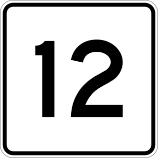
Massachusetts Route 12 is a 64.41-mile-long (103.66 km) north-south state highway that runs through central Massachusetts from a continuation of Connecticut Route 12 at the Connecticut state line at Dudley to the New Hampshire state line at Winchendon where it continues north as New Hampshire Route 12.

Interstate 95 (I-95) is a part of the Interstate Highway System that parallels the East Coast of the United States from Miami, Florida, in the south to Houlton, Maine, in the north. In the US state of Massachusetts, it spans 92 miles (148 km) along a north–south axis. It is the third-longest Interstate Highway in Massachusetts, behind I-90 and I-495, while I-95 in full is the longest north–south Interstate and sixth-longest Interstate Highway in the US.

The Wilbur Cross Highway is a freeway running along a portion of Connecticut Route 15 and U.S. Route 5 from Wethersfield to East Hartford, Connecticut, and then continuing northeast as a section of Interstate 84, part of which is also cosigned as U.S. Route 6. The freeway ends at a junction with the tolled Massachusetts Turnpike in Sturbridge, Massachusetts. The entire route was formerly signed as Route 15.

Interstate 44 (I-44) is an Interstate Highway that runs diagonally through the U.S. state of Oklahoma, spanning from the Texas state line near Wichita Falls, Texas, to the Missouri border near Joplin, Missouri. It connects three of Oklahoma's largest cities: Oklahoma City, Tulsa, and Lawton. Most of I-44 in Oklahoma is a toll road. In southwestern Oklahoma, I-44 is the H. E. Bailey Turnpike and follows a diagonally northwest–southeast direction. From Oklahoma City to Tulsa, I-44 follows the Turner Turnpike. As I-44 leaves Tulsa, it becomes the Will Rogers Turnpike to the Missouri border. In the Lawton, Oklahoma City, and Tulsa metropolitan areas, I-44 is toll-free. In Oklahoma City, I-44 is also known as the Will Rogers Expressway.

Route 116 is a 68.26-mile-long (109.85 km) north–south state highway in Massachusetts. The route runs from Route 20A in Springfield through mill towns, college towns and rural towns, crossing the Connecticut River three times before finally ending at Route 8 in Adams.

U.S. Route 20 (US 20) runs its easternmost 153 miles (246 km) in the U.S. state of Massachusetts. The highway crosses the state border from New Lebanon, New York, into Hancock and runs eastward to Boston, where it ends at Route 2 in Kenmore Square. It spends the vast majority of its journey paralleling I-90, which has largely superseded US 20 for through travel. Still, US 20 directly serves many towns and local business areas which the turnpike bypasses.

U.S. Route 44 (US 44) is an east–west United States Numbered Highway that runs for 237 miles (381 km) through four states in the Northeastern United States. The western terminus is at US 209 and New York State Route 55 (NY 55) in Kerhonkson, New York, a hamlet in the Hudson Valley region. The eastern terminus is at Route 3A in Plymouth, Massachusetts.


