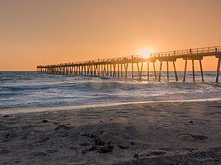
Southern California is a geographic and cultural region that generally comprises the southern portion of the U.S. state of California. It includes the Los Angeles metropolitan area as well as the Inland Empire. The region generally contains ten of California's 58 counties: Imperial, Kern, Los Angeles, Orange, Riverside, San Bernardino, San Diego, Santa Barbara, San Luis Obispo, and Ventura counties.

San Luis Obispo County, officially the County of San Luis Obispo, is a county on the Central Coast of California. As of the 2020 census, the population was 282,424. The county seat is San Luis Obispo.

San Luis Obispo is a city and county seat of San Luis Obispo County, in the U.S. state of California. Located on the Central Coast of California, San Luis Obispo is roughly halfway between the San Francisco Bay Area in the north and Greater Los Angeles in the south. The population was 47,063 at the 2020 census.

Baywood-Los Osos is an unincorporated community in western San Luis Obispo County, California. The population was 14,351 in the 2000 census. It includes the communities of Los Osos, which is located near Morro Bay, Baywood Park, and the former community of Cuesta-by-the-Sea.

The Central Coast is an area of California, roughly spanning the coastal region between Point Mugu and Monterey Bay. It lies northwest of Los Angeles and south of the San Francisco Bay Area, and includes the rugged, rural, and sparsely populated stretch of coastline known as Big Sur.

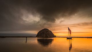
Morro Bay State Park is a state park on the Morro Bay lagoon, in western San Luis Obispo County, on the Central Coast of California. On the lagoon's northeastern and eastern edges in the park, there are saltwater and brackish marshes that support thriving bird populations.

Los Osos is an unincorporated town in San Luis Obispo County, California, United States. Located on the Central Coast of California, Los Osos had a reported population of 14,465 in 2020. For statistical purposes, the United States Census Bureau has defined Los Osos as a census-designated place (CDP).

Estero Bay is a bay located on the Pacific Coast in San Luis Obispo County, central California. It is about 15 miles (24 km) from its south end at Point Buchon/Montana de Oro State Park, to its north end at Point Estero, which is about 5 miles (8 km) northwest of Cayucos. It is indented about 5 miles (8 km) into the California coast.

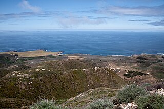
Montaña de Oro is a state park in Central Coastal California, six miles southwest of Morro Bay and two miles south of Los Osos.

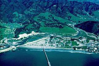
San Luis Obispo Creek is a stream, about 18 miles (29 km) long, in San Luis Obispo County, California. It drains a large coastal watershed that includes the city of San Luis Obispo, emptying into the Pacific Ocean at Avila Beach.
California's 24th congressional district is a congressional district in the U.S. state of California. The district is currently represented by Salud Carbajal. It contains all of Santa Barbara County, most of San Luis Obispo County, and part of Ventura County. Cities in the district include Santa Barbara, Ventura, San Luis Obispo, Santa Maria, and Ojai.

Edna Valley is an American Viticultural Area (AVA) located in San Luis Obispo (SLO) County, California encompassing the rural town of Edna which is 9 miles (14 km) southeast of the county seat San Luis Obispo and north of the small coastal town Arroyo Grande. It was established by the Bureau of Alcohol, Tobacco and Firearms (ATF) as the county's first AVA within California’s multi-county Central Coast AVA effective May 12, 1982. It became an sub-appellation of the county’s newest San Luis Obispo Coast viticultural area since April 2022. The valley is diagonally flanked by Lake Lopez to the south and Islay Hill to the north. The elongated valley extends along a northwest-southeast axis bordered to the west by the Santa Lucia Mountains and surrounded by volcanic mountains and characterized by black humus and clay-rich soils. With moderate sunshine, cool maritime fog, and rich oceanic and volcanic soils, the Edna Valley appellation has California's longest growing season. The valley is kept cool by breezes from the Pacific Ocean and morning fog. The extended growing season allows complex flavors to develop in the grapes.

Los Osos Oaks State Natural Reserve is a California State Park in western San Luis Obispo County, in the Central Coast of California region. It preserves centuries-old coast live oaks growing atop relict sand dunes. It is located in the Los Osos Valley between San Luis Obispo and Baywood Park-Los Osos, just outside the town of Los Osos. The 85-acre (34 ha) park was established in 1972.

The Los Osos Valley is a valley within San Luis Obispo County, in the Central Coast of California region.

The Elfin Forest Natural Area is a nature preserve protecting a unique plant community in Los Osos-Baywood Park, San Luis Obispo County, central California. It consists of prehistoric sand dunes, rising 150 feet (46 m) above southern Morro Bay, on the north of Los Osos-Baywood Park.
Los Osos Back Bay is a prehistoric Chumash archaeological site in the Los Osos Valley, near the coast in San Luis Obispo County, California.

Rancho Cañada de los Osos y Pecho y Islay was a 32,431-acre (131.24 km2) Mexican land grant in Los Osos Valley and the southern Estero Bay headlands, in present-day San Luis Obispo County, California.
Rancho Pecho y Islay was an 8,856.8-acre (35.842 km2) Mexican land grant in the Irish Hills, Montaña de Oro State Park and Diablo Canyon Power Plant in present-day San Luis Obispo County, California.
Rancho Cañada de los Osos was a 23,574.2-acre (95.401 km2) Mexican land grant in Los Osos Valley in present-day San Luis Obispo County, California.


