Dayton–Wright Brothers Airport is a public airport located 10 miles (16 km) south of the central business district of Dayton, Ohio, located mainly in Miami Township, Montgomery County and partly in Clearcreek Township, Warren County, near the suburb of Springboro. It is owned and operated by the City of Dayton and serves as the reliever airport for Dayton International Airport. It mainly serves corporate and personal aircraft users. The airport's identifying code, MGY, is a reference to its former name of Montgomery County Airport.

Cuyahoga County Airport, also known as Robert D. Shea Field, is a public use airport in northeastern Cuyahoga County, Ohio, United States. Owned and operated by Cuyahoga County since 1946, it also serves Lake County and Geauga County. The airport is located 10 nautical miles east of downtown Cleveland and sits on the border of three cities: Highland Heights, Richmond Heights and Willoughby Hills. It is included in the National Plan of Integrated Airport Systems for 2011–2015, which categorized it as a general aviation reliever airport for Cleveland Hopkins International Airport.
Wend Valley Airport is a privately-owned, public-use general aviation airport located northwest of Charlotte in Eaton County, Michigan, United States.
Campbell Airport is a public-use airport located two miles (3 km) southwest of the central business district of Grayslake, a village in Lake County, Illinois, United States. It is privately owned by Kane Illinois Properties, Inc.

Moraine Airpark is a public-use airport situated in the city of Moraine, Ohio, United States. 4 miles (6.4 km) southwest of the city of Dayton in Montgomery County.
Newark–Heath Airport is a public airport located in Heath, Ohio. It is three miles (4.8 km) southwest of the central business district of Newark, a city in Licking County, Ohio, United States. The airport was opened in 1930 by the city of Newark, and was transferred to the Licking County Regional Airport Authority in 1967. The airport currently has a McDonnell Douglas F-4C Phantom II S.N. 64–0683 on static display.

Union County Airport is a public use airport in Union County, Ohio, United States. It is owned by the Union County Airport Authority and located one nautical mile (2 km) southeast of the central business district of Marysville, Ohio. This airport is included in the National Plan of Integrated Airport Systems for 2011–2015, which categorized it as a general aviation facility.
Medina Municipal Airport is a public use airport in Medina County, Ohio, United States. It is owned by the City of Medina and is located four nautical miles (7.41 km) east of the city's central business district. According to the FAA's National Plan of Integrated Airport Systems for 2007-2011, it is categorized as a reliever airport.
Paul C. Miller–Sparta Airport is a public airport located 3 mi (5 km) southeast of Sparta, Michigan. Established in 1941, the airport is currently owned and operated by the Village of Sparta and is self-supporting, requiring no public funding. It is included in the Federal Aviation Administration (FAA) National Plan of Integrated Airport Systems for 2017–2021, in which it is categorized as a regional general aviation facility.

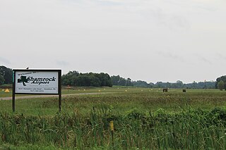
Brooklyn Airport, also known as Shamrock Field, is a privately owned, public-use airport located in Brooklyn, Michigan, United States. It sits at an elevation of 987 feet.

Luce County Airport is a county-owned public-use airport located three miles southeast of the central business district of Newberry, a city in Luce County, Michigan, United States. It is included in the Federal Aviation Administration (FAA) National Plan of Integrated Airport Systems for 2017–2021, in which it is categorized as a basic general aviation facility.
Jack Barstow Airport, also known as Jack Barstow Municipal Airport, is a city-owned, public-use airport located three nautical miles (6 km) northwest of the central business district of Midland, a city in Midland County, Michigan, United States. It is included in the Federal Aviation Administration (FAA) National Plan of Integrated Airport Systems for 2017–2021, in which it is categorized as a local general aviation facility.

Marion Municipal Airport is three miles northeast of Marion, in Marion County, Ohio. The FAA's National Plan of Integrated Airport Systems for 2011–2015 categorized it as a general aviation facility.
Dalton Airport is a privately owned, public use airport located two nautical miles (4 km) east of the central business district of Flushing, in Genesee County, Michigan, United States. It is named after its founder, Edwin P. Dalton, who opened it in 1946 on the former site of the Marsa farm.
Menominee Regional Airport is a public use airport located 1 mile (2 km) northwest of the central business district of Menominee, Michigan, a city in Menominee County, Michigan, United States. It is included in the Federal Aviation Administration (FAA) National Plan of Integrated Airport Systems for 2021–2025, in which it is categorized as a local general aviation facility.
South Haven Area Regional Airport is a public-use airport located 3 miles south of South Haven, Michigan. It is publicly owned by the city through the South Haven Area Regional Airport Authority.
Three Rivers Municipal Dr. Haines Airport is a public-use airport located two miles northeast of Three Rivers, Michigan. It is publicly owned by the city and covers 305 acres.
Andrews University Airpark is a privately owned, public use airport located 2 miles west of Berrien Springs, Michigan. It is owned and managed by Andrews University, a Seventh Day Adventist university that manages an aviation department.
Ray Community Airport is a privately owned, public use airport located in Ray Township, Macomb County. Michigan. The airport sits on 93 acres of land at an elevation of 632 feet.
Marine City Airport is a privately owned, public use airport located 4 miles west of Marine City in St. Clair County, Michigan.


