
Perth is the capital and largest city of Western Australia. It is the fourth most populous city in Australia and Oceania, with a population of over 2.2 million within Greater Perth. It is part of the South West Land Division of Western Australia, with the majority of Perth's metropolitan area on the Swan Coastal Plain between the Indian Ocean and the Darling Scarp. The city has expanded outward from the original British settlements on the Swan River, upon which its central business district and port of Fremantle are situated.
Benger is a locality just north of Brunswick Junction in the South West of Western Australia.

Bolgart is a townsite north of Toodyay in Western Australia. It is in the Shire of Victoria Plains.

Tammin is a town in the central agricultural region of Western Australia, 184 kilometres (114 mi) east of Perth and midway between the towns of Cunderdin and Kellerberrin on the Great Eastern Highway.

Burracoppin is a townsite on the Great Eastern Highway, east of Merredin in the Wheatbelt region of Western Australia.
Carrabin is a small town located about 43 kilometres (27 mi) east-north-east of Merredin, on the railway line between Merredin and Southern Cross in Western Australia.

Bodallin is a town located around half way between Merredin and Southern Cross in Western Australia.
Moorine Rock is located in the eastern agricultural region of Western Australia, 347 km east of Perth and 22 km west south west of Southern Cross.
Yerecoin is a small town located in the Wheatbelt region of Western Australia, in the Shire of Victoria Plains,156 kilometres (97 mi) north-northeast of the state capital, Perth.

The town of Hyden is located 292 kilometres (181 mi) east-southeast of Perth, Western Australia in the Shire of Kondinin. Hyden is home to Wave Rock, Mulka's Cave and Hippos Yawn, all popular local tourist attractions.

Meckering is a town 130 kilometres (80.8 mi) east of Perth, Western Australia along the Great Eastern Highway. Meckering is located within the Shire of Cunderdin.

Bruce Rock is a town in the eastern Wheatbelt region of Western Australia, approximately 243 kilometres (151 mi) east of Perth and 48 kilometres (30 mi) southwest of Merredin. It is the main town in the Shire of Bruce Rock.

Ardath is a small town in the Wheatbelt region of Western Australia 20 kilometres (12 mi) south of the town of Bruce Rock.

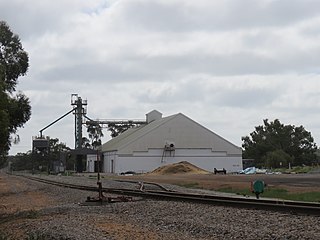
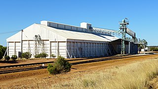
Koorda is a town in the north eastern Wheatbelt region of Western Australia, approximately 236 kilometres (147 mi) east of Perth and 43 kilometres (27 mi) north of Wyalkatchem at the northeastern end of the Cowcowing Lakes. It is the main town in the Shire of Koorda. At the 2016 census Koorda had a population of 414. The surrounding areas produce wheat and other cereal crops. The town is a receival site for Cooperative Bulk Handling.
Arrino is a small town in the Mid West region of Western Australia. The town is located between Mingenew and Three Springs on the Midlands Road.
Kulja is a small town in the Wheatbelt region of Western Australia. The town is situated along the Bonnie Rock to Burakin Road.

Maya is a small town in the Mid West region of Western Australia.
Binnu is a town on the North West Coastal Highway in the Mid West region of Western Australia.
Howatharra is a small town in the Mid West region of Western Australia, between Geraldton and Binnu. It is situated just off the North West Coastal Highway and on the Oakagee River.
Paynesville is a ghost town and locality in the Mid West region of Western Australia between the towns of Mount Magnet and Sandstone.

