The Dafo Temple is a famous Buddhist temple in Zhejiang and has a long history of more than 1600 years. This Temple is the symbol of the Xinchang prefecture and it attracts tens of thousands of visitors every year. Recently, the temple and its surroundings have been used as a location for movies and filming, because of its natural environment.
The Edmonton International Film Festival (EIFF) is a nine-day film festival in Edmonton, Alberta, Canada, hosted at Landmark Cinemas at Edmonton City Centre.

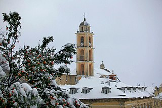
Cervione Cathedral is a former Roman Catholic cathedral in Cervione on the island of Corsica, and a national monument of France. It was the seat of the Bishop of Aleria until 1801, when all Corsican sees were merged into the Bishopric of Ajaccio.

Młynik is a village in the administrative district of Gmina Wąbrzeźno, within Wąbrzeźno County, Kuyavian-Pomeranian Voivodeship, in north-central Poland. It lies approximately 5 kilometres (3 mi) south of Wąbrzeźno and 32 km (20 mi) north-east of Toruń.
Wałyczyk is a village in the administrative district of Gmina Wąbrzeźno, within Wąbrzeźno County, Kuyavian-Pomeranian Voivodeship, in north-central Poland.

Kraśnica is a village in the administrative district of Gmina Opoczno, within Opoczno County, Łódź Voivodeship, in central Poland. It lies approximately 9 kilometres (6 mi) north of Opoczno and 65 km (40 mi) south-east of the regional capital Łódź.
Stanisławów is a village in the administrative district of Gmina Wolbórz, within Piotrków County, Łódź Voivodeship, in central Poland.

Kaczorów is a village in the administrative district of Gmina Nowy Kawęczyn, within Skierniewice County, Łódź Voivodeship, in central Poland. It lies approximately 11 kilometres (7 mi) south-east of Skierniewice and 55 km (34 mi) east of the regional capital Łódź.

Stanisławów is a village in the administrative district of Gmina Rzeczyca, within Tomaszów Mazowiecki County, Łódź Voivodeship, in central Poland. It lies approximately 7 kilometres (4 mi) north-west of Rzeczyca, 21 km (13 mi) north-east of Tomaszów Mazowiecki, and 56 km (35 mi) east of the regional capital Łódź.

Kalinówka is a village in the administrative district of Gmina Urszulin, within Włodawa County, Lublin Voivodeship, in eastern Poland. It lies approximately 32 kilometres (20 mi) south-west of Włodawa and 48 km (30 mi) east of the regional capital Lublin.
Rydzyn Włościański is a village in the administrative district of Gmina Strzegowo, within Mława County, Masovian Voivodeship, in east-central Poland.

Żerań Mały is a village in the administrative district of Gmina Olszewo-Borki, within Ostrołęka County, Masovian Voivodeship, in east-central Poland. It lies approximately 8 kilometres (5 mi) south of Olszewo-Borki, 9 km (6 mi) south-west of Ostrołęka, and 94 km (58 mi) north of Warsaw.

Przezmark is a village in the administrative district of Gmina Stary Dzierzgoń, within Sztum County, Pomeranian Voivodeship, in northern Poland. It lies approximately 7 kilometres (4 mi) east of Stary Dzierzgoń, 31 km (19 mi) east of Sztum, and 80 km (50 mi) south-east of the regional capital Gdańsk.

Różyńsk Wielki is a village in the administrative district of Gmina Prostki, within Ełk County, Warmian-Masurian Voivodeship, in northern Poland. It lies approximately 13 kilometres (8 mi) west of Prostki, 18 km (11 mi) south-west of Ełk, and 116 km (72 mi) east of the regional capital Olsztyn.

Jabłonowo-Maćkowięta is a village in the administrative district of Gmina Janowiec Kościelny, within Nidzica County, Warmian-Masurian Voivodeship, in northern Poland. It lies approximately 6 kilometres (4 mi) south-west of Janowiec Kościelny, 14 km (9 mi) south of Nidzica, and 60 km (37 mi) south of the regional capital Olsztyn.

Sierosławiec is a village in the administrative district of Gmina Krzęcin, within Choszczno County, West Pomeranian Voivodeship, in north-western Poland. It lies approximately 4 kilometres (2 mi) south of Krzęcin, 14 km (9 mi) south-east of Choszczno, and 73 km (45 mi) south-east of the regional capital Szczecin.

Rurka is a settlement in the administrative district of Gmina Goleniów, within Goleniów County, West Pomeranian Voivodeship, in north-western Poland. It lies approximately 8 kilometres (5 mi) south of Goleniów and 17 km (11 mi) north-east of the regional capital Szczecin.

Próchnowo is a village in the administrative district of Gmina Mirosławiec, within Wałcz County, West Pomeranian Voivodeship, in north-western Poland. It lies approximately 11 kilometres (7 mi) east of Mirosławiec, 16 km (10 mi) west of Wałcz, and 111 km (69 mi) east of the regional capital Szczecin.
Pöide-Keskvere is a village in Saaremaa Parish, Saare County in western Estonia.
Koigi is a village in Saaremaa Parish, Saare County in western Estonia.


