
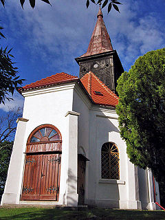
Skorkov is a small village near in the Havlíčkův Brod District, Vysočina Region of the Czech Republic. 77 (<9000) people live there and it has 6,2 km².
Kruszynki is a village in the administrative district of Gmina Brodnica, within Brodnica County, Kuyavian-Pomeranian Voivodeship, in north-central Poland.

Karczemka is a village in the administrative district of Gmina Dobrcz, within Bydgoszcz County, Kuyavian-Pomeranian Voivodeship, in north-central Poland. It lies 5 kilometres (3 mi) west of Dobrcz and 19 km (12 mi) north of Bydgoszcz.

Voskehat, is a village in the Aragatsotn Province of Armenia, located on the right bank of Amberd river, 7 km southwest of the provincial capital Ashtarak. It is surrounded by the villages of Agarak from the north, Voskevaz from the east and Lernamerdz from the south. It has an average elevation of 1025 meters above sea level.
Jasionowo is a village in the administrative district of Gmina Lipsk, within Augustów County, Podlaskie Voivodeship, in north-eastern Poland, close to the border with Belarus.
Studzieńczyna is a village in the administrative district of Gmina Janów, within Sokółka County, Podlaskie Voivodeship, in north-eastern Poland.

Nağdalı is a village in the Absheron Rayon of Azerbaijan.
Józefów is a village in the administrative district of Gmina Czastary, within Wieruszów County, Łódź Voivodeship, in central Poland. It lies approximately 3 kilometres (2 mi) north-east of Czastary, 14 km (9 mi) east of Wieruszów, and 97 km (60 mi) south-west of the regional capital Łódź.
Plechówka is a village in the administrative district of Gmina Kazimierza Wielka, within Kazimierza County, Świętokrzyskie Voivodeship, in south-central Poland.
Kochanów is a village in the administrative district of Gmina Borkowice, within Przysucha County, Masovian Voivodeship, in east-central Poland.
Nowy Buczek is a village in the administrative district of Gmina Lipka, within Złotów County, Greater Poland Voivodeship, in west-central Poland. It lies approximately 6 kilometres (4 mi) south of Lipka, 19 km (12 mi) north-east of Złotów, and 119 km (74 mi) north of the regional capital Poznań.
Różki is a village in the administrative district of Gmina Kołczygłowy, within Bytów County, Pomeranian Voivodeship, in northern Poland. It lies approximately 8 kilometres (5 mi) north-east of Kołczygłowy, 20 km (12 mi) north-west of Bytów, and 86 km (53 mi) west of the regional capital Gdańsk.
Stare Łosienice is a village in the administrative district of Gmina Stężyca, within Kartuzy County, Pomeranian Voivodeship, in northern Poland. It lies approximately 9 kilometres (6 mi) north of Stężyca, 21 km (13 mi) west of Kartuzy, and 49 km (30 mi) west of the regional capital Gdańsk.
Piskorzewo is a village in the administrative district of Gmina Pisz, within Pisz County, Warmian-Masurian Voivodeship, in northern Poland. It lies approximately 13 kilometres (8 mi) south of Pisz and 91 km (57 mi) east of the regional capital Olsztyn.
Sułkowo is a village in the administrative district of Gmina Pełczyce, within Choszczno County, West Pomeranian Voivodeship, in north-western Poland. It lies approximately 6 kilometres (4 mi) north of Pełczyce, 13 km (8 mi) south-west of Choszczno, and 59 km (37 mi) south-east of the regional capital Szczecin.
Zatoń Dolna is a village in the administrative district of Gmina Chojna, within Gryfino County, West Pomeranian Voivodeship, in north-western Poland, close to the German border. It lies approximately 11 kilometres (7 mi) north-west of Chojna, 30 km (19 mi) south-west of Gryfino, and 50 km (31 mi) south-west of the regional capital Szczecin.
Brzeźno is a settlement in the administrative district of Gmina Barwice, within Szczecinek County, West Pomeranian Voivodeship, in north-western Poland. It lies approximately 8 kilometres (5 mi) north-west of Barwice, 28 km (17 mi) west of Szczecinek, and 120 km (75 mi) east of the regional capital Szczecin.
Koprzywno is a settlement in the administrative district of Gmina Barwice, within Szczecinek County, West Pomeranian Voivodeship, in north-western Poland. It lies approximately 6 kilometres (4 mi) west of Barwice, 27 km (17 mi) west of Szczecinek, and 117 km (73 mi) east of the regional capital Szczecin.
Świętno is a village in the administrative district of Gmina Grzmiąca, within Szczecinek County, West Pomeranian Voivodeship, in north-western Poland. It lies approximately 17 kilometres (11 mi) north-west of Szczecinek and 135 km (84 mi) east of the regional capital Szczecin.
Dřínov is a village and municipality in Mělník District in the Central Bohemian Region of the Czech Republic.


