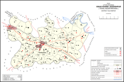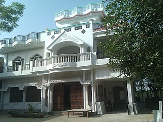
Sultanpur district is a district in the Awadh region of the Indian state of Uttar Pradesh. This district is a part of Ayodhya division of the state. The administrative headquarters of the district is Sultanpur city. The total area of Sultanpur district is 2672.89 Sq. km.
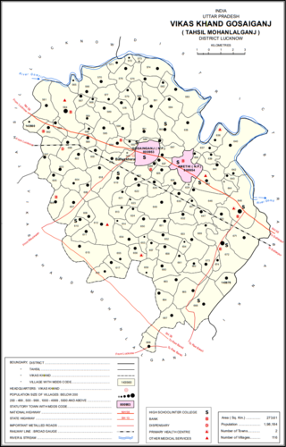
Gosainganj, also spelled Goshainganj or Gosaiganj is a town and nagar panchayat in Lucknow district of Uttar Pradesh, India. It is the seat of a community development block, which is included in the tehsil of Mohanlalganj. As of 2011, its population is 9,649, in 1,685 households. The starting point of the Purvanchal Expressway i.e. Chand Saray village is situated 2.5 km away from Gosainganj.
Jagdishpur is a town in Amethi in the Indian state of Uttar Pradesh.

Baramadpur is a village in Akhand Nagar block of Kadipur tehsil in Sultanpur district of Uttar Pradesh, India. As of 2011, it has a population of 3,251 people, in 442 households. It has one primary school and one primary health centre and it hosts both a regular market and a weekly haat. It is part of the nyaya panchayat of Sajampur.

Parsandan is a village in Nawabganj block of Unnao district, Uttar Pradesh, India. It was historically the capital of a pargana, since at least the time of Akbar. As of 2011, its population is 3,946, in 778 households.

Ain is a village in Sarojaninagar block of Lucknow district, Uttar Pradesh, India. The Nagwa river flows past the northeastern side of the village, and the road to Mohan is on the southwestern side. The village is well-irrigated and has stiff loamy soil with a proportion of clay, and rice is the staple crop. There is a market held on Tuesdays and Saturdays, mostly specialising in livestock.

Thulendi is a village in Bachhrawan block of Rae Bareli district, Uttar Pradesh, India. It is located 6 km from Bachhrawan, the block headquarters, on an elevated plain with clayey soil. A historic village, Thulendi served as a pargana headquarters from the early 1400s until the late 1700s, and it has several old monuments including a fort built under the Jaunpur Sultanate and two large tanks othat are said to be even older. As of 2011, Thulendi's population was 6,616, in 1,195 households.

Kumhrawan is a village in Shivgarh block of Rae Bareli district, Uttar Pradesh, India. Formerly a pargana headquarters, it consists of a main village and several scattered hamlets. As of 2011, Kumhrawan has a population of 2,441, in 426 households.

Inhauna is a village and corresponding in Singhpur block of Rae Bareli district, Uttar Pradesh, India. As of 2011, its population is 13,049, in 2,021 households. Located at the junction of the Raebareli-Rudauli and Lucknow-Jaunpur roads, Inhauna is an old town that once served as the seat of a pargana as well as (briefly) a tehsil, and it has the ruins of an old fort built under the Nawabs of Awadh. The old marketplace, known as Ratanganj, was built in 1863 by the tahsildar Ratan Narain. Markets are held twice per week, on Mondays and Thursdays, and most of the trade is in livestock.

Jagdishpur is a village in Dih block of Rae Bareli district, Uttar Pradesh, India. It is located 21 km from Raebareli, the district headquarters. As of 2011, it has a population of 4,538 people, in 840 households. It belongs to the nyaya panchayat of Dih.

Chak Gajraj is a village in Khiron block of Rae Bareli district, Uttar Pradesh, India. It is located 11 km from Lalganj, the tehsil headquarters. As of 2011, it has a population of 429 people, in 68 households. It has 1 primary school and no healthcare facilities and it does not host a weekly haat or a permanent market. It belongs to the nyaya panchayat of Semari.

Chak Bhadokhar is a village in Rahi block of Rae Bareli district, Uttar Pradesh, India. It is located 11 km from Rae Bareli, the district headquarters. As of 2011, it has a population of 115 people, in 22 households. The village has no schools, medical facilities nor hosts any weekly haat or permanent market. It belongs to the nyaya panchayat of Bhadokhar.

Chak Rar is a village in Rahi block of Rae Bareli district, Uttar Pradesh, India. It is located 11 km from Rae Bareli, the district headquarters. As of 2011, it has a population of 1,005 people, in 182 households. It has one primary school and no medical facilities. The village hosts a weekly haat but not a permanent market. It belongs to the nyaya panchayat of Lodhwari.
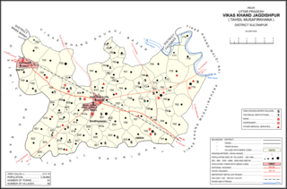
Gaimau is a village in Jagdishpur block of Sultanpur district, Uttar Pradesh, India. It is located 50 km from Sultanpur, the district headquarters. As of 2011, it has a population of 1,617 people, in 255 households. It has one primary school and no healthcare facilities and does not host a permanent market or weekly haat. It belongs to the nyaya panchayat of Harimau.

Jaisinghpur is a village and tehsil headquarters in Sultanpur district, Uttar Pradesh, India. As of 2011, it has a population of 2,211 people, in 353 households. It has 4 primary schools and one hospital. It hosts a haat on Tuesdays and Saturdays mostly dealing in tat patti. It serves as the headquarters of a nyaya panchayat which also includes 23 other villages. It is also the seat of a community development block, which was inaugurated in 1953.
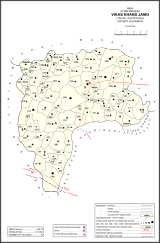
Jamo, also spelled Jamun or Jamon, is a village and community development block headquarters in Gauriganj tehsil of Amethi district, Uttar Pradesh, India. As of 2011, it had a population of 6,734 people, in 1,182 households. It was historically the capital of the pargana of Gaura Jamun. It is located at the intersection of four minor district roads, some of which are prone to flooding during the rainy season.

Gaura is a village in Jamo block of Amethi district, Uttar Pradesh, India. The namesake of the historical pargana of Gaura Jamun, Gaura consists of a main site called Gaura khas in the northeast surrounded by several smaller hamlets. The village lands are fertile and contain many orchard groves. In the east-central part there is a large jhil which provides a convenient source of irrigation but also sometimes overflows and floods the surrounding fields. Gaura is located just north of Jamo on the Gauriganj-Jagdishpur road, and another road also leads off to Musafirkhana.

Katari is a village in Jamo block of Amethi district, Uttar Pradesh, India. It is located by a stream called the Naiya or Kandu nala, which flows east toward the Gomti river. The main highway from Lucknow to Jaunpur passes further north. Katari was historically the seat of a taluqdari estate held by a leading branch of the Kanhpuria Rajputs.

Baraulia is a village in Jamo block of Amethi district, Uttar Pradesh, India. As of 2011, it has a population of 3,878 people, in 691 households. It has one primary school and no healthcare facilities and it hosts both a regular market and a weekly haat. It belongs to the nyaya panchayat of Hardo.

Piparpur is a village in Bhadar block of Amethi district, Uttar Pradesh, India. The historical capital of the pargana of Asal, Piparpur is located on the road from Amethi to Chanda, just west of the intersection with the main Allahabad-Faizabad road. Running through the village is a stream that originates in the Bhujwa jhil and flows into neighbouring Prataphgarh district where it joins with the Chamraura. The banks of this stream are well-wooded; they used to be more so, but a lot of it was cut down around the turn of the 20th century to provide materials for the railway. There is also some significant usar land, especially in the north of the village.
