
Joinville Island is the largest island of the Joinville Island group, about 40 nautical miles long in an east–west direction and 12 nautical miles wide, lying off the northeastern tip of the Antarctic Peninsula, from which it is separated by the Antarctic Sound.
Hope Bay is a bay 3 nautical miles long and 2 nautical miles wide, indenting the tip of the Antarctic Peninsula and opening on Antarctic Sound.

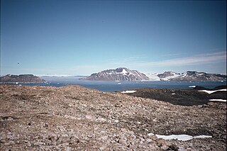
James Ross Island is a large island off the southeast side and near the northeastern extremity of the Antarctic Peninsula, from which it is separated by Prince Gustav Channel. Rising to 1,630 metres (5,350 ft), it is irregularly shaped and extends 40 nautical miles in a north–south direction.

Vega Island is an island in Antarctica, 17 nautical miles long and 6 nautical miles wide, which is the northernmost of the James Ross Island group and lies in the west part of Erebus and Terror Gulf. It is separated from James Ross Island by Herbert Sound and from Trinity Peninsula by Prince Gustav Channel.
Joinville Island group is a group of antarctic islands, lying off the northeastern tip of the Antarctic Peninsula, from which Joinville Island group is separated by the Antarctic Sound.
The Longing Peninsula is a peninsula 9 nautical miles long terminating in Cape Longing, situated at the northeast end of the Nordenskjöld Coast where it separates the Larsen Ice Shelf from the Prince Gustav Ice Shelf.
Hughes Bay is a bay lying between Cape Sterneck and Cape Murray along the west coast of the Antarctic Peninsula.

The Erebus and Terror Gulf is a gulf on the southeast side of the tip of the Antarctic Peninsula, bordered on the northeast by the Joinville Island group and on the southwest by the James Ross Island group.

The Prince Gustav Channel is a strait about 80 nautical miles long and from 4 to 15 nautical miles wide, separating James Ross Island and Vega Island from the Trinity Peninsula, Antarctica.

Seymour Island or Marambio Island, is an island in the chain of 16 major islands around the tip of the Graham Land on the Antarctic Peninsula. Graham Land is the closest part of Antarctica to South America. It lies within the section of the island chain that resides off the west side of the peninsula's northernmost tip. Within that section, it is separated from Snow Hill Island by Picnic Passage, and sits just east of the larger key, James Ross Island, and its smaller, neighboring island, Vega Island.
Drygalski Glacier is a broad glacier, 18 nautical miles long which flows southeast from Herbert Plateau through a rectangular re-entrant to a point immediately north of Sentinel Nunatak on the east coast of Graham Land, Antarctica.

Ulu Peninsula is that portion of James Ross Island northwest of the narrow neck of land between Rohss Bay and Croft Bay, extending from Cape Obelisk to Cape Lachman, in Antarctica.

Andersson Island is an island 7 nautical miles long and 4 nautical miles wide, lying 0.5 nautical miles south of Jonassen Island at the west side of the south entrance to Antarctic Sound, off the northeast tip of the Antarctic Peninsula. It is a volcanic island of the James Ross Island Volcanic Group.
Eagle Island is an island 5 nautical miles long and 4 nautical miles wide, rising to 560 metres (1,840 ft) on the NE side. It is the largest island in the archipelago which lies between Trinity Peninsula and Vega Island. Eagle Island is separated from the Antarctic mainland by the 1.77 km wide Aripleri Passage. It is volcanic in origin, having been K-Ar dated 1.7 ± 0.2 and 2.0 ± 0.2 million years old. It forms part of the James Ross Island Volcanic Group.
The Tabarin Peninsula is a peninsula 15 nautical miles long and 5 to 12 nautical miles wide, lying south of the trough between Hope Bay and Duse Bay and forming the east extremity of Trinity Peninsula in the Antarctic Peninsula.
The Wright Ice Piedmont is an ice piedmont extending westward from Lanchester Bay along the west coast of Graham Land in Antarctica.
Croft Bay is a bay which indents the north-central side of James Ross Island and forms the southern part of Herbert Sound, south of the northeastern end of the Antarctic Peninsula.
Markham Bay is a bay 8 nautical miles wide, lying between Ekelöf Point and Hamilton Point on the east side of James Ross Island, Antarctica.

Röhss Bay is a bay 11 nautical miles wide, between Cape Broms and Cape Obelisk on the southwest side of James Ross Island, Antarctica.
The Naze is a peninsula in north James Ross Island, marking the southeast entrance to Herbert Sound and extending about 5 nautical miles northeast from Terrapin Hill toward the south-central shore of Vega Island.


