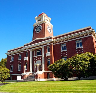
Clallam County is a county in the U.S. state of Washington. As of the 2020 census, the population was 77,155, with an estimated population of 77,805 in 2022. The county seat and largest city is Port Angeles; the county as a whole comprises the Port Angeles, WA Micropolitan Statistical Area. The name is a Klallam word for "the strong people". The county was formed on April 26, 1854. Located on the Olympic Peninsula, it is south from the Strait of Juan de Fuca, which forms the Canada–US border, as British Columbia's Vancouver Island is across the strait.

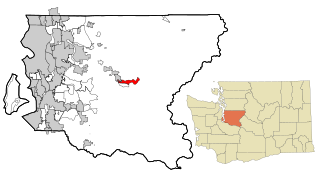
Bell Hill is an unincorporated community and census-designated place (CDP) in Clallam County, Washington, United States. The population was 837 at the 2010 census, up from 731 at the 2000 census. Located just south of the city of Sequim, Bell Hill has become a fast-growing destination for the very wealthy, with a high population of Californians who found success in high tech businesses. Although Sequim is not affluent, it is known for its low levels of rain, a quality that has made Bell Hill very attractive. Bell Hill gets somewhat more precipitation than Sequim but is drier than most western Washington areas.

Blyn is a census-designated place (CDP) in Clallam County, Washington, United States. The population was 101 at the 2010 census, down from 162 at the 2000 census. It is located near the city of Sequim on the shores of Sequim Bay. The area includes the Jamestown S'Klallam Indian Reservation, established in 1874 by the Jamestown S'Klallam Tribe, who named their community Jamestown after their leader; Lord James Balch.

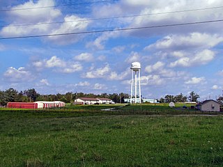
Carlsborg is an unincorporated community and census-designated place (CDP) in Clallam County, Washington, United States. The population was 995 at the 2010 census, up from 855 at the 2000 census.

Port Angeles East is a census-designated place (CDP) in Clallam County, Washington, United States. The population was 3,036 at the 2010 census. This unincorporated urban growth area bordering the city of Port Angeles is known by locals as the Gales Addition.

River Road is a census-designated place (CDP) in Clallam County, Washington, United States. The population was 454 at the 2010 census. It is a primarily residential area next to the city of Sequim.
Riverpoint is an unincorporated community and census-designated place (CDP) in east King County, Washington, United States. As of the 2020 census, it had a population of 774. At the 2010 census, the area was listed as the Tanner CDP and had a population of 1,018 over a larger area.
Lanham is an unincorporated community and census-designated place in Prince George's County, Maryland. As of the 2020 United States Census it had a population of 11,282. The New Carrollton station as well as an Amtrak station are across the Capital Beltway in New Carrollton, Maryland. Doctors Community Hospital is located in Lanham.
Clallam Bay is an unincorporated community and census-designated place (CDP) in Clallam County, Washington, United States, at the mouth of the Clallam River into Clallam Bay. Known for its natural environment and hunting, Clallam Bay is partially reliant on tourism. Clallam Bay is considered the twin city of nearby Sekiu. As of the 2010 census, the population of Clallam Bay was 363.
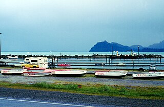
Sekiu is an unincorporated community and census-designated place in Clallam County, Washington, United States. As of the 2010 census it had a population of 27. Overlooking the west side of Clallam Bay and the Strait of Juan de Fuca, it is twinned with the community of Clallam Bay, on the east side of the bay.
Clarkrange is an unincorporated community and census-designated place (CDP) in Fentress County, Tennessee, United States. It is concentrated around the intersection of U.S. Route 127 and Tennessee State Route 62, in Tennessee's western Cumberland Plateau region. The 2010 census reported the population of Clarkrange as 575.
Mace is an unincorporated community and census-designated place (CDP) in Walnut Township, Montgomery County, in the U.S. state of Indiana.

Port Colden is an unincorporated community and census-designated place (CDP) located within Washington Township, in Warren County, in the U.S. state of New Jersey, that was created as part of the 2010 United States Census. As of the 2010 Census, the CDP's population was 122.
Bark Ranch is an unincorporated community and a census-designated place (CDP) located in and governed by Boulder County, Colorado, United States. The Bark Ranch CDP encompasses the Bar-K Ranch housing community. The CDP is a part of the Boulder, CO Metropolitan Statistical Area. The population of the Bark Ranch CDP was 202 at the United States Census 2020. The Ward post office serves the area.

Glendale is an unincorporated community and a census-designated place (CDP) located in and governed by Boulder County, Colorado, United States. The CDP is a part of the Boulder, CO Metropolitan Statistical Area. The population of the Glendale CDP was 64 at the United States Census 2020. The Jamestown post office serves the area.

Grimsley is an unincorporated community and census-designated place (CDP) in Fentress County, Tennessee, United States. Its population was 1,167 as of the 2010 census. Its ZIP code is 38565.

Old Jamestown is a census-designated place (CDP) in St. Louis County, Missouri, United States. The population was 19,184 at the 2010 census. Old Jamestown is northwest of the city of St. Louis and borders the Missouri River.
Boulevard Park is a census-designated place (CDP) in King County, Washington, United States. The population was 5,287 at the 2010 census. Boulevard Park was part of the Riverton-Boulevard Park CDP in 2000 but was split for the 2010 census into its own CDP.
Wilderness Rim is a census-designated place (CDP) in King County, Washington, United States. It lies at an elevation of 1,043 feet (318 m). The population was 1,523 at the 2010 census.
Port Gamble Tribal Community is a census-designated place (CDP) corresponding to the Port Gamble S'Klallam Reservation in Kitsap County, Washington, United States. The population was 916 at the 2010 census.

