
National Route 7 is a major north-south national highway on the Sea of Japan side of the island of Honshū, Japan. It traverses four prefectures, with Niigata at its southern end, then Yamagata, Akita, and finally, Aomori at its northern end. The 471.8-kilometer (293.2 mi) long highway begins at an intersection with national routes 8, 17, 113, 116, 289, 350, and 402 in the capital of Niigata, Niigata. Travelling north, the highway links the prefectural capitals Akita and Aomori. In central Aomori the highway ends at the northern terminus of National Route 4 and National Route 45.
National Route 13 is a highway in Japan on the island of Honshū which runs from Fukushima in Fukushima Prefecture to Akita in Akita Prefecture.
National Route 44 is the easternmost of the national highways of Japan. It connects the cities of Kushiro and Nemuro in eastern part of the island and prefecture of Hokkaido in northern Japan.
National Route 174 is a national highway connecting the Port of Kobe and National Route 2 in Kobe, Japan. It is the shortest national highway in Japan.

National Route 130 is a national highway connecting Port of Tokyo and Route 15 in Tokyo, Japan. With a length of 0.5 kilometers, it is the second shortest national highway in Japan behind Japan National Route 174.
National Route 50 is a national highway of Japan connecting Maebashi and Mito.

National Route 51 is a national highway of Japan connecting Chūō-ku, Chiba and Mito, Ibaraki.

National Route 108 is a national highway of Japan connecting Ishinomaki and Yurihonjō, Akita in Japan, with a total length of 186.9 kilometers (116.1 mi).

National Route 132 is a national highway of Japan connecting the Port of Kawasaki and Miyamaechō, Kawasaki-ku, Kawasaki in Japan, with a total length of 4.5 km (2.8 mi).

National Route 203 is a national highway of Japan connecting Karatsu and Saga in Japan, with a total length of 47.3 km (29.39 mi).
National Route 211 is a national highway of Japan connecting Hita, Ōita and Yahatanishi-ku, Kitakyūshū in Japan, with a total length of 76.3 km (47.41 mi).
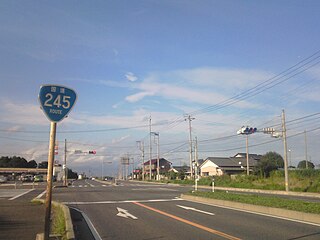
National Route 245 is a national highway of Japan connecting Mito and Hitachi in Ibaraki prefecture, with a total length of 42.6 km (26.47 mi).

National Route 259 is a national highway of Japan connecting Toba, Mie and Toyohashi in Japan, with a total length of 47 km (29.2 mi).

National Route 281 is a national highway of Japan that traverses the prefecture of Iwate in a southwest–northeast routing. It connects the prefecture's capital city, Morioka to the coastal city of Kuji. It has a total length of 111 kilometers (69 mi).

National Route 357 is a national highway of Japan connecting Chūō-ku, Chiba and Yokosuka in Japan, with a total length of 70 km (43.5 mi). The highway parallels the Bayshore Route.
National Route 383 is a national highway of Japan connecting Hirado, Nagasaki and Imari, Saga in Japan, with a total length of 75.8 km (47.1 mi).

National Route 396 is a national highway of Japan connecting Tōno, Iwate and Morioka, Iwate in Japan, with a total length of 58.7 km (36.47 mi).
National Route 404 is a national highway of Japan connecting Nagaoka, Niigata and Jōetsu, Niigata in Japan, with a total length of 95.7 km (59.47 mi).

National Route 501 is a national highway of Japan connecting between Omuta, Fukuoka and Uto, Kumamoto in Japan, with total length has 47.1 km (29.3 mi).
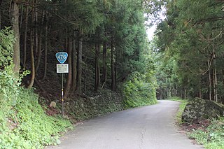
National Route 476 is a national highway of Japan. The highway connects Ōno, Fukui and Tsuruga, Fukui. It has a total length of 76.2 kilometers (47.3 mi).

