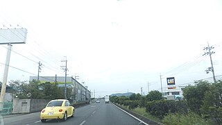
National Route 1 is a major highway on the island of Honshū in Japan. It connects Chūō, Tokyo in the Kantō region with the city of Osaka, Osaka Prefecture in the Kansai region, passing through the Chūbu region en route. It follows the old Tōkaidō westward from Tokyo to Kyoto, and the old Kyo Kaidō from there to Osaka. Between Tokyo and Aichi Prefecture it parallels the Tomei Expressway; from there to Mie Prefecture, the Higashi-Meihan Expressway, and from Shiga Prefecture to Osaka, the Meishin Expressway. It has a total length of 760.9 kilometers (472.8 mi). At its eastern terminus in Nihonbashi, Chūō, Tokyo, it meets National Routes 4, 6, 14, 15, 17, and 20. At its western terminus in Umeda, Kita-ku, Osaka, it links with Routes 2, 25, 26 and other highways.

National Route 2 is a major highway on the islands of Honshū and Kyūshū in Japan. It follows the old Sanyōdo westward from the city of Osaka, Osaka Prefecture in the Kansai region to the city of Kitakyūshū in Fukuoka Prefecture, passing through the San'yō region en route. Between Hyōgo Prefecture and Yamaguchi Prefecture it parallels the Sanyō Expressway; it crosses the Kanmon Straits through the Kanmon Roadway Tunnel. Its total length is 533.2 km. At its Osaka terminus, it meets Route 1; at its western terminus, it links with Routes 3 and 10.

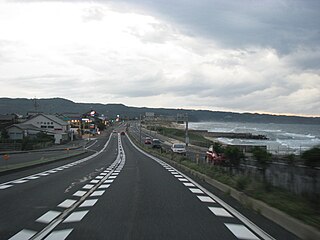
National Route 7 is a major north-south national highway on the Sea of Japan side of the island of Honshū, Japan. It traverses four prefectures, with Niigata at its southern end, then Yamagata, Akita, and finally, Aomori at its northern end. The 471.8-kilometer (293.2 mi) long highway begins at an intersection with national routes 8, 17, 113, 116, 289, 350, and 402 in the capital of Niigata, Niigata. Travelling north, the highway links the prefectural capitals Akita and Aomori. In central Aomori the highway ends at the northern terminus of National Route 4 and National Route 45.
National Route 8 is a major highway in the Hokuriku and Kansai regions of central Japan. The 574.1-kilometer (356.7 mi) highway begins at an intersection with National Routes 7, 17, 49, 113, and 116 in Chūō-ku, Niigata. It travels southwest across central Honshu, connecting the prefecture capitals: Toyama, Kanazawa, Fukui, and Ōtsu. In Kyoto it travels concurrently with National Route 1 toward its endpoint at an intersection with National Routes 9, 24, and 367 in Shimogyō-ku, Kyoto.

National Route 9 is an important highway in the Kansai and Chūgoku regions. It connects the prefectural capitals of Kyoto, Tottori, Matsue, and Yamaguchi. Other significant cities along the route include Yonago, Tottori and Shimonoseki. National Route 9 also passes through parts of Hyōgo Prefecture.

National Route 15 is a national highway connecting Tokyo and Yokohama in Japan. It is commonly referred to as Dai-Ichi Keihin (第一京浜).

National Route 22 is a national highway connecting Nagoya, Aichi Prefecture, and Gifu, Gifu Prefecture in Japan. The route follows the old Minoji, a 17th-century trade route that connected the Nakasendō and the Tōkaidō.
National Route 28 is a national highway connecting Kobe and Tokushima in Japan. It is the only national highway that traverses Awaji Island as the route uses ferries to connect the two cities of Naruto, Tokushima and Akashi, Hyōgo.
National Route 31 is a national highway connecting Kaita, Hiroshima and Kure in Japan.
National Route 174 is a national highway connecting the Port of Kobe and National Route 2 in Kobe, Japan. It is the shortest national highway in Japan.

National Route 165 is a national highway connecting Kita-ku in the city of Osaka, Osaka Prefecture, and the city of Tsu, Mie Prefecture, Japan.
National Route 54 is a national highway of Japan connecting Naka-ku, Hiroshima and Matsue.

National Route 199 is a national highway of Japan connecting Moji-ku, Kitakyūshū and Yahatanishi-ku, Kitakyūshū in Japan, with a total length of 33.2 km (20.63 mi).

National Route 200 is a national highway of Japan connecting Yahatanishi-ku, Kitakyūshū and Chikushino, Fukuoka, with a total length of 91.2 km (56.67 mi).

National Route 231 is a national highway of Japan connecting Kita-ku, Sapporo and Rumoi, Hokkaido in Japan, with a total length of 129.2 km (80.28 mi).

National Route 274 is a national highway of Japan connecting Kita-ku, Sapporo and Shibecha, Hokkaidō in Japan, with a total length of 371.8 km (231.03 mi).
National Route 302 is a national highway of Japan connecting Nakagawa-ku, Nagoya and Nakagawa-ku, Nagoya in Japan, with a total length of 54 km (33.55 mi). Route 302 serves as Nagoya's inner loop and runs concurrent with much of the Mei-Nikan Expressway.

National Route 308 is a national highway of Japan connecting Chūō-ku, Osaka and Nara, with a total length of 32.9 kilometers (20.44 mi).

National Route 309 is a national highway of Japan connecting Kumano, Mie and Hirano-ku, Osaka in Japan, with a total length of 145.5 km (90.41 mi).

National Route 357 is a national highway of Japan connecting Chūō-ku, Chiba and Yokosuka in Japan, with a total length of 70 km (43.5 mi). The highway parallels the Bayshore Route.


