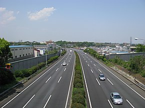
The Shuto Expressway is a network of Tolled expressways in the Greater Tokyo Area of Japan. It is operated and maintained by the Metropolitan Expressway Company Limited.
National Route 1 is a major highway on the island of Honshū in Japan. It connects Chūō, Tokyo in the Kantō region with the city of Osaka, Osaka Prefecture in the Kansai region, passing through the Chūbu region en route. It follows the old Tōkaidō westward from Tokyo to Kyoto, and the old Kyo Kaidō from there to Osaka. Between Tokyo and Aichi Prefecture it parallels the Tomei Expressway; from there to Mie Prefecture, the Higashi-Meihan Expressway, and from Shiga Prefecture to Osaka, the Meishin Expressway. It has a total length of 760.9 kilometers (472.8 mi). At its eastern terminus in Nihonbashi, Chūō, Tokyo, it meets National Routes 4, 6, 14, 15, 17, and 20. At its western terminus in Umeda, Kita-ku, Osaka, it links with Routes 2, 25, 26 and other highways.

Route 246 is a major highway on the island of Honshū in Japan. It originates in Chiyoda, Tokyo and terminates in Numazu, Shizuoka. In and near Tokyo, it parallels the routes of the Dai-ichi Keihin, Dai-ni Keihin, and Tōmei Expressways, the Tōkyū Den-en-toshi Line, Odakyu Odawara Line, Gotemba Line, and other transportation systems.
National Route 12 is a Japanese national highway connecting the two largest cities of Hokkaido, Sapporo and Asahikawa. The 135.7-kilometer-long (84.3 mi) highway begins at an intersection with National Routes 36 and 230 in Sapporo. It travels northeast across the western side of Hokkaido to Asahikawa where it ends at an intersection with National Routes 39 and 40.

National Route 15 is a national highway connecting Tokyo and Yokohama in Japan. It is commonly referred to as Dai-Ichi Keihin (第一京浜).
National Route 48 is a national highway of Japan that connects the capital cities of Miyagi Prefecture and Yamagata Prefecture, Sendai and Yamagata. It has a total length of 75.0 kilometers (46.6 mi).
National Route 101 is a national highway of Japan connecting the capitals of Aomori and Akita prefectures, Aomori and Akita in northern Japan, with a total length of 241.6 kilometers (150.1 mi). The majority of the highway travels along the coast of the Sea of Japan, paralleling the more inland National Route 7. The present-day highway largely follows the path of the Ōmagoe-kaidō, an Edo period road that linked the Kubota and Hirosaki feudal domains.

National Route 106 is a national highway of Japan that connects the cities of Miyako and Morioka in Iwate Prefecture. As of June 2020, it has a total length of 92.4 kilometers (57.4 mi), though the highway is in the process of being upgraded to the Miyako–Morioka Connector, which will follow a shorter route than the older highway. It is paralleled for most of its length by JR East's Yamada Line.
National Route 129 is a national highway of Japan connecting Hiratsuka and Sagamihara in Kanagawa Prefecture in the Kantō region of Japan. It has a total length of 31.7 km (19.7 mi).

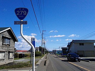
National Route 279 is a national highway of Japan that traverses the prefectures of Aomori and Hokkaido, as well as the Tsugaru Strait that separates them. The 134.0-kilometer (83.3 mi) highway begins at an intersection with National Route 5 in Hakodate, then crosses the Tsugaru Strait on a ferry from Hakodate to Ōma, Aomori, that it shares with National Route 279, where it then travels south through eastern Aomori Prefecture, passing through the city of Mutsu before ending at an intersection with National Route 4 in Noheji.

National Route 394 is a national highway in the Japanese prefecture of Aomori. Route 394 stretches 185 km from National Routes 279 and 338 in Mutsu southwest to National Route 7 in Hirosaki.
National Route 423 is a national highway of Japan connecting Kita-ku, Osaka and Kameoka, Kyoto in the Kansai region of Japan.
National Route 424 is a national highway located entirely within Wakayama Prefecture, Japan. It connects the cities of Tanabe and Kinokawa, spanning the western side of the prefecture in a south–north routing. The highway has a total length of 113.0 kilometers (70.2 mi).

National Route 478 is a national highway of Japan connecting between Miyazu, Kyoto and Kumiyama, Kyoto in Japan, with total length has 63.9 kilometers (39.7 mi).
National Route 483 is a national highway of Japan connecting between Toyooka, Hyōgo and Tamba, Hyōgo in Japan, with a total length of 11.6 kilometers (7.2 mi).

The Yokohane Route, signed as Route K1, is one of the tolled routes of the Shuto Expressway system serving the Greater Tokyo Area and is one of seven of the routes in the system serving Kanagawa Prefecture. The route is a 19.7-kilometer (12.2 mi) long radial highway running southwest from the southern terminus of the Haneda Route in Ōta near Haneda International Airport in Tokyo to the Kariba Route in Naka-ku, Yokohama in Kanagawa Prefecture. Alongside the Haneda Route, it connects Tokyo's Inner Circular Route in central Tokyo to Yokohama.
The Yokohama North Route, signed as Route K7, is one of the tolled routes of the Shuto Expressway system serving the Greater Tokyo Area and is one of seven of the routes in the system serving Kanagawa Prefecture. The route is a 8.2-kilometer (5.1 mi) long expressway running west from the northern terminus of the Daikoku Route at a junction with the Yokohane Route in Tsurumi-ku, Yokohama, to the Daisan Keihin Road in Tsuzuki-ku, Yokohama in Kanagawa Prefecture. Alongside the Daikoku Route, it connects northern Yokohama to the region-spanning Bayshore Route.
The Mitsuzawa Route, signed as Route K2, is one of the tolled routes of the Shuto Expressway system serving the Greater Tokyo Area and is one of seven of the routes in the system serving Kanagawa Prefecture. The route is a 2.3-kilometer (1.4 mi) long expressway running west from a junction with the Yokohane Route in Kanagawa-ku, Yokohama, to the Daisan Keihin Road and the Yokohama Shindō in Hodogaya-ku, Yokohama in Kanagawa Prefecture. It serves as a radial route running west from central Yokohama.

The Yokohama Shindō (横浜新道) is a major highway located entirely in the city of Yokohama in the Greater Tokyo Area of Japan. It is signed as a bypass of National Route 1 as well as being partially designated as an expressway numbered E83. It is a bypass that travels from the southwestern corner of the city in Totsuka-ku northeast to Kanagawa-ku. It largely serves as a bypass to the west of central Yokohama.
The Yokohama Northwest Route, signed as Route K7, is one of the tolled routes of the Shuto Expressway system serving the Greater Tokyo Area and is one of seven of the routes in the system serving Kanagawa Prefecture. The route is a 7.1-kilometer-long (4.4 mi) expressway running west from a junction with the Tōmei Expressway in Aoba-ku, Yokohama, to the Daisan Keihin Road in Tsuzuki-ku, Yokohama. Alongside the Yokohama North Route and the Daikoku Route, it connects the Tōmei Expressway in northern Yokohama to the region-spanning Bayshore Route.


