Japan National Route 279

Last updated

Japanese National Route Sign 0279.svg
National Route 279
国道279号
Japan National Route 279
Japan National Route 279 highlighted in red
Route279 Mutsu.JPG
Route information
Length134.0 km [1]  (83.3 mi)
Existed1970–present
Major junctions
North endJapanese National Route Sign 0005.svgJapanese National Route Sign 0278.svg National Route 5  / National Route 278
in Hakodate, Hokkaido
Major intersections
South endJapanese National Route Sign 0004.svg National Route 4
in Noheji, Aomori
Location
Country Japan
Highway system
Japanese National Route Sign 0278.svg National Route 278 Japanese National Route Sign 0280.svg National Route 280

National Route 279 (国道279号, Kokudō Nihyaku nana-jukyūgō) is a national highway of Japan that traverses the prefectures of Aomori and Hokkaido, as well as the Tsugaru Strait that separates them. The 134.0-kilometer (83.3 mi) highway begins at an intersection with National Route 5 in Hakodate, then crosses the Tsugaru Strait on a ferry from Hakodate to Ōma, Aomori, that it shares with National Route 279, where it then travels south through eastern Aomori Prefecture, passing through the city of Mutsu before ending at an intersection with National Route 4 in Noheji.

Contents

National Route 279's path across Aomori follows one of the oldest roads in northern Japan, a pilgrimage path called the Tanabu Kaidō (田名部街道) to Mount Osore, a caldera believed in Japanese mythology to be a gate to the underworld.

Route description

Hakodate

National Route 279 begins at an intersection with National Route 5 in central Hakodate, east of Hakodate Station. The highway travels southwest through the city, then curves to the northwest, and turns northeast towards the former site of the city's ferry terminal, which was moved to the northwest of Hakodate Station. The highway's brief 1.8-kilometer (1.1 mi) route in Hokkaido ends at the former terminal, which has since been converted into a retail area. [2] Aside from the last 100 meters (330 ft) of the highway near the ferry terminal, the highway also carries the Main Line of the Hakodate City Tram in its median. [3]

Aomori Prefecture

National Route 279 along the coast of the Tsugaru Strait hamanasurain - panoramio - Yobito KAYANUMA.jpg
National Route 279 along the coast of the Tsugaru Strait

The highway is then carried south across the Tsugaru Strait via the Tsugaru Kaikyō Ferry to Ōma on the northern tip of Aomori Prefecture's Shimokita Peninsula. From the route's northern terminus in Hakodate to Ōma, National Route 338 runs concurrent with National Route 279; however, in Ōma, National Route 338 leaves the concurrency, traveling south while Route 279 heads southeast towards Mutsu. In Aomori, Route 279 is known as the Mutsu Hamanasu Line, named after the hamanasu , known in English as the Rosa rugosa, a shrub-like rose that grows on the beaches of Japan. [4] [5]

In Mutsu, it intersects with the northern end of the Mutsu Bypass, an auxiliary parallel route of the highway, and routes 279 and 338 briefly meet again, sharing a short concurrency. After traveling through the central district of the city together, National Route 338 leaves National Route 279 at the southern end of the Mutsu Bypass. It continues its path southeast across the peninsula while National Route 279 heads south towards Yokohama, and eventually Noheji at the southern base of the peninsula. The highway reaches a rest area on the north shore of the Miho River in Yokohama. [6] Between Yokohama and Noheji, National Route 279 is closely paralleled by the Shimokita Expressway, a highway signed as an auxiliary route of National Route 279 that has supplanted the original route as the main thoroughfare between Yokohama and Noheji. The two highways meet at junction in southern Yokohama, where the original route continues south along Mutsu Bay while the expressway takes a more inland route through the village of Rokkasho. Upon entering Noheji, the route travels southwest through sparsely populated coastal woodlands before entering the central part of the town where it curves to the south. After passing by the town hall, the route terminates at an intersection with National Route 4. [7]

Average daily traffic

National Route 279 is maintained by the Road Bureau of the Ministry of Land, Infrastructure, Transport and Tourism (MLIT), which conducts surveys on the Japan's national routes and expressways every five years to measure their average daily traffic. In 2015, the most utilized point along the route, was at the junction between it and Aomori Route 7 in Mutsu, where a daily average of 9,440 vehicles traveled on National Route 279. The least busy section of the highway was between the ferry terminal at Ōma and the intersection where the highway meets National Route 338, it carried an average of only 1,337 vehicles. [8]

History

National Route 279 near the old ferry terminal in Hakodate R279 Hakodate.jpg
National Route 279 near the old ferry terminal in Hakodate

National Route 279 was preceded by the Tanabu-kaidō (田名部街道), a road established by the Nanbu clan during the Edo period as a branch of the longer Ōshū Kaidō (now known as National Route 4). It traveled between Noheji-shukuba and the Buddhist temple and folk religion pilgrimage destination of Mount Osore, believed to be a mystical gate to the underworld in both Ainu mythology and Japanese Buddhism, [9] near the former town of Tanabu (now part of Mutsu). The road appears on maps as early as 1647, and by 1699 it was labeled as the Tanabu-kaidō on a map produced by the Nanbu. Pilgrimages along the Tanabu-kaidō to Mount Osore date back to 862, but it is uncertain if the establishment of a maintained road took place before the Nanbu built it. [10]

National Route 279 was established by the Cabinet of Japan in 1970 along the Tanabu-kaidō between Noheji and Ōma, the ferry linking Ōma and Hakodate, and the short section in Hakodate. [11] [12] Since its designation, bypasses of the original route have been built, these include the incomplete, limited-access Shimokita Expressway between Noheji and Yokohama, as well as the Nimaibashi Bypass in Mutsu. [13]

Incidents and closures

On 1 February 2012, a blizzard trapped 329 people on the highway in Aomori Prefecture. [14] On 9 August 2021, most of a bridge over the Koaka River on the northern edge of Mutsu was washed away during Tropical Storm Lupit. [15] No people were harmed as a result of the bridge collapse; however, it cut off direct highway access to Mutsu for the residents of Ōma and Kazamaura until a signalized one-lane bridge was built on 20 June 2022 to the south of the original to partially restore the connection. [16] [17]

Major intersections

PrefectureLocationkm [18] [19] miDestinationsNotes
Hokkaido Hakodate 0.00.0Japanese National Route Sign 0005.svgJapanese National Route Sign 0278.svg National Route 5  / National Route 278 north – to Sapporo, Oshamambe, Mount E Northern terminus; northern end of Route 338 concurrency
1.20.75Hokkaido Route 675 (Tachimachi Misaki Hakodate Teishajō route)
1.71.1Hokkaido Route 457 (Hakodate Gyokō route)
Tsugaru Strait 1.8–
28.8
1.1–
17.9
Japan ferry sign.png Tsugaru Kaikyō Ferry
Aomori Ōma 30.018.6Japanese National Route Sign 0338.svg National Route 338 south – to Hotokegaura, Sai Southern end of Route 338 concurrency
Mutsu 60.337.5Aomori Prefecture Route 4 – to Osorezan
69.743.3Aomori Prefecture Route 266 east – to Shiriyazaki
74.546.3Japanese National Route Sign 0279.svg National Route 279 south (Mutsu Bypass)
75.346.8Japanese National Route Sign 0338.svg National Route 338 (Ōminato Bypass)
76.047.2Aomori Prefecture Route 6
76.547.5Japanese National Route Sign 0338.svg National Route 338 northNorthern end of National Route 338 concurrency
76.947.8Aomori Prefecture Route 6 north – to Shiriyazaki
77.248.0Japanese National Route Sign 0279.svgJapanese National Route Sign 0338.svg National Route 279 north (Mutsu Bypass) / National Route 338 south – to Hachinohe, Misawa Southern end of National Route 338 concurrency
78.648.8Aomori Prefecture Route 4 north – to Osorezan, Central Mutsu
91.156.6Aomori Prefecture Route 7 east – to Odanosawa
Yokohama 103.564.3Aomori Prefecture Route 179 – to Yokohama Town office, Mutsu-Yokohama Station, Rokkasho
105.865.7Aomori Prefecture Route 179 north – to Yokohama Town office, Mutsu-Yokohama Station
111.469.2Japanese National Route Sign 0279.svg National Route 279 south (Shimokita Expressway) – to Aomori, Towada Yokohama-Fukkoshi Interchange
Noheji 121.975.7Aomori Prefecture Route 180 east – to Rokkasho, Noheji-kita Interchange
128.279.7Aomori Prefecture Route 5 east – to Rokkasho, Noheji-kimyō Interchange
131.781.8Aomori Prefecture Route 243 west – to Aomori
132.482.3Aomori Prefecture Route 246 east – to Mizuhami
133.082.6Aomori Prefecture Route 178
134.083.3Shinkansen jre.svgJapanese National Route Sign 0004.svgJapanese National Route Sign 0045.svg National Route 4  / National Route 45 – to Towada, Shichinohe, Aomori, Shichinohe-Towada Station Southern terminus; National Route 45 is not signed
1.000 mi = 1.609 km; 1.000 km = 0.621 mi

Auxiliary routes

Shimokita Expressway

The Shimokita Expressway is an incomplete two-lane national expressway in Aomori Prefecture that is signed as an auxiliary route of National Route 279. The expressway travels south from Yokohama through the municipalities of Rokkasho and Noheji, where the main section of the expressway currently ends at an interchange with National Route 4. [20] A short expressway stub opened in Mutsu in December 2019. When completed, the expressway will stretch 68 kilometers (42 mi) from Mutsu south to the town of Shichinohe. [21]

Mutsu Bypass

The Mutsu Bypass is a 2.2-kilometer-long (1.4 mi) auxiliary route of National Route 279 in the central district of Mutsu. From its northern terminus with its parent route, it heads southeast and crosses over the Jotachi River. It has a junction with the Ōminato Bypass, an auxiliary route of National Route 338. After this junction the Mutsu Bypass travels south, paralleling the main line of National Route 279 until it reaches its southern terminus at the junction of National Routes 279 and 338. [22] [23]

See also

Related Research Articles

<span class="mw-page-title-main">Aomori</span> Prefecture capital and core city in Tōhoku, Japan

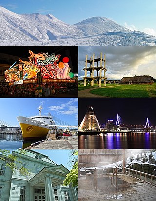
Aomori, officially Aomori City, is the capital city of Aomori Prefecture, in the Tōhoku region of Japan. As of 1 August 2023, the city had an estimated population of 264,945 in 136,781 households, and a population density of 321 people per square kilometer spread over the city's total area of 824.61 km2 (318.38 sq mi). Aomori is one of Japan's 62 core cities and the core of the Aomori metropolitan area.

<span class="mw-page-title-main">Aomori Prefecture</span> Prefecture of Japan

Aomori Prefecture ([a̠o̞mo̞ɾʲikẽ̞ɴ]) is a prefecture of Japan in the Tōhoku region. The prefecture's capital, largest city, and namesake is the city of Aomori. Aomori is the northernmost prefecture on Japan's main island, Honshu, and is bordered by the Pacific Ocean to the east, Iwate Prefecture to the southeast, Akita Prefecture to the southwest, the Sea of Japan to the west, and Hokkaido across the Tsugaru Strait to the north. Aomori Prefecture is the 8th-largest prefecture, with an area of 9,645.64 km2 (3,724.20 sq mi), and the 31st-most populous prefecture, with more than 1.18 million people. Approximately 45 percent of Aomori Prefecture's residents live in its two core cities, Aomori and Hachinohe, which lie on coastal plains. The majority of the prefecture is covered in forested mountain ranges, with population centers occupying valleys and plains. Aomori is the third-most populous prefecture in the Tōhoku region, after Miyagi Prefecture and Fukushima Prefecture. Mount Iwaki, an active stratovolcano, is the prefecture's highest point, at almost 1,624.7 m (5,330 ft).

<span class="mw-page-title-main">Mutsu, Aomori</span> City in Tōhoku, Japan

Mutsu is a city located in Aomori Prefecture, Japan. As of 31 January 2023, the city had an estimated population of 53,804 in 28553, and a population density of 62 persons per km2. The total area of the city is 864.12 square kilometers (333.64 sq mi), making it the largest municipality in Aomori Prefecture in terms of area.
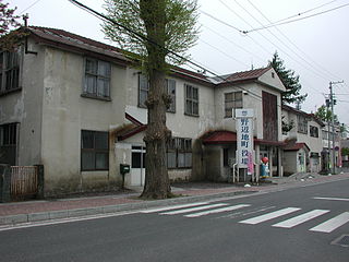
<span class="mw-page-title-main">Noheji</span> Town in Tōhoku, Japan

Noheji is a town located in Aomori Prefecture, Japan. As of 28 February 2023, the town had an estimated population of 12,249 in 6313 households, and a population density of 150 persons per km2. The total area of the town is 81.68 square kilometers (31.54 sq mi).

<span class="mw-page-title-main">Ōma</span> Town in Tōhoku, Japan

Ōma is a town located in Aomori, Japan. As of 31 January 2023, the town had an estimated population of 4,868 in 2500 households, and a population density of 93 per square kilometre (240/sq mi). The total area of the town is 52.10 square kilometres (20.12 sq mi).

<span class="mw-page-title-main">Asamushi-Onsen Station</span> Railway station in Aomori, Aomori Prefecture, Japan

Asamushi-Onsen Station is a railway station and major stop along the Aoimori Railway Line in the city of Aomori in Aomori Prefecture, Japan. It is operated by the third sector railway operator Aoimori Railway Company.

National Route 4 is a major national highway in eastern Honshū, Japan. Measuring 738.5 kilometers long (458.9 mi), it is the longest highway in the country. When oversea routes are included, it is the second longest highway in Japan, with National Route 58 then measuring 884.4 kilometers (549.5 mi) because of its maritime sections. The highway connects Tokyo and Aomori via Utsunomiya, Kōriyama, Sendai, and Morioka.

<span class="mw-page-title-main">Japan National Route 7</span> National highway in Japan

National Route 7 is a major north-south national highway on the Sea of Japan side of the island of Honshū, Japan. It traverses four prefectures, with Niigata at its southern end, then Yamagata, Akita, and finally, Aomori at its northern end. The 471.8-kilometer (293.2 mi) long highway begins at an intersection with national routes 8, 17, 113, 116, 289, 350, and 402 in the capital of Niigata, Niigata. Travelling north, the highway links the prefectural capitals Akita and Aomori. In central Aomori the highway ends at the northern terminus of National Route 4 and National Route 45.

<span class="mw-page-title-main">Ōminato Line</span>

The Ōminato Line is a railway line operated by East Japan Railway Company. It connects Noheji Station and Ōminato Station on the Shimokita Peninsula in eastern Aomori Prefecture.

National Route 45 is a national highway of Japan connecting Aoba-ku, Sendai and Aomori, Aomori. Alongside Japan National Route 6, it is a main route along the Pacific coast of eastern Japan. It is paralleled closely by the incomplete Sanriku Expressway between Sendai and Hachinohe.

National Route 101 is a national highway of Japan connecting the capitals of Aomori and Akita prefectures, Aomori and Akita in northern Japan, with a total length of 241.6 kilometers (150.1 mi). The majority of the highway travels along the coast of the Sea of Japan, paralleling the more inland National Route 7. The present-day highway largely follows the path of the Ōmagoe-kaidō, an Edo period road that linked the Kubota and Hirosaki feudal domains.

<span class="mw-page-title-main">Japan National Route 280</span> National highway of Japan

National Route 280 is a national highway of Japan that traverses the prefectures, Aomori and Hokkaido as well as the Tsugaru Strait that separates them. It currently is made up of two sections that travel 150.7 kilometres (93.6 mi) from Aomori, north across the Tsugaru Peninsula to Sotogahama where the first section ends at the site of a former ferry to across the Tsugaru Strait to the town, Fukushima. The other section begins at the corresponding former ferry terminal in Fukushima. The road then travels alongside the southern coast of Hokkaido concurrently with National Route 228 to Hakodate where the route meets its northern terminus.

<span class="mw-page-title-main">Japan National Route 338</span> National highway in Japan

National Route 338 is a national highway in the Japanese prefectures of Hokkaido and Aomori. Route 338 stretches 241.3 kilometers (149.9 mi) from National Route 5 in Hakodate, Hokkaido south across the Tsugaru Strait by ferry to Ōma, Aomori, around the western, southern, and eastern edges of the Shimokita Peninsula and finally to Oirase.

National Route 339 is a national highway of Japan that traverses the western side of Aomori Prefecture, traveling south to north. The 108.4-kilometer (67.4 mi) highway begins as a concurrent route with National Route 7 in central Hirosaki, it then leaves National Route 7 in Fujisaki and travels north through the municipalities of Itayanagi, Tsuruta, Goshogawara, and Nakadomari before ending at an intersection with National Route 280 in Sotogahama. In a unique feature, a 0.4-kilometer-long (0.25 mi) section of the route on Cape Tappi is a staircase.

<span class="mw-page-title-main">Japan National Route 394</span> National highway in Japan

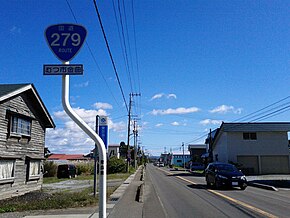
National Route 394 is a national highway in the Japanese prefecture of Aomori. Route 394 stretches 185 km from National Routes 279 and 338 in Mutsu southwest to National Route 7 in Hirosaki.

<span class="mw-page-title-main">Michinoku Toll Road</span> Toll road in Aomori Prefecture, Japan

The Michinoku Toll Road is a two-lane toll road in Aomori Prefecture connecting the cities Aomori and Hachinohe via Shichinohe. It serves as an alternative to Japan National Route 4, bypassing the towns Hiranai and Noheji by cutting directly through the Hakkōda Mountains and other mountains of the northern Ōu Mountain Range. The road is managed by the Aomori Prefecture Road Corporation and is numbered E4A as an extension of the Tōhoku Expressway.

<span class="mw-page-title-main">Kamikita Expressway</span> Free two-lane expressway in Aomori Prefecture

The Kamikita Expressway is a free two-lane expressway in Aomori Prefecture connecting the towns of Shichinohe and Rokunohe. Alongside other tolled roads, the expressway is part of a series of highways that will link the Hachinohe Expressway to the Aomori Expressway. The road is managed by the Ministry of Land, Infrastructure and Transport and is numbered E4A as an extension of the Tōhoku Expressway. It is routed concurrently with an alternate route of Japan National Route 45.

<span class="mw-page-title-main">Tsugaru Expressway</span>

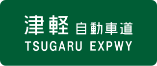
The Tsugaru Expressway is a two-lane national expressway in Aomori Prefecture, Japan. The expressway connects the prefecture's capital, Aomori, and the Tōhoku Expressway to the municipalities of Goshogawara, Tsugaru and, Ajigasawa. It is owned and operated by Ministry of Land, Infrastructure, Transport and Tourism and is signed as an auxiliary route of National Route 101 as well as E64 under their "2016 Proposal for Realization of Expressway Numbering."

<span class="mw-page-title-main">Shimokita Expressway</span>

The Shimokita Expressway is a two-lane national expressway in Aomori Prefecture, Japan. The expressway connects Noheji to the municipalities of Rokkasho, and Yokohama. It is owned and operated by Ministry of Land, Infrastructure, Transport and Tourism (MLIT), and is signed as an auxiliary route of National Route 279, but has no expressway number under their "2016 Proposal for Realization of Expressway Numbering."

The Tanabu Kaidō (田名部街道) is a road in eastern Aomori Prefecture that connects the town of Noheji in the south, to the city of Mutsu to the north. It was established by the Nanbu clan as an extension of the Matsumaedō a sub-route of the Ōshū Kaidō, one of the five routes established by Tokugawa Ieyasu for traveling government officials during the Edo period.

References

  1. "一般国道の路線別、都道府県別道路現況" [Road statistics by General National Highway route and prefecture](PDF) (in Japanese). Ministry of Land, Infrastructure, Transport and Tourism. Retrieved 10 October 2019.
  2. Google (11 October 2019). "Route 279 in Hakodate" (Map). Google Maps . Google. Retrieved 11 October 2019.
  3. "ICASMAP2" (PDF). City of Hakodate (Map) (in Japanese). 21 January 2014. Retrieved 6 February 2020.
  4. "「はまなすライン」の改良について" [Improvement of the Hamanasu Line]. Aomori Prefecture Government. 3 January 2006. Retrieved 10 February 2020.
  5. "Flower Calendar". Imperial Household Agency . Retrieved 10 February 2020.
  6. "michinoeki-Yokohama". Michi-no-Eki Website. Retrieved 10 February 2020.
  7. Google (10 October 2019). "Route 279" (Map). Google Maps . Google. Retrieved 10 October 2019.
  8. 平成27年度全国道路・街路交通情勢調査 一般交通量調査 箇所別基本表 [2015 Traffic Report by intersection](PDF) (Report). Ministry of Land, Infrastructure, Transport and Tourism. 2015. p. 7. Retrieved 10 February 2020.
  9. Chris Bamforth (22 December 2006). "Mountain of dread". The Japan Times. Retrieved 10 February 2020.
  10. Aomori Prefecture Folklore Museum (29 March 1986). 青森県「歴史の道」調査報告書 [Aomori Prefecture Historic Roads Survey Report] (in Japanese). Aomori Prefecture Board of Education. p. 1. JPNO   000001805973.
  11. 一般国道の路線を指定する政令 [Cabinet Order Designating General National Routes] (in Japanese). Cabinet of Japan. 1965. Retrieved 10 October 2019 via Wikisource.
  12. "ノスタルジック航路(函館〜大間航路)" [Nostalgic Route (Hakodate-Ōma)]. Tsugaru Kaikyō Ferry (in Japanese). Retrieved 10 February 2020.
  13. "道路施設・高規格道路建設課(道路整備)" [Road Facilities and Expressway Construction Section (Road Improvement)]. Aomori Prefecture Government (in Japanese). 1 July 2008. Retrieved 18 October 2019.
  14. "「いつになったら動く」鳥取の大雪、立ち往生15時間超" ["When will it move?" Heavy Snow in Tottori causes 15-hour Traffic Jam]. The Asahi Shimbun (in Japanese). 24 January 2017. Retrieved 11 October 2019.
  15. "【動画】青森 むつ 国道279号線の橋の一部崩れる 大雨影響" [[Video] Mutsu, Aomori Part of the bridge on National Route 279 collapsed due to heavy rain]. NHK (in Japanese). 10 August 2022. Archived from the original on 17 January 2022. Retrieved 24 September 2022.
  16. "青森で大雨、むつで橋の一部崩落 自衛隊に派遣要請" [Heavy rain in Aomori, partial collapse of bridge at Mutsu Request for dispatch to the Self-Defense Forces]. Kahoku Shimpō (in Japanese). 10 August 2021. Archived from the original on 12 August 2021. Retrieved 24 September 2022.
  17. "国道279号「小赤川橋」の進捗状況について" [About the progress of National Route 279 "Koakagawa Bridge"] (in Japanese). City of Mutsu. 3 June 2022. Retrieved 24 September 2022.
  18. Google (11 October 2019). "Route 279 in Hakodate" (Map). Google Maps . Google. Retrieved 11 October 2019.
  19. Google (10 October 2019). "Route 279" (Map). Google Maps . Google. Retrieved 10 October 2019.
  20. "下北半島縦貫道路|青森県庁ウェブサイト Aomori Prefectural Government" [Shimokita Expressway: Aomori Prefectural Government website]. www.pref.aomori.lg.jp. Retrieved 5 February 2020.
  21. "下北道むつ南バイパスが一部開通" [Partial opening of the Shimokita Mutsu South Bypass] (in Japanese). 23 December 2019. Retrieved 5 February 2020.
  22. "一般国道279号 下北半島縦貫道路「むつ南バイパス」 交通開放(開通)のお知らせ" [National Highway 279 Shimokita Peninsula Expressway "Mutsu-minami Bypass" (opening)](PDF) (in Japanese). 29 November 2019. Retrieved 17 February 2020.
  23. Google (17 February 2020). "Mutsu Bypass" (Map). Google Maps . Google. Retrieved 17 February 2020.