
Aomori Prefecture ([a̠o̞mo̞ɾʲikẽ̞ɴ]) is a prefecture of Japan in the Tōhoku region. The prefecture's capital, largest city, and namesake is the city of Aomori. Aomori is the northernmost prefecture on Japan's main island, Honshu, and is bordered by the Pacific Ocean to the east, Iwate Prefecture to the southeast, Akita Prefecture to the southwest, the Sea of Japan to the west, and Hokkaido across the Tsugaru Strait to the north. Aomori Prefecture is the 8th-largest prefecture, with an area of 9,645.64 km2 (3,724.20 sq mi), and the 31st-most populous prefecture, with more than 1.18 million people. Approximately 45 percent of Aomori Prefecture's residents live in its two core cities, Aomori and Hachinohe, which lie on coastal plains. The majority of the prefecture is covered in forested mountain ranges, with population centers occupying valleys and plains. Aomori is the third-most populous prefecture in the Tōhoku region, after Miyagi Prefecture and Fukushima Prefecture. Mount Iwaki, an active stratovolcano, is the prefecture's highest point, at almost 1,624.7 m (5,330 ft).

Mutsu is a city located in Aomori Prefecture, Japan. As of 31 January 2023, the city had an estimated population of 53,804 in 28553, and a population density of 62 persons per km2. The total area of the city is 864.12 square kilometers (333.64 sq mi), making it the largest municipality in Aomori Prefecture in terms of area.

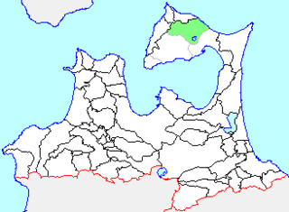
Yokohama is a town located in Aomori Prefecture, Japan. As of 1 March 2023, the town had an estimated population of 4,258 in 2134 households, and a population density of 33 persons per km2, in 1,779 households. The total area of the town is 126.38 square kilometres (48.80 sq mi).

Hiranai is a town located in Aomori Prefecture, Japan and a part of the Aomori metropolitan area. As of 1 December 2023, the town had an estimated population of 9,967 in 4,775 households, and a population density of 46 persons per km². It is the most heavily populated town in Higashitsugaru District. The total area of the town is 217.09 km2 (83.82 sq mi).
Imabetsu is a town located in Aomori Prefecture, Japan and a part of the Aomori metropolitan area. As of 31 December 2022, the town had an estimated population of 2,311 in 1338 households, and a population density of 18 persons per km2. The total area of the town is 125.27 km2 (48.37 sq mi).

Yomogita is a village located in Aomori Prefecture, Japan and a part of the Aomori metropolitan area. As of 31 January 2023, the village had an estimated population of 2740 in 1129 households, and a population density of 32 persons per km2. The total area of the village is 80.84 square kilometres (31.21 sq mi).
Fukaura is a town located in Aomori Prefecture, Japan. As of 31 January 2023, the town had an estimated population of 7,268 in 3553 households, and a population density of 15 persons per km2. The total area of the town is 488.85 km2 (188.75 sq mi).
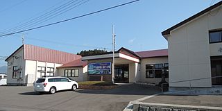
Ōhata was a town located in Shimokita District in northern Aomori Prefecture, Japan.

Ōma is a town located in Aomori, Japan. As of 31 January 2023, the town had an estimated population of 4,868 in 2500 households, and a population density of 93 per square kilometre (240/sq mi). The total area of the town is 52.10 square kilometres (20.12 sq mi).

Higashidōri is a village located in Aomori, Japan. As of 31 January 2023, the village had an estimated population of 5,913 in 2829 households, and a population density of 20 persons per km². Its total area is 295.27 square kilometres (114.00 sq mi).
Kazamaura is a village located in Aomori Prefecture, Japan. As of 28 February 2023, the village had an estimated population of 1,673 in 864 households, and a population density of 24 persons per km2. The total area of the village is 69.55 square kilometres (26.85 sq mi).

Wakinosawa was a village located in Shimokita District in northern Aomori Prefecture, Japan.

The Shimokita Peninsula is the remote northeastern cape of the Japanese island of Honshū, stretching out towards Hokkaidō.

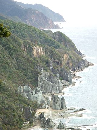
Hotokegaura is a series of rock formations along the sea cliffs on the west coast of Shimokita Peninsula at the entrance to Mutsu Bay in far northern Japan. These rock formations were designed a Natural Monument of Aomori Prefecture in 1934, and became further protected from April 23, 1941 as a nationally designated Place of Scenic Beauty and Natural Monument, From 1968, the rock formations were also located within the borders of the Shimokita Hantō Quasi-National Park. In 1975, the surrounding waters were designated as Hotokegaura Marine Park.

Sotogahama is a town located in Aomori Prefecture, Japan and a part of the Aomori metropolitan area. As of 1 January 2023, the town had an estimated population of 4,990 in 2239 households, and a population density of 22 persons per km2. The total area of the town is 230.30 square kilometres (88.92 sq mi).

Mutsu Bay is a bay located within Aomori Prefecture, in the northern Tōhoku region of northern Japan. It has an east-west distance of approximately 40 kilometers and a north-south distance of approximately 40 kilometers at its eastern end, with a total area of approximately 1,667.89 square kilometers.
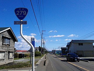
National Route 279 is a national highway of Japan that traverses the prefectures of Aomori and Hokkaido, as well as the Tsugaru Strait that separates them. The 134.0-kilometer (83.3 mi) highway begins at an intersection with National Route 5 in Hakodate, then crosses the Tsugaru Strait on a ferry from Hakodate to Ōma, Aomori, that it shares with National Route 279, where it then travels south through eastern Aomori Prefecture, passing through the city of Mutsu before ending at an intersection with National Route 4 in Noheji.

National Route 338 is a national highway in the Japanese prefectures of Hokkaido and Aomori. Route 338 stretches 241.3 kilometers (149.9 mi) from National Route 5 in Hakodate, Hokkaido south across the Tsugaru Strait by ferry to Ōma, Aomori, around the western, southern, and eastern edges of the Shimokita Peninsula and finally to Oirase.
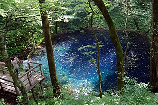
Shimokita Hantō Quasi-National Park is a quasi-national park in the Shimokita Peninsula of Aomori Prefecture in the Tōhoku region of far northern Honshū in Japan. It is rated a protected landscape according to the IUCN. The park, consists of several discontinuous locations, which include:

Taijima is an uninhabited set of rocky islands off the coast of the Shimokita Peninsula in Mutsu Bay. The island is a part of the city of Mutsu in Aomori Prefecture. The island has 0.4 kilometers (0.25 mi) of coastline and an area of 0.016 square kilometers (0.0062 sq mi). It is a part of the prefecture-managed, Shimokita Hantō Quasi-National Park.


