
Marmolada is a mountain in northeastern Italy and the highest mountain of the Dolomites. It lies between the borders of Trentino and Veneto. The Marmolada is an ultra-prominent peak (Ultra).

Pizzo Rotondo is a mountain in the Lepontine Alps. At 3,190 metres above sea level, it is the highest mountain lying on the border between the cantons of Ticino and Valais, as well as the highest summit of the Lepontine Alps lying between Nufenen Pass and Lukmanier Pass.

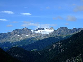
Pizzo Gallina is a 3,061-metre-high (10,043 ft) mountain in the Lepontine Alps of Switzerland, overlooking the Nufenen Pass.

Pizzo Centrale is a mountain in the Lepontine Alps, located on the border between the cantons of Uri and Ticino. At 2,999 metres above sea level, it is the highest summit overlooking Gotthard Pass from the east. Lago della Sella is located on its southern side. Over its northern side lies a glacier, named Ober Schatzfirn.

Pizzo di Cassimoi is a mountain of the Lepontine Alps, located on the border between the Swiss cantons of Ticino (west) and Graubünden (east). The mountain overlooks two lakes: Lago di Luzzone on its north-eastern side and Zervreilasee on its north-eastern side.

The Zapporthorn or Pizzo Zapport is a mountain of the Swiss Lepontine Alps, overlooking San Bernardino Pass in Graubünden. Its summit is the tripoint between the valleys of Hinterrhein, Calanca and Mesolcina. The summit is located approximately two kilometres east from the Ticino border.

The Portjengrat is a mountain of the Pennine Alps, located on the border between Switzerland and Italy. It lies south of the Weissmies and the Zwischbergen Pass, where the international border diverges away from the main Alpine watershed. The summit of the Portjengrat has an elevation of 3,654 metres above sea level and is the tripoint between the valleys of Saas, Divedro and Antrona. It is the culminating point of the Antrona valley.

The Wandfluhhorn is a mountain of the Lepontine Alps, located on the border between Switzerland and Italy. It overlooks Bosco/Gurin on its (Swiss) eastern side and Formazza on its (Italian) western side. Reaching a height of 2,863 metres above sea level, the Wandfluhhorn is the highest summit of the Bosco/Gurin valley.

The Madonie are one of the principal mountain ranges on the island of Sicily, located in the Northern part of the island.

Pizzo Barone is a mountain of the Lepontine Alps in Switzerland. It is located south of Pizzo Campo Tencia and is the highest summit of the Valle Verzasca in the canton of Ticino. From Sonogno a trail leads to the summit.

Pizzo di Claro is a 2,727 metres high mountain of the Lepontine Alps, located on the border between the Swiss cantons of Ticino and Graubünden. It overlooks Claro on its western side, although Cresciano is closer. On its eastern side it overlooks the valley of Calanca near Arvigo (Graubünden). A small lake lies west of the summit at 2,198 metres, Lago Canee.

The Surettahorn is a mountain in the Oberhalbstein Range of the Alps located on the border between Italy and Switzerland. It overlooks the Splügen Pass on its west side.
Piz Cancian is a mountain in the Bernina Range of the Alps, located on the border between Italy and the Switzerland. The summit has an elevation of 3,103 metres (10,180 ft) above sea level.
Pizzo Quadro is a mountain of the Lepontine Alps on the Swiss-Italian border. With an elevation of 2,793 metres above sea level, it is the highest summit of the range lying south of the Wandfluhhorn and the Guriner Furggu. Pizzo Quadro is located between the localities of San Rocco di Prèmia (Piedmont) and Campo (Ticino).

Tambohorn or Pizzo Tambo[ˈpittso ˈtambo] or Pizzo Tambò[ˈpittso tamˈbɔ] is a mountain located at the eastern extremity of the Lepontine Alps on the Swiss-Italian border. The mountain lies on the German-Italian language border, west of the Splügen Pass which divides the Western Alps from the Eastern Alps.

Pizzo Coca is a mountain that straddles the Val Seriana and the Valtellina in Lombardy, Italy. It is the highest peak in the Bergamo Alps. Its height is 3,050 metres with a prominence height of 1,878 metres and a saddle of 1,172 metres. A post-glacial valley exists near a point called "ometto in sassi" at 2,400 meters.

The Chrüzlistock is a mountain of the Glarus Alps, located north of Sedrun on the border between the Swiss canton of Graubünden and Uri. The southern unnamed summit has an elevation of 2,717 metres (8,914 ft) and the northern summit, which is the named peak and is located on the cantonal border, has an elevation of 2,709 metres (8,888 ft).

Pizzo Bianco is a mountain of the Pennine Alps, overlooking Macugnaga in the Italian region of Piedmont. It lies on the range north of the Punta Grober, between the Belvedere Glacier and the valley of Quarazza.
Pizzo Ferré is a mountain of the Lepontine Alps, located west of Isola in the Italian region of Lombardy. The Swiss border runs 140 metres west of the summit at approximately 3,040 m.
Pizzo di Zocca is a mountain of the Bregaglia Range, located on the border between Switzerland and Italy. Its summit lies between the valleys of Albigna and Val di Mello.
