
Yass Valley Council is a local government area in the Southern Tablelands region of New South Wales, Australia. The area is located adjacent to the Hume and Barton Highways and the Main Southern railway line.

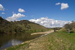
Yass is a town on the periphery of the Southern Tablelands and South West Slopes of New South Wales, Australia. The name appears to have been derived from an Aboriginal word, "Yarrh", said to mean 'running water'.

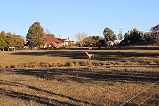
Murrumbateman is a town in the Southern Tablelands of New South Wales, Australia. It is on the Barton Highway, approximately 30 kilometres north-west of Canberra, and is part of the Yass Valley Shire. At the 2016 census, Murrumbateman had a population of 3,219 people.

Uriarra is a locality in the Southern Tablelands of New South Wales, Australia in the Yass Valley Shire. It is north of the locality of Uriarra in the Australian Capital Territory and north-west of Canberra. At the 2016 census, it had a population of 30. The locality is mostly located in the Urayarra parish of Cowley County, although part of it in Pabral parish, which lies further west.

Sutton is a small village in the Southern Tablelands of New South Wales, Australia in Yass Valley Shire. It is situated on the west bank of the Yass River, about 17 kilometres south of Gundaroo, near the Federal Highway, not far from Canberra. It has a primary school, an Anglican church, a general store, an estate agent, an artists gallery, and a baker. Sutton has its own volunteer Bush Fire Brigade located in the village.

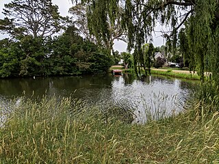
Gundaroo is a small village in the Southern Tablelands of New South Wales, Australia and in Yass Valley Council. It is situated to the east of the Yass River, about 16 kilometres (10 mi) north of Sutton, about 15 kilometres (9 mi) west of the Lake George range. At the 2016 census, Gundaroo "state suburb" had a population of 1,146. At the 2006 census, its "urban centre/locality" had a population of 331.
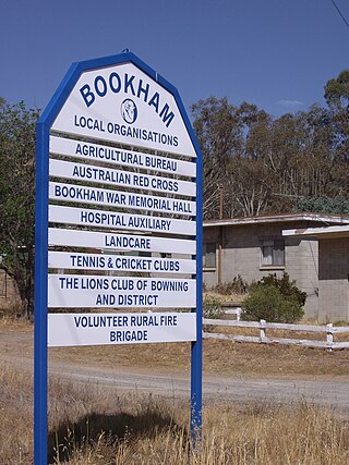
Bookham is a small village and rural locality in the South West Slopes and Riverina regions of New South Wales, Australia in Yass Valley Shire. It is about 29 km west of Yass on the Hume Highway.
Burrinjuck is a village community in the far eastern part of the Riverina, in the South West Slopes of New South Wales. By road it is about 15 kilometres (9.3 mi) southwest of Woolgarlo and 28 kilometres (17 mi) south from Bookham. The name of the town is derived from an Aboriginal word meaning 'mountain with a rugged top'. At the 2016 census, the Burrinjuck area had a population of 19.
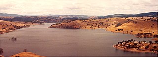
Woolgarlo is a locality on the foreshores of the Yass River arm of Lake Burrinjuck, in the far eastern part of the Riverina in the Yass Valley Shire of New South Wales, Australia. At the 2016 census, it had a population of 26.
Cavan is a rural community situated on the south bank of the Murrumbidgee River in the Yass Valley Shire. At the 2016 census, it had a population of 47. It is situated by road, about 40 kilometres southwest of Yass and 43 northwest of Canberra. It was named after the town of Cavan in Ireland. It is reportedly owned by Rupert Murdoch.
The Jeir Creek, a perennial river that is part of the Murrumbidgee catchment within the Murray–Darling basin, is located in the South West Slopes region of New South Wales, Australia.
Lade Vale is a locality in the Upper Lachlan Shire, New South Wales, Australia. It lies on the south side of the Hume Highway about 30 km to the east of Yass. At the 2016 census, it had a population of 128.

Jerrawa is a locality in the Upper Lachlan Shire, New South Wales, Australia. It lies on the north side of the Hume Highway about 30 km to the east of Yass and was served by Jerrawa railway station on the Main Southern line between Sydney and Melbourne between 1876 and 1975. At the 2016 census, it had a population of 73.
Manton is a locality in the Yass Valley Council, New South Wales, Australia. It lies on both sides of both the Hume Highway and the Barton Highway to the east of their intersection about 10 km to the east of Yass. At the 2016 census, it had a population of 294.

Bellmount Forest is a locality in the Upper Lachlan Shire and the Yass Valley Council area, New South Wales, Australia. It lies on the both sides of the Gundaroo Road between Gundaroo and Gunning, about 50 km north of Canberra. At the 2016 census, it had a population of 114.

Yass River is a locality in the area of the Yass Valley Council, in New South Wales, Australia. It lies on both sides of both the Yass River to the northeast of Murrumbateman and the northwest of Gundaroo. It is about 50 km north of Canberra. At the 2016 census, it had a population of 350.
Mullion is a locality in the Southern Tablelands of New South Wales, Australia in the Yass Valley Shire. It lies north-west of Canberra on the western side of the Murrumbidgee River. At the 2016 census, it had a population of 84. It had a public school from 1959 to 1972. The locality is located in the Umburra parish of Cowley County, with a small part of it in Mullion parish, which lies further west.

Good Hope is a locality in the Southern Tablelands of New South Wales, Australia in the Yass Valley Shire. It lies south-west of Yass on the northern side of Lake Burrinjuck on the Murrumbidgee River and south of the Yass River. At the 2016 census, it had a population of 165.
Narrangullen, New South Wales is a rural locality of Yass Valley Council on the south side of Lake Burrinjuck on the road between Yass and Wee Jasper, about 60 km northwest of Canberra. At the 2016 census, it had a population of 27. Narrangullen had a "provisional" school in 1943.
Boambolo is a locality in the Yass Valley Council, New South Wales, Australia. It is on the Yass–Wee Jasper road about 15 km south of Yass. At the 2016 census, it had a population of 53.
