
Uriarra is a locality in the Southern Tablelands of New South Wales, Australia in the Yass Valley Shire. It is north of the locality of Uriarra in the Australian Capital Territory and north-west of Canberra. At the 2016 census, it had a population of 30. The locality is mostly located in the Urayarra parish of Cowley County, although part of it in Pabral parish, which lies further west.
Wallaroo is a rural locality in New South Wales close to the Australian Capital Territory. It lies north of the Australian Capital Territory border, north west of Hall, west of the Barton Highway, and east of the Murrumbidgee River. It is approximately 19 kilometres north-west of the Australian city of Canberra. At the 2016 census, it had a population of 707.

Jerangle is a locality in New South Wales, Australia. The locality is in the Snowy Monaro Regional Council local government area, 366 kilometres (227 mi) south of the state capital, Sydney and 112 kilometres (70 mi) south east of the national capital, Canberra. At the 2016 census, Jerangle had a population of 96.

Mount Fairy is a locality in the Queanbeyan–Palerang Regional Council, New South Wales, Australia. It is located to the east of the Bungendore–Tarago road. At the 2016 census, it had a population of 205.
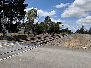
Yarra is a locality in the Goulburn Mulwaree Council, New South Wales, Australia. It is located about 18 km southwest of Goulburn, 84 km northeast of Canberra and 213 km southwest of Sydney. It lies at the intersection of the Federal Highway and the Hume Highway. At the 2016 census, it had a population of 173. Yarra railway station was a station on the Main Southern railway line from 1875 to the 1970s. A small settlement grew up around the railway station and the Hume Highway, parts of which were demolished during road widening in the 1970s. It had a public school from 1869 to 1970, operating as a "half-time" school until 1873.
Nanima is a locality in the Yass Valley Council area, New South Wales, Australia. It lies on the both sides of the Murrumbateman Road between Murrumbateman and Gundaroo, about 37 km north of Canberra. At the 2016 census, it had a population of 165.

Rose Valley is a locality in the Municipality of Kiama, in the Illawarra region of New South Wales, Australia. It lies west of the Princes Highway to the west of Gerringong about 130 km south of Sydney. At the 2016 census, it had a population of 76. It had a public school from 1868 to 1877 and 1884 to 1904.

Good Hope is a locality in the Southern Tablelands of New South Wales, Australia in the Yass Valley Shire. It lies south-west of Yass on the northern side of Lake Burrinjuck on the Murrumbidgee River and south of the Yass River. At the 2016 census, it had a population of 165.

Anembo is a locality in the Snowy Monaro Region, New South Wales, Australia. It lies south of Captains Flat and northeast of Bredbo. At the 2016 census, it had a population of 66. It had a public school from 1868 to 1942, often operating "half-time" or "house to house".

Jingera is a locality in the Snowy Monaro Region, New South Wales, Australia. It lies south of Captains Flat and northeast of Bredbo. At the 2016 census, it had a population of 39. It had a public school from 1889 to 1911 and from 1914 to 1941, often operating "half-time".
Mulloon is a locality in the Queanbeyan-Palerang Region, Southern Tablelands, New South Wales, Australia.

Manar is a locality in the Queanbeyan-Palerang Region, Southern Tablelands, New South Wales, Australia. It lies on both sides of the Kings Highway between Bungendore and Braidwood at the intersection with the Braidwood–Goulburn road. At the 2016 census, it had a population of 118.

Monga is a locality in the Queanbeyan-Palerang Region, Southern Tablelands, New South Wales, Australia. It lies on the Kings Highway at the top of the Clyde Mountain, about 110 km east of Canberra and 22 km southeast of Braidwood. A large part of the locality forms part of the Monga National Park. At the 2016 census, it had a population of 14. It had a "provisional" school from 1947 to 1955 and a "public" school from 1955 to 1971.
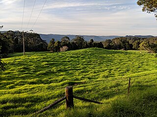
Bellawongarah is a locality in the City of Shoalhaven in New South Wales, Australia. It lies west of the Princes Highway on the Kangaroo Valley Road between Berry and Kangaroo Valley. It lies about 23 kilometre north of Nowra and about 160 km south of Sydney. At the 2016 census, it had a population of 127. It lies on a ridge and is partly covered by temperate rain forest and partly by grasslands that were formerly used for dairying, but are now mainly used for rural residences.

Tinderry is a locality in the Snowy Monaro Region, New South Wales, Australia. It lies to the east of Michelago and South West of Captains Flat. At the 2016 census, it had a population of 66. The western part of the locality lies on the Tinderry Range, which includes Tinderry Peak and Tinderry Twin Peak. A large part of the mountainous terrain forms Tinderry Nature Reserve. Further east the terrain is more open and includes grazing country and the small settlement of Little Tinderry. A public school was located at Little Tinderry from 1899 to 1913, generally described as "half-time", but "provisional" in 1900 and early 1901.

Merrill is a locality in the Upper Lachlan Shire, New South Wales, Australia. It lies on Merrill Creek, to the west of the road from Gunning to Crookwell, about 15 km north of Gunning and 80 km north of Canberra. At the 2016 census, it had a population of 31.

Yerriyong is a locality in the City of Shoalhaven in New South Wales, Australia. It lies about 17 km to the southwest of Nowra on the road to Nerriga and Canberra. It is largely made up of eucalyptus forest. At the 2016 census, it had a population of 25.
Far Meadow is a locality in the City of Shoalhaven in New South Wales, Australia. It lies to the south of Coolangatta Road to the southeast of Berry. At the 2016 census, it had a population of 215.
Bolong is a locality in the City of Shoalhaven in New South Wales, Australia. It lies to the north of the Shoalhaven River and to the west of Broughton Creek. It is northeast of Nowra. At the 2016 census, it had a population of 104.

Bannister is a locality in the Upper Lachlan Shire, New South Wales, Australia. It lies about 20 km south of Crookwell and 90 km northeast of Canberra. At the 2016 census, it had a population of 120.

