The Districts of Ghana are second-level administrative subdivisions of Ghana, below the level of region. There are 261 local metropolitan, municipal and district assemblies.
The Upper East Region is located in north Ghana and is the third smallest of the 16 administrative regions in Ghana. It occupies a total land surface of 8,842 square kilometers or 2.7 per cent of the total land area of Ghana. The Upper East regional capital is Bolgatanga, sometimes referred to as Bolga. Other major towns in the region include Navrongo, Paga, Bawku and Zebilla.

The Northern Region is one of the sixteen regions of Ghana. It is located in the north of the country and was the largest of the sixteen regions, covering an area of 70,384 square kilometres or 31 percent of Ghana's area until December 2018 when the Savannah Region and North East Region were created from it. The Northern Region is divided into 14 districts. The region's capital is Tamale.
Kwahu refers to an area and group of people that live in Ghana and are part of the Twi-speaking Akan group. The area has been dubbed Asaase Aban, or the Natural Fortress, in view of its position as the highest habitable elevation in the country. Kwahu lies in the Eastern Region of Ghana, on the west shore of Lake Volta. The Kwahus share the Eastern Region with their fellow Akans: the Akyem and Akuapem, as well as the Adangbe-Krobos. A significant migrant population from the Northern and Volta Regions and some indigenous Guans from the bordering Oti and Brong East Regions live in the Afram Plains area. They work as traders, farm-hands, fisherfolk, and caretakers in the fertile waterfront 'melting pot'.

Suhum, Ghana is a peri-urban town and the capital of the Suhum Municipal District, a district in the Eastern Region Ghana. Suhum has a 2021 settlement population of 126,403. The town lies along the Accra-Kumasi Highway.

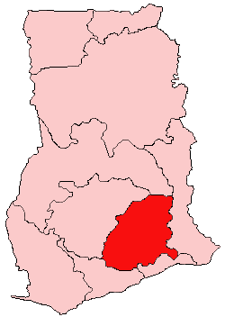
Nkoranza North is one of the constituencies represented in the Parliament of Ghana. It elects one Member of Parliament (MP) by the first past the post system of election. Nkoranza North is located in the Nkoranza district of the Bono East Region of Ghana.

Kibi or Kyebi is a town and the capital of the East Akim Municipal District, a district in the Eastern Region of south Ghana, on the eastern slopes of the Atewa Range. Kibi lies at an altitude of 318 m and, in 2013, had a population of 11,677 people.

Sissala East is one of the constituencies represented in the Parliament of Ghana. It elects one Member of Parliament (MP) by the first past the post system of election. Sissala East is located in the Sissala East Municipal of the Upper West Region of Ghana.
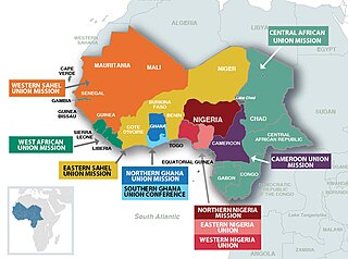
The West-Central Africa Division (WAD) of Seventh-day Adventists is a sub-entity of the General Conference of Seventh-day Adventists, which coordinates the Church's operations in 22 African countries, which include Benin, Burkina Faso, Cameroon, Cape Verde, Central African Republic, Chad, Congo, Equatorial Guinea, Gabon, Gambia, Ghana, Guinea, Guinea-Bissau, Ivory Coast, Liberia, Mali, Mauritania, Niger, Nigeria, Senegal, Sierra Leone, and Togo. Its headquarters is in Abidjan, Côte d'Ivoire. The Division membership as of June 30, 2021 is 889,196

Roads in Ghana form a network of varied quality and capacity. Responsibility for the road network differs between trunk and non-trunk routes. Trunk roads, which are the most important roads, are administered by the Ghana Highway Authority, which was established in 1974 to develop the trunk road network. Ghana's 13,367 km of trunk roads accounts for 33% of the total road network of 40,186 km. The Department of Feeder Roads is responsible for the construction and maintenance of feeder roads in Ghana, while responsibility for urban roads lies with the Department of Urban Roads.
Bosome Freho District is one of the forty-three districts in Ashanti Region, Ghana. Originally it was formerly part of the then-larger Amansie East District in 2004; until the eastern part of the district was split off by a decree of president John Agyekum Kufuor on 29 February 2008 to create Bosome Freho District; thus the remaining part has been renamed as Bekwai Municipal District while it was elevated to municipal district assembly status on that same year. The district assembly is located in the southern part of Ashanti Region and has Asiwa as its capital town.

Abetifi is a small town in south Ghana and is the capital of Kwahu East district, a district in the Eastern Region of south Ghana.
Kukurantumi is the capital of the Abuakwa North Municipal District of the Eastern Region of Ghana.
Asiakwa is a town in the East Akim District of the Eastern Region of Ghana.
Apedwa is a town in the East Akim District of the Eastern Region of Ghana.
Anyinam is a town and capital of the Atiwa East District located in the Eastern Region of Ghana.
Manhyia is a town in the West Akim District of the Eastern Region of Ghana.

The Division One League is the second tier football league in Ghana organized by the Ghana Football Association. It was previously known by the title sponsor as the GN Bank Division One League. It is below the Ghana Premier League. The winner of each of the 3 zones will promote to the 1st tier League

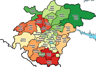
Atiwa East District is one of the thirty-three districts in Eastern Region, Ghana. Originally it was formerly part of the then-larger East Akim District on 17 February 2004, which was created from the former East Akim District Council, until the eastern part of the district was split off to create Atiwa East District on 1 June 2018; thus the remaining part has been renamed as Atiwa West District. The district assembly is located in the central part of Eastern Region and has Anyinam as its capital town.
Atiwa West District is one of the thirty-three districts in Eastern Region, Ghana. Originally it was formerly part of the then-larger East Akim District on 17 February 2004, which was created from the former East Akim District Council, until the eastern part of the district was split off to create Atiwa East District on 1 June 2018; thus the remaining part has been renamed as Atiwa West District. The district assembly is located in the central part of Eastern Region and has Kwabeng as its capital town.
