Beulah is an unincorporated community in northern Texas county and southern Phelps County, Missouri, United States. It is located at the edge of the Mark Twain National Forest, approximately nine miles north of Licking in adjacent Texas County. The community is on both sides of Missouri Route K, three miles west of U.S. Route 63.
Vida is an unincorporated community in Phelps County, Missouri, United States. Vida is approximately six miles south of Rolla, near the junction of US Highway 63 and Missouri Route W. Vida is located at an elevation of 1033 feet above sea level. Vida can be found on Phelps County plat maps in Section 10, Township 36 N, Range 9 W.
Spring Creek is a stream in Maries and Phelps counties of Missouri. It is a tributary of Gasconade River.
Nelsonville is an unincorporated community in Marion County, in the U.S. state of Missouri.
Blooming Rose is an unincorporated community in the southwest corner of Phelps County, in the U.S. state of Missouri. The community is on Missouri Route K between Beulah to the east and Duke to the north. Licking is approximately nine miles (14 km) to the southeast, in Texas County.
Clinton is an unincorporated community in Phelps County, in the U.S. state of Missouri.
Dillon is an unincorporated community in Phelps County, in the U.S. state of Missouri. The community is located along the BNSF railroad line between Rolla and St. James.
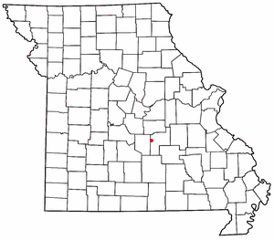
Elk Prairie is an unincorporated community in Phelps County, in the U.S. state of Missouri. The community was located on Missouri Route 72 approximately seven miles south-southeast of Rolla.
Kaintuck Hollow is a valley in western Phelps County in the Ozarks of Missouri.
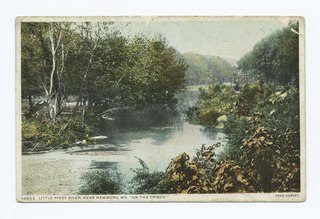
Little Piney Creek is a stream in the Phelps, Texas and Dent counties of the Ozarks of southern Missouri. It is a tributary of the Gasconade River.
Table Rock is an unincorporated area in northwestern Phelps County, in the U.S. state of Missouri. The community is located on the west bank of the Gasconade River, approximately 2.5 miles north of Jerome.
Winkler is an unincorporated community in southeast Phelps County, in the U.S. state of Missouri. The community is located on Missouri Route 68, thirteen miles north of Salem and eleven miles south of St. James.
Arlington Township is an inactive township in Phelps County, in the U.S. state of Missouri.
Cold Spring Township is an inactive township in Phelps County, in the U.S. state of Missouri.
Dillon Township is an inactive township in Phelps County, in the U.S. state of Missouri.
Liberty Township is an inactive township in Phelps County, in the U.S. state of Missouri.
Meramec Township is an inactive township in Phelps County, in the U.S. state of Missouri.
Rolla Township is an inactive township in Phelps County, in the U.S. state of Missouri.
Spring Creek Township is an inactive township in Phelps County, in the U.S. state of Missouri.
Fountain Farm is an extinct town in Washington County, in the U.S. state of Missouri.