Related Research Articles

Hot Spring County is located in the U.S. state of Arkansas. As of the 2020 census, the population was 33,040. The county seat is Malvern. Established on November 2, 1829, in the Arkansas Territory from a part of Clark County; it was named after the hot springs at Hot Springs, Arkansas, which were formerly in the county.
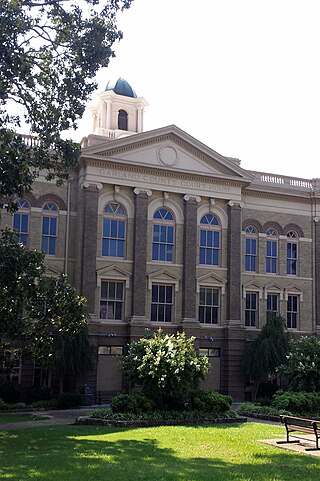
Garland County is located in the U.S. state of Arkansas. As of the 2020 census, the population was 100,180. The county seat is Hot Springs.
Fulton County is a county located in the U.S. state of Arkansas. As of the 2020 census, the population was 12,075. The county seat is Salem. Fulton County was formed on December 21, 1842, and named for William Fulton, the last governor of the Arkansas Territory. It is an alcohol prohibition or dry county.
Boone County is located in the U.S. state of Arkansas, along the Missouri border. As of the 2020 census, the population was 37,373. The county seat is Harrison. It is Arkansas's 62nd county, formed on April 9, 1869.

Elm Springs is a city in Benton and Washington Counties, Arkansas, United States. Located immediately west of Springdale in the Northwest Arkansas metropolitan statistical area, Elm Springs has been gaining population in recent years, including a 47% increase in population between the 2000 and 2010 censuses.

Gateway is a town in Benton County, Arkansas, United States. The population was 436 at the 2020 census, up from 405 in 2010. It is part of the Northwest Arkansas region. The town's name reflects its situation as the "gateway" to and from Arkansas.

Highfill is a town in Benton County, Arkansas, United States. The population was 1,587 as of the 2020 census. It is home to the Northwest Arkansas National Airport, which serves all of the Northwest Arkansas region. In September 2023, officials of the airport voted to detach itself from the city over taxing and public service disputes.

Prairie Creek is a census-designated place (CDP) in Benton County, Arkansas, United States. Per the 2020 census, the population was 2,217. It is a lakefront community adjacent to Beaver Lake and Rogers within the Northwest Arkansas region.

Siloam Springs is a city in Benton County, Arkansas, United States, and located on the western edge of the Northwest Arkansas metropolitan area. As of the 2020 census, the population of the city was 17,287. The community was founded in 1882 and was characterized by the purported healing powers of the spring water feeding Sager Creek and trading with nearby Native American tribes. The city shares a border on the Arkansas–Oklahoma state line with the city of West Siloam Springs, Oklahoma, which is within the Cherokee Nation territory. It is home of John Brown University.

Lonsdale is a town in Garland County, Arkansas, United States. It is part of the Hot Springs Metropolitan Statistical Area. The population was 103 at the 2020 census.

Mountain Pine is a city in Garland County, Arkansas, United States. It is part of the Hot Springs Metropolitan Statistical Area. The population was 770 at the 2010 United States Census. It is located immediately southeast of Lake Ouachita below the Blakely Mountain Dam. The city consists of five defined neighborhoods, Pinewood (north), South Mountain Pine, a business district, Cozy Acres (southwest) and Mountain View/Timberland area.

Delaplaine is a town in Greene County, Arkansas, United States. The population was 116 at the time of the 2010 census.

Donaldson is a town in Hot Spring County, Arkansas, United States. The population was 301 at the 2010 census.

Mineral Springs is a city in Howard County, Arkansas, United States. The population was 1,208 at the 2010 census.
Ravenden is a town in Lawrence County, Arkansas, United States. The population was 470 at the 2010 census. The town is in the valley of the Spring River along U.S. Highway 63 and the Burlington-Northern Railroad.

Sherwood is a city in Pulaski County, Arkansas, United States. As of the 2020 census, the population of the city was 32,731, making it the 13th most populous city in Arkansas. It is part of the Little Rock−North Little Rock−Conway Metropolitan Statistical Area with 699,757 people according to the 2010 census.

O'Kean is a town in Randolph County, Arkansas, United States. The population was 192 at the 2020 census.

Marshall is the largest city in and county seat of Searcy County in Arkansas, United States. It is located in the Ozarks at the foot of the Boston Mountain Range 10.5 mi (16.9 km) south of America's first National River, the Buffalo National River. Marshall serves as a hub for area tourism including camping, floating, hiking, bicycling and Dark Sky viewing.

Beebe is a city in White County, Arkansas, United States. The population was 7,315 at the 2010 U.S. Census, making it the second most populous in the county. The city is home to Arkansas State University-Beebe. ASU-Beebe also has branch campuses in Heber Springs and Searcy and at Little Rock Air Force Base.
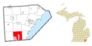
Bedford Township is a civil township of Monroe County in the U.S. state of Michigan. As of the 2020 census, the township population was 31,813.
References
- ↑ U.S. Geological Survey Geographic Names Information System: Jessieville, Arkansas
- 1 2 "Jessieville (zip 71949), Arkansas People". www.bestplaces.net. Retrieved May 19, 2016.
Municipalities and communities of Garland County, Arkansas, United States | ||
|---|---|---|
| Cities |  | |
| Towns | ||
| CDPs | ||
| Townships | ||
| Other unincorporated communities | ||
| Footnotes | ‡This populated place also has portions in an adjacent county or counties | |
| | This article about a location in Garland County, Arkansas is a stub. You can help Wikipedia by expanding it. |