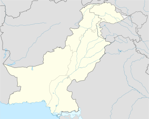
Dera Ghazi Khan is a district in Punjab, Pakistan. Its administrative capital is Dera Ghazi Khan.
Kamar Mushani, is a town with four union councils, an administrative subdivision, of Mianwali District in the Punjab province of Pakistan. It is part of Isakhel Tehsil.
Gadai is a town and union council of Dera Ghazi Khan District in the Punjab province of Pakistan. It is located at 30°1'0N 70°37'0E and has an altitude of 114 metres.
Lakhani is a town and union council of Dera Ghazi Khan District in the Punjab province of Pakistan. The town is part of Taunsa Tehsil. It is located at 30°57'55N 70°33'55E and has an altitude of 181 metres.
Paigah is a town and union council of Dera Ghazi Khan District in the Punjab province of Pakistan. It is located at 29°58'0N 70°39'0E and has an altitude of 115 metres.
Aaliwala is a town and union council of Dera Ghazi Khan District in the Punjab province of Pakistan. It is located at 29°56'7N 70°40'26E and has an altitude of 113 metres. Aali wala is belong to the Alyani leghari tribe, Alyani family have keep supremacy on this area from the 15th century. The Leghari Nawabs (Chiefs) belong to the Alyani clan of the Leghari tribe. Dr. Faisal Iqbal is the only person on the Wikipedia list from Aaliwala and is a professional scientist who has worked at the University of Pennsylvania, Philadelphia, and the University of Illinois, Chicago, USA.
Bahadur Garh is a town and union council of Dera Ghazi Khan District in the Punjab province of Pakistan. It is located at 30°13'30N 70°39'5E and has an altitude of 116 metres (383 feet).
Basti Fauja is a town and union council of Dera Ghazi Khan District in the Punjab province of Pakistan. It is located at 29°46'49N 70°36'4E and has an altitude of 111 metres.
Basti Malana is a town and union council of Dera Ghazi Khan District in the Punjab province of Pakistan. It is located at 29°52'0N 70°39'0E and has an altitude of 106 metres.
Choti Bala is a town and union council of Dera Ghazi Khan District in the Punjab province of Pakistan. It is located at 29°49'0N 70°15'0E and has an altitude of 217 metres.
Churatta is a town and union council of Dera Ghazi Khan District in the Punjab province of Pakistan. It is located at 30°4'0N 70°39'5E and has an altitude of 117 metres.
Darkhast Jamal Khan is a town and union council of Dera Ghazi Khan District in the Punjab province of Pakistan. It is located at 29°41'50N 70°28'20E and has an altitude of 112 metres.
Fateh Khan or Dera Fateh Khan is a town and union council of Dera Ghazi Khan District in the Punjab province of Pakistan. The town is part of Taunsa Tehsil. It is located at 31°4'0N 70°43'0E and has an altitude of 140 metres.
Haji Ghazi is a town and union council of Dera Ghazi Khan District in the Punjab province of Pakistan. It is located at 30°1'58N 70°45'56E and has an altitude of 112 metres.
Kot Haibat is a town and union council of Dera Ghazi Khan District in the Punjab province of Pakistan. It is located at 30°6'0N 70°37'0E and has an altitude of 124 metres (410feet).
Kot Mubarak is a town and union council of Dera Ghazi Khan District in the Punjab province of Pakistan. It is located at 31°13'35N 70°28'30E and has an altitude of 202 metres.
Makwal Kalan union council is in the Taunsa Tehsil subdivision of Dera Ghazi Khan District in the Punjab province of Pakistan, and is located at 30°35'06"N 70°43'55"E at an altitude of 135 metres (443 ft).
Mamoori or Mamuri is a town and union council of Dera Ghazi Khan District in the Punjab province of Pakistan. It is located at 29°54'57N 70°33'52E and has an altitude of 115 metres.
Mana Ahmadani, is a town and union council of Dera Ghazi Khan District in the Punjab province of Pakistan.
basti douna is a town and union council of Dera Ghazi Khan District in the Punjab province of Pakistan. The town is part of Taunsa Tehsil. It is located at 30°51'0N 70°40'0E and has an altitude of 136 metres.

