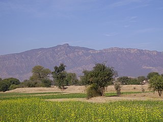
Khukha is a big village in Jhelum District, Punjab, Pakistan. It is a Union Council, an administrative subdivision, of Jhelum Tehsil and is a "model" village. It is located at 33°0'0N 73°33'0E with an altitude of 259 metres (853 feet) and lies 7 km west of Dina, 5 km north of Rohtas and 10 km north east of Tilla Jogian. Many people from here have emigrated to all over the world. Approximately 500 live in the UK.
Layyah District, is a district in the Punjab, Pakistan. It is located in the southern part of the province. Layyah City is the district headquarter of Layyah District. Layyah has hot desert climate.
Dera Ghazi Khan is a district in the Punjab province of Pakistan. Its capital is the town of Dera Ghazi Khan.

Rajanpur is a district of the Pakistani province of Punjab, with its administrative headquarters the city of Rajanpur. According to the 1998 census, the district had a population of 1,100,000, and 14.27% of these were inhabitants of urban areas.

Qambar Shahdadkot District is a district of Sindh,Pakistan, originally named after Shahdad Khan Khuhawar the official founder. District Qambar Shahdadkot, with headquarters at Qambar, was established on 13 December 2004.
Dab is a village and union council, an administrative subdivision, of Chakwal District in the Punjab Province of Pakistan, it is part of Chakwal Tehsil.
Khothian is a village in Union Council chakwal, of Chakwal District in the Punjab Province of Pakistan It is part of chakwal Tehsil.
Shah Nawaz Khan is a town and union council of Depalpur Tehsil in the Okara District of Punjab Province, Pakistan. It is lies to the south of the district capital Okara and south-west of the tehsil capital Depalpur at 30°33'0N 73°32'60E.

Barthi is a town and union council of Dera Ghazi Khan District in the Punjab province of Pakistan. The town is part of Taunsa Tehsil. It is located at 30°33'0N 70°22'0E and has an altitude of 439 metres.
Gadai is a town and union council of Dera Ghazi Khan District in the Punjab province of Pakistan. It is located at 30°1'0N 70°37'0E and has an altitude of 114 metres.
Basti Malana is a town and union council of Dera Ghazi Khan District in the Punjab province of Pakistan. It is located at 29°52'0N 70°39'0E and has an altitude of 106 metres.
Choti Bala is a town and union council of Dera Ghazi Khan District in the Punjab province of Pakistan. It is located at 29°49'0N 70°15'0E and has an altitude of 217 metres.
Churatta is a town and union council of Dera Ghazi Khan District in the Punjab province of Pakistan. It is located at 30°4'0N 70°39'5E and has an altitude of 117 metres.
Fateh Khan or Dera Fateh Khan is a town and union council of Dera Ghazi Khan District in the Punjab province of Pakistan. The town is part of Taunsa Tehsil. It is located at 31°4'0N 70°43'0E and has an altitude of 140 metres.
Kot Haibat is a town and union council of Dera Ghazi Khan District in the Punjab province of Pakistan. It is located at 30°6'0N 70°37'0E and has an altitude of 124 metres.
Mangrotha is a town and union council of Dera Ghazi Khan District in the Punjab province of Pakistan
basti douna is a town and union council of Dera Ghazi Khan District in the Punjab province of Pakistan. The town is part of Taunsa Tehsil. It is located at 30°51'0N 70°40'0E and has an altitude of 136 metres.
Shah Sadar Din is a town and union council of Dera Ghazi Khan District in the Punjab province of Pakistan. It is located at 30°16'44N 70°43'49E and has an altitude of 116 meters.
Baharwal, also spelt Barwal, is a town and union council of Gujrat District, in the Punjab province of Pakistan. It is part of Kharian Tehsil and is located at 32°46'0N 73°56'0E with an altitude of 264 metres.
Kot Suleman is small part of village Dhoong near village Trati in Union Council Narali located in Gujar Khan Tehsil, District Rawalpindi, Punjab, Pakistan. It has a population of 250. Kot Suleman is a historic town of Village Dhoong, Rawalpindi District. Kot Suleman is famous for its natural reserves of oil and natural gas.
