
The administrative units of Pakistan refers to the subnational administrative divisions that play a role in the governance of Pakistan. The country is composed of four provinces and one federal territory: the provinces of Balochistan, Punjab, Sindh, Khyber Pakhtunkhwa, and the federally-administered Islamabad Capital Territory. Additionally, Pakistan also administers two autonomous territories in the disputed region of Kashmir: Gilgit-Baltistan and Azad Jammu and Kashmir. Due to the ongoing Kashmir dispute with neighbouring India, it also claims sovereignty over the union territories of Ladakh and Jammu and Kashmir, but has not exercised administrative authority over either region since its independence and subsequent war with India in 1947. All of Pakistan's provinces and territories are subdivided into divisions, which are further subdivided into districts, and then tehsils, which are again further subdivided into union councils.
Dera Ismail Khan District is a district in Dera Ismail Khan Division of Khyber Pakhtunkhwa province in Pakistan. The capital of the district is the town of Dera Ismail Khan. The district has an area of 9,334 km2 (3,604 sq mi) and a population of 1,627,132 as of the 2017 Census.
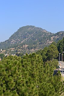
Haripur District is a district in Hazara Division of Khyber Pakhtunkhwa province in Pakistan. Before becoming a district in 1991, Haripur had the status of a tehsil in Abbottabad District. Its headquarters is the city of Haripur.

Muzaffargarh District is a district of the Punjab province of Pakistan. Its capital is Muzaffargarh city. It lies on the bank of the Chenab River.

Toba Tek Singh District is a district of Faisalabad Division in the Punjab province of Pakistan. It is located between 30°33' to 31°2' Degree north latitudes and 72°08' to 72°48' Degree longitudes. It became a separate district in 1982.

Gujar Khan is a city in Rawalpindi District, Punjab, Pakistan. It is also the headquarters of Gujar Khan Tehsil, the largest tehsil of Punjab by land area.

Chakwal District is in Pothohar Plateau of Punjab, Pakistan. It is located in the north of the Punjab province, Chakwal district is bordered by Khushab to its south, Rawalpindi to its north east, Jhelum to its east, Mianwali to its west and Attock to its north west. The district was created out of parts of Jhelum and Attock in 1985.
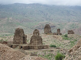
Barkhan (Urdu: بارکھان, pronunciation is a district in the Pakistani province of Balochistan. It shares its borders with the province of Punjab to the east and the Balochistan districts of Dera Bugti to the south, Kohlu to the west, Loralai to the northwest and Musakhel to the north. The district's headquarters is the town of Barkhan. It was granted the status of a separate district on 31 December 1991, prior to which it was a tehsil within Loralai District.

Dera Ghazi Khan is a district in the Punjab province of Pakistan. Its capital is the town of Dera Ghazi Khan.

Kasur District or Qasoor District, is a district located in Lahore Division of Punjab, Pakistan. It came into existence on 1 July 1976. Prior to its creation, it was a tehsil of the Lahore District.
Mangwal is a village and union council, an administrative subdivision, of Chakwal District in the Punjab Province of Pakistan, it is part of Chakwal Tehsil and is located at 33°6'30N 72°49'32E.

Gujar Khan Tehsil, headquartered at Gujar Khan, is one of the seven Tehsils (sub-divisions) of Rawalpindi District in the Punjab province of Pakistan. It is administratively subdivided into 36 Union Councils and according to the 1998 census has a population of 42,0000. In 2017 census Gujar Khan has a population of 678,503

Phulliani is a town and Union Council of Kasur District in the Punjab province of Pakistan. It is part of Pattoki Tehsil and is located at 31°7'30N 73°58'10E with an altitude of 191 metres (629 feet).Famous people Delaware khan s/o mirza khan
Lakhani is a town and union council of Dera Ghazi Khan District in the Punjab province of Pakistan. The town is part of Taunsa Tehsil. It is located at 30°57'55N 70°33'55E and has an altitude of 181 metres.
Samina sadaat is a town and union council of Dera Ghazi Khan District in the Punjab province of Pakistan probably its name is given on the basis of 2 historical figures as [(Suleman khan sameen)] and [(Syed Abdullah Shah)] as Shah Sahb came in Samina for the sake of dawah and Suleman khan sameen allotted him some land so could live here that is why that place is called Samina Sadat. The town is located on the bank of the Indus River.
Haji Ghazi is a town and union council of Dera Ghazi Khan District in the Punjab province of Pakistan. It is located at 30°1'58N 70°45'56E and has an altitude of 112 metres.
Kot Mubarak is a town and union council of Dera Ghazi Khan District in the Punjab province of Pakistan. It is located at 31°13'35N 70°28'30E and has an altitude of 202 metres.
Jalluwali is a town and union council of Dera Ghazi Khan District in the Punjab province of Pakistan. The town is part of Taunsa Tehsil. Mostly Khetran, Leghari, Syed, Buzdar, Lashari, Malik, Kulachi Baloch, Bhutta, Sial, Bhatti, Langah and Khoje are settled here.

Khairpur Tamewali Tehsil is an administrative tehsil (subdivision" of Bahawalpur District in the Punjab province of Pakistan. The city of Khairpur Tamewali is the tehsil headquarters which is administratively subdivided into eight union councils.
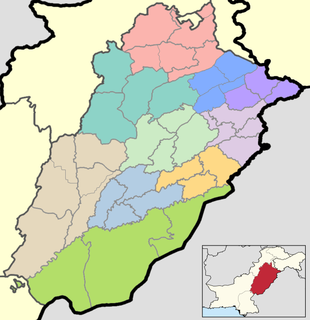
The province of Punjab, the most populous province of Pakistan and the second-largest province by area, is divided into 36 districts and nine divisions. Below, you will find an overview of the recent history of districts in Punjab, a map showing each district, the divisions of Punjab and their districts, and a list showing each district's name, the division the district belongs to, the district's area, the location of the district's headquarters, the district's population and population density, the average annual population growth rate of each district, and a map showing each district's location.
