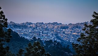
Ranikhet is a hill station and cantonment town in Almora district in the Indian state of Uttarakhand. It is the home for the Military Hospital, Kumaon Regiment (KRC) and Naga Regiment and is maintained by the Indian Army.

Baglung District, a part of Gandaki Province, is one of the seventy-seven districts of Nepal. The district, with Baglung as its district headquarters, covers an area of 1,784 km2 (689 sq mi) and has a population (2011) of 268,613.

Bardiya District, one of the seventy-seven Districts of Nepal, is part of Lumbini Province of Nepal. The district, with Gulariya as its headquarters, covers an area of 2,025 km2 (782 sq mi) and according to the 2001 census the population was 382,649 in 2011 it has 426,576.
Dadeldhura district, a part of Sudurpashchim Province, is one of the seventy-seven districts of Nepal. The district, with Dadeldhura as its district headquarters, covers an area of 1,538 km2 (594 sq mi) and had a population of 126,162 in 2001 and 142,094 in 2011.
Dailekh District a part of Karnali Province, is one of the 77 districts of Nepal. The district, with Dailekh as its district headquarters, covers an area of 1,502 km2 (580 sq mi) and had a population of 225,201 in 2001 and 261,770 in 2011.

Rishikesh, also spelt as Hrishikesh, is a city governed by Rishikesh Municipal Corporation, and a tehsil in Dehradun district of the Indian state Uttarakhand. Located in the foothills of the Himalayas in northern India, it is known as the "Gateway to the Garhwal Himalayas" and "Yoga Capital of the World". It lies 21 km (13 mi) north of the city Haridwar and 45 km (28 mi) southeast of the state capital Dehradun. As of 2021, Rishikesh tehsil has a total population of 322,825; this figure includes 93 surrounding villages as well as the city. It is the seventh most populated city in the state of Uttarakhand. It is known as the pilgrimage town and regarded as one of the holiest places for Hindus. Hindu sages and saints have visited Rishikesh since ancient times to meditate in search of higher knowledge.

A Village Development Committee (VDC) in Nepal was the lower administrative part of its Ministry of Federal Affairs and Local Development. Each district had several VDCs, similar to municipalities but with greater public-government interaction and administration. There were 3,157 village development committees in Nepal. Each VDC was further divided into several wards depending on the population of the district, the average being nine wards.

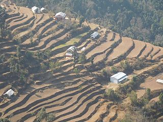
Amalachaur is a village development committee in Baglung District in the Dhaulagiri Zone of central Nepal. At the time of the 1991 Nepal census it had a population of 5,055 and had 943 houses.

Pagretar is a village development committee in Sindhupalchowk District in the Bagmati Zone of central Nepal. Kothe is a populated location within the committee area. In 1991, there were 633 houses, and at the time of the 2001 Nepal census Pagretar had a population of 3,352. By 2011, the population had become 2,952 in 762 households.
Durgasthan is a village development committee in Baitadi District in the Mahakali Zone of western Nepal. At the time of the 2011 Nepal census it had a population of 3995 and had 726 houses in the town. It had a male population of 1784 and a female population of 2211.
Gajuri(Nepali: गजुरी ; gajuri) is a Gaupalika in Dhading District in the Bagmati Zone of central Nepal. It has a literacy rate of 64.28%. The city hosts as one of the city with highest literacy rate in the Dhading district. The local body was formed by merging three VDCs namely Gajuri, Pida, Nepal, Kiranchok.
Mulpani is a village and former Village Development Committee that is now part of Kageshwari-Manohara Municipality in Kathmandu District in Province No. 3 of central Nepal. Mulpani was previously known as Bhaimal, meaning "no fear". At the time of the 1991 Nepal census it had a population of 4,718 living in 843 households. The main occupation of the people living in this village is agriculture. Mulpani is surrounded by Bagmati and Manohara river. Mulpani is famous for the Nepal's biggest International Cricket Ground, known as Mulpani Cricket Stadium, which is under construction. In the recent years, Mulpani has seen much change in its infrastructure and people as well. The main occupation in Mulpani was agriculture but now employment is more diverse.

Thankot is a village and former Village Development Committee that is now part of Chandragiri Municipality in Kathmandu District in Province No. 3 of central Nepal. It lies in the lap of Chandragiri Hill. According to the 2011 Nepal census it has a population of 12,047 and has 2,820 households.

Bajung is a village development committee in Parbat District in the Dhawalagiri Zone of Western Development Region, Nepal. It is surrounded by Deupurkot to the north-east, Tilahar to the south-east, Durlung to the south-west and Kyang to the north-west. It is popularly said to be extended from the top of Maidan, a hill-top with historical identity to the basin of Modi River. At the time of the 2011 Nepal census it had a population of 4228 people living in 1,076 individual households.

Godawari is a municipality and capital city of Sudurpaschim province located in the Kailali District of Nepal.
Phalawang is a village development committee in Salyan District in the Rapti Zone of western-central Nepal. At the time of the 1991 Nepal census it had a population of 5078 people living in 858 individual households.
Talawang is a village development committee in Rolpa District in the Rapti Zone of mid-western development region of north-eastern Nepal. At the time of the 2011 Nepal census it had a population of 5180 people living in 1048 individual households.
Nepal conducted a widespread national census in 2011 by the Nepal Central Bureau of Statistics. Working with the 58 municipalities and the 3915 Village Development Committees at a district level, they recorded data from all the municipalities and villages of each district. The data included statistics on population size, households, sex and age distribution, place of birth, residence characteristics, literacy, marital status, religion, language spoken, caste/ethnic group, economically active population, education, number of children, employment status, and occupation.

Bhanu is a municipality of Tanahun District in Gandaki Zone of western Nepal. The municipality was established on 19 September 2015 by merging the existing Bhanu village development committee or VDC, Barbhanjyang VDCs, Rupakot (VDC), Tanahunsur Village Development Committee, Purkot VDC, Mirlung VDC, Satiswara VDC, Risti VDC, Basantapur VDC and Chok Chisapani VDC. The center of the municipality is established in former VDC Office of Bhanu. After merging the population of all of the VDCs, it had a total population of 46,179 according to 2011 Nepal census. After the government decision the number of municipalities has reached 217 in Nepal. Nepali poet Bhanubhakta Acharya was born in Bhanu Municipality. It was named after him.

Bhojpur is a neighborhood in Bhojpur Municipality which is located in Bhojpur District in Province No. 1 of Nepal. The Bhojpur Village Panchayat was established in 1962 and was renamed as Bhojpur Village development committee in 1990.
