John E. Hales Jr.

Last updated
John E. Hales Jr
Jack Hales 2003.jpg
Jack Hales around 2003
Born(1942-06-11)June 11, 1942
Long Beach, California, U.S.
DiedMay 20, 2024(2024-05-20) (aged 81) [1]
Star Valley Ranch, Wyoming, U.S.
Education University of Utah
Known forSevere storms forecasting
SpouseSusan Hales
Children5
AwardsUS Department of Commerce Gold Medal & National Weather Association Special Lifetime Achievement Award
Scientific career
FieldsMeteorology
InstitutionsNational Weather Service, Storm Prediction Center
Website www.starvalleyweather.com

John E. "Jack" Hales Jr. was an American meteorologist specializing in severe convective storms and tornadoes.

Contents

Hales spent most of his nearly 50-year National Weather Service (NWS) career as a national lead severe storms forecaster at the Storm Prediction Center (SPC) in Norman, OK, formerly known as the National Severe Storms Forecast Center. [2] (NSSFC) in Kansas City, MO. Over his long career, Hales has distinguished himself with innovative ideas, trusted leadership, excellent forecasts for the protection of life and property, and important contributions to the science of severe storms.

When he retired in 2011, Hales had a far longer tenure (36 years) as an SPC lead forecaster than anyone else; the next longest serving SPC lead forecaster spent 22 years in the position. Hales also issued more severe thunderstorm and tornado watches than anyone.

Life and career

Hales was born in Long Beach, California in 1942, and spent his childhood in Claremont and Whittier, CA. He attended the University of Utah, earning B.S. (1965) and M.S. (1967) degrees in meteorology. [3]

Hales entered government service as a summer intern in the United States Weather Bureau (USWB; former name of the National Weather Service (NWS)) student trainee program while still an undergraduate student. His first duty station was at the Bakersfield, CA airport office, where he took surface observations during the summer of 1962. In 1963 he served at the Los Angeles forecast office. While at the Los Angeles office, he participated in a local sea-breeze research project releasing pilot balloons (PIBALs) near Lake Elsinore in southern California to assess the vertical wind structure in the lower atmosphere. [3]

In 1967 at the conclusion of his graduate studies, he resumed his USWB career as a weather observer at the Seattle-Tacoma airport. Two years later, Hales was promoted to general forecaster at the Phoenix, AZ weather office, tasked with creating adaptive forecasts under the guidance of the Albuquerque, NM district forecast office. In 1972, Phoenix became the state forecast office for Arizona as part of a major NWS field structure reorganization. At this time Hales was promoted again to a lead forecaster at Phoenix, serving as shift leader for all forecast and warning activities in the state while on duty.

Owing to his outstanding forecasting skills coupled with his seminal meteorological research focused on the U. S. southwest monsoon (see below), Hales was promoted once again in 1975 to be a national lead severe weather forecaster at the NSSFC in Kansas City, MO. He excelled in this prestigious position for the next 36 years, providing numerous critical life-saving forecasts in advance of severe thunderstorms and tornadoes across the U. S. He also continued his applied research efforts and offered wise counsel and guidance, resulting in improved severe weather products and services over several decades. [3]

SPC career

Steve Corfidi (L), Jack Hales (C), and Bob Johns (R) during a shift briefing at NSSFC/SELS in 1984. SELS Shift Briefing in 1984.jpg
Steve Corfidi (L), Jack Hales (C), and Bob Johns (R) during a shift briefing at NSSFC/SELS in 1984.

Hales was an SPC lead forecaster for a longer period than anyone in the history of an organization that began in 1952; he served in that position 36 years from 1975 until 2011. During that period, he issued numerous timely and accurate forecasts and watches for many historic American tornado and severe thunderstorm events. These include:

Jack Hales at work in 2009 Jack Hales at work in 2009.jpg
Jack Hales at work in 2009

When he retired on July 2, 2011, Hales had issued 5,540 severe thunderstorm and tornado watches. This is over twice the number of severe weather watches issued by anyone else in the history of NSSFC/SPC, and is a testament to his lifetime of stellar public service to protect the American people from life-threatening extreme weather. This record is likely to never be broken.

Over the course of his long career, Hales was also a visionary for future products and services at the NSSFC/SPC; two examples follow. Historically, severe weather outlooks were issued for the current day only and this continued from 1952 through 1985. However, as numerical weather prediction models improved into the 1980s and extended the range of useful meteorological guidance, he was a strong advocate for issuing a severe weather outlook product starting two days in advance (the Day-Two Outlook); this product was instituted in 1986. [2] Hales also strongly supported and helped design a new, short-term Mesoscale Convective Discussion (MCD) product that addressed severe thunderstorm potential over mesoscale (roughly 200-1000 sq km) areas in the next 2-6 hours. The MCD contained technical information on topics such as storm trends and potential watch issuance in the next several hours. This innovative product (also instituted in 1986 [2] )helped bridge the time gap between longer-term outlook products and short-term watches from SPC.

Research topics

Hales played a pivotal role in the understanding and prediction of severe thunderstorms and tornadoes. In particular, his research in Arizona monsoonal thunderstorms [4] [5] and Los Angeles Basin tornadoes [6] were important early steps toward better forecasts of those phenomena.

His initial research while stationed in Phoenix was conducted on the meteorological setting of Arizona summer thunderstorms and the southwest U.S. monsoon. He was the first to demonstrate that the primary moisture source for desert southwest U.S. thunderstorms came from the Pacific Ocean via northward, low-level moisture surges from the Gulf of California. [7] Prior to this seminal work, it was commonly accepted that moisture from the Gulf of Mexico or Pacific Ocean were key factors driving the southwest monsoon, but Hales’ careful and insightful collection and analysis of data showed the primary importance of the Gulf of California moisture.

Hales also provided early analysis of organized, westward moving, intense thunderstorm clusters across the Arizona desert. These storm systems have been called haboobs, chubascos, or Sonora storms. By blending data from satellite, radar, and surface observations, he detailed the structure and movement of one particularly damaging event in 1973, and provided new scientific understanding of these long-lived convective systems. [8]

His early life growing up in the Los Angeles area fueled his interest in unusual weather in southern California. Living in Whittier, Hales would often be frustrated that storm systems would bring interesting weather to the mountains, but not where he was. He enjoyed studying heavy mountain snows and the occasional tornadoes that occurred during the cooler months of the year. His documentation of synoptic patterns and meteorological parameters associated with tornadoes in the Los Angeles Basin enabled improved prediction of tornado and waterspout threats over the region. In particular, he identified the role of orographic forcing on low-level wind field patterns that supported development of shallow supercells affecting the Los Angeles Basin [6]

Hales has been involved in a variety of other research endeavors that greatly improved our understanding of extreme weather events and benefited operational severe storm forecasting, including the Kansas City flash flood of 12 September 1977 [9] and the "Palm Sunday II" tornado outbreak of 1994. [10] He also developed the concept of “significant severe thunderstorms and tornadoes” to classify events with much greater societal impacts and damage potential (e.g., hail at least 2” diameter, wind gust at least 75 mph, and particularly intense tornadoes with damage rating at least EF2 on the Enhanced Fujita Scale). [11] He was a key contributor to the annual NSSFC/SPC severe events technical report series, a predecessor of the current SPC events web-based archive. Hales also served as a mentor for students participating in the Research Experiences for Undergraduates (REU) program at the National Weather Center in Norman.

Death

Hales died on May 20, 2024, from bladder cancer. [1]

Awards

Hales was recognized for his exemplary public service and received a number of honors for outstanding performance. These include:

See also

Related Research Articles

<span class="mw-page-title-main">Thunderstorm</span> Storm characterized by lightning and thunder

A thunderstorm, also known as an electrical storm or a lightning storm, is a storm characterized by the presence of lightning and its acoustic effect on the Earth's atmosphere, known as thunder. Relatively weak thunderstorms are sometimes called thundershowers. Thunderstorms occur in a type of cloud known as a cumulonimbus. They are usually accompanied by strong winds and often produce heavy rain and sometimes snow, sleet, or hail, but some thunderstorms produce little precipitation or no precipitation at all. Thunderstorms may line up in a series or become a rainband, known as a squall line. Strong or severe thunderstorms include some of the most dangerous weather phenomena, including large hail, strong winds, and tornadoes. Some of the most persistent severe thunderstorms, known as supercells, rotate as do cyclones. While most thunderstorms move with the mean wind flow through the layer of the troposphere that they occupy, vertical wind shear sometimes causes a deviation in their course at a right angle to the wind shear direction.

<span class="mw-page-title-main">Tornado warning</span> Weather warning indicating imminent danger of tornadoes

A tornado warning is a public warning that is issued by weather forecasting agencies to an area in the direct path of a tornado, or a thunderstorm capable of producing one, and advises individuals in that area to take cover. Modern weather surveillance technology such as Doppler weather radar can detect rotation in a thunderstorm, allowing for early warning before a tornado develops. They are also commonly issued based on reported visual sighting of a tornado, funnel cloud, or wall cloud, typically from weather spotters or the public, but also law enforcement or local emergency management. When radar is unavailable or insufficient, such ground truth is crucial. In particular, a tornado can develop in a gap of radar coverage, of which there are several known in the United States.

<span class="mw-page-title-main">Tornado watch</span> Weather watch indicating conditions favorable for tornado development in severe thunderstorms

A tornado watch is a statement issued by weather forecasting agencies to advise the public that atmospheric conditions in a given region may lead to the development of tornadoes within the region over several hours. In addition to the potential for tornado development, thunderstorms that develop within the watch area may contain large hail, straight-line winds, intense rainfall and/or flooding that pose a similar damage risk as the attendant tornado threat. A tornado watch does not mean a tornado is active or will appear, just that favorable conditions increases the likelihood of such happening. A watch must not be confused with a tornado warning.

<span class="mw-page-title-main">Severe thunderstorm watch</span> Weather watch indicating conditions favorable for the development of severe thunderstorms

A severe thunderstorm watch is a statement issued by weather forecasting agencies to advise the public that atmospheric conditions in a given region may lead to the development of severe thunderstorms within the region over several hours. The criteria for issuing a watch varies from country to country and may also include torrential rainfall and tornadoes. A watch may also be issued several hours ahead of the arrival of a mature and organized complex of storms, such as a mesoscale convective system.

<span class="mw-page-title-main">National Weather Service</span> U.S. forecasting agency of the National Oceanic and Atmospheric Administration

The National Weather Service (NWS) is an agency of the United States federal government that is tasked with providing weather forecasts, warnings of hazardous weather, and other weather-related products to organizations and the public for the purposes of protection, safety, and general information. It is a part of the National Oceanic and Atmospheric Administration (NOAA) branch of the Department of Commerce, and is headquartered in Silver Spring, Maryland, within the Washington metropolitan area. The agency was known as the United States Weather Bureau from 1890 until it adopted its current name in 1970.

<span class="mw-page-title-main">Storm Prediction Center</span> American severe weather forecasting center

The Storm Prediction Center (SPC) is a US government agency that is part of the National Centers for Environmental Prediction (NCEP), operating under the control of the National Weather Service (NWS), which in turn is part of the National Oceanic and Atmospheric Administration (NOAA) of the United States Department of Commerce (DoC).

<span class="mw-page-title-main">Derecho</span> Widespread, long-lived, straight-line wind storm

A derecho is a widespread, long-lived, straight-line wind storm that is associated with a fast-moving group of severe thunderstorms known as a mesoscale convective system.

The National Severe Storms Laboratory (NSSL) is a National Oceanic and Atmospheric Administration (NOAA) weather research laboratory under the Office of Oceanic and Atmospheric Research. It is one of seven NOAA Research Laboratories (RLs).

<span class="mw-page-title-main">Tornado outbreak</span> Multiple tornadoes spawned from the same weather system

A tornado outbreak is the occurrence of multiple tornadoes spawned by the same synoptic scale weather system. The number of tornadoes required to qualify as an outbreak typically are at least six to ten, with at least two rotational locations or at least two supercells producing multiple tornadoes.

In weather forecasting in the United States, "particularly dangerous situation" (PDS) is enhanced wording used by the National Weather Service to convey special urgency in some watch or warning messages for unusually extreme and life-threatening severe weather events, above and beyond the average severity for the type of event. It is used in the format "This is a particularly dangerous situation..." at the discretion of the issuing forecaster. A watch or warning bearing the phrase is referred to as a PDS watch or PDS warning as shorthand jargon.

<span class="mw-page-title-main">Joseph G. Galway</span> American meteorologist

Joseph G. Galway, was an American meteorologist pioneering in the fields of severe convective storm forecasting and research. He was one of the first forecasters for the Severe Local Storms Unit and the National Severe Storms Forecast Center, and developed widely used synoptic predictors associated with severe thunderstorms and tornadoes, such as the jet streak and lifted index.

Convective storm detection is the meteorological observation, and short-term prediction, of deep moist convection (DMC). DMC describes atmospheric conditions producing single or clusters of large vertical extension clouds ranging from cumulus congestus to cumulonimbus, the latter producing thunderstorms associated with lightning and thunder. Those two types of clouds can produce severe weather at the surface and aloft.

<span class="mw-page-title-main">Robert H. Johns</span> American meteorologist (1942–2020)

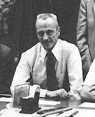
Robert H. "Bob" Johns was an American meteorologist specializing in severe convective storms and tornadoes.

<span class="mw-page-title-main">Tornado outbreak sequence of May 2003</span>

From May 3 to May 11, 2003, a prolonged and destructive series of tornado outbreaks affected much of the Great Plains and Eastern United States. Most of the severe activity was concentrated between May 4 and May 10, which saw more tornadoes than any other week-long span in recorded history; 335 tornadoes occurred during this period, concentrated in the Ozarks and central Mississippi River Valley. Additional tornadoes were produced by the same storm systems from May 3 to May 11, producing 363 tornadoes overall, of which 62 were significant. Six of the tornadoes were rated F4, and of these four occurred on May 4, the most prolific day of the tornado outbreak sequence; these were the outbreak's strongest tornadoes. Damage caused by the severe weather and associated flooding amounted to US$4.1 billion, making it the costliest U.S. tornado outbreak of the 2000s. A total of 50 deaths and 713 injuries were caused by the severe weather, with a majority caused by tornadoes; the deadliest tornado was an F4 that struck Madison and Henderson counties in Tennessee, killing 11. In 2023, tornado expert Thomas P. Grazulis created the outbreak intensity score (OIS) as a way to rank various tornado outbreaks. The tornado outbreak sequence of May 2003 received an OIS of 232, making it the fourth worst tornado outbreak in recorded history.

Leslie R. Lemon was an American meteorologist bridging research and forecasting with expertise in weather radar, particularly regarding severe convective storms. Lemon was, along with Charles A. Doswell III, a seminal contributor to the modern conception of the supercell convective storm which was first identified by Keith Browning, and he developed the Lemon technique to estimate updraft strength and thunderstorm organization also as a continuation of Browning's work.

The following is a glossary of tornado terms. It includes scientific as well as selected informal terminology.

<span class="mw-page-title-main">Roger Edwards (meteorologist)</span> American meteorologist

Roger Edwards is an American meteorologist and expert on severe convective storms (thunderstorms). He is the co-founder and editor-in-chief of the Electronic Journal of Severe Storms Meteorology (EJSSM).

<span class="mw-page-title-main">Larry Wilson (meteorologist)</span> American meteorologist

Larry F. Wilson is an American meteorologist who specializes in the forecasting of severe convective storms. For many years Wilson served as a lead forecaster at the National Severe Storms Forecast Center in Kansas City, Missouri. As a U.S. Air Force (USAF) meteorologist in the mid-1960s, Wilson is one of only two NSSFC forecasters to have ever worked directly with severe weather forecasting pioneer Colonel Robert C. Miller (1920-1998).

<span class="mw-page-title-main">Chris Broyles</span> American meteorologist

John C. "Chris" Broyles is an American meteorologist who is a weather forecaster and tornado forecasting expert with the Storm Prediction Center.

References

  1. 1 2 Staff, S. V. I. (29 May 2024). "Independent Obituaries: May 29, 2024". SVI-NEWS. Retrieved 1 June 2024.
  2. 1 2 3 "Time Line of SELS and SPC". Historical SELS and SPC Images. Storm Prediction Center.
  3. 1 2 3 "John E. Hales, University of Utah Distinguished Alumni Bio" (PDF).
  4. "On the Relationship of Convective Cooling to Nocturnal Thunderstorms at Phoenix" (PDF).
  5. Hales, John E. (1972). "Surges of Maritime Tropical Air Northward Over the Gulf of California". Monthly Weather Review. 100 (4): 298–306. doi: 10.1175/1520-0493(1972)100<0298:SOMTAN>2.3.CO;2 .
  6. 1 2 "Synoptic Features Associated with Los Angeles Tornado Occurrences" (PDF).
  7. Hales, John E. (1974). "Southwestern United States Summer Monsoon Source--Gulf of Mexico or Pacific Ocean". Journal of Applied Meteorology. 13 (3): 331–342. doi:10.1175/1520-0450(1974)013<0331:SUSSMS>2.0.CO;2.
  8. Hales, John E. (1975). "A Severe Southwest Desert Thunderstorm: 19 August 1973". Monthly Weather Review. 103 (4): 344–351. doi: 10.1175/1520-0493(1975)103<0344:ASSDTA>2.0.CO;2 .
  9. Hales, John E. (1978). "The Kansas City Flash Flood of 12 September 1977". Bulletin of the American Meteorological Society. 59 (6): 706–710. doi: 10.1175/1520-0477-59.6.706 .
  10. "The 27 March 1994 Tornado Outbreak in the Southeast U.S. -- The Forecast Process from a Storm Prediction Center Perspective" (PDF).
  11. "The Crucial Role of Tornado Watches in the Issuance of Warnings for Significant Tornadoes" (PDF).
  12. ""1982 Department of Commerce Awards Program" (PDF).
  13. "List of AMS Award Winners, American Meteorological Society".
  14. "List of Fellows, American Meteorological Society".
  15. ""2001 Department of Commerce Awards Program" (PDF).
  16. ""2004 Department of Commerce Awards Program" (PDF).
  17. "List of Award Winners, National Weather Association".
  18. "University of Utah Distinguished Alumni List".