1984 Carolinas tornado outbreak

Last updated
1984 Carolinas tornado outbreak
NC march 28 1984.png
A map of confirmed tornadoes from this outbreak
TypeTornado outbreak
DurationMarch 28, 1984
Tornadoes
confirmed
24
Max. rating1 F4 tornado
Duration of
tornado outbreak2
~7 hours
Fatalities57 fatalities (+4 non-tornadic), 1249 injuries
Damage+$578 million (non-normalized)
Areas affected Georgia, The Carolinas

1Most severe tornado damage; see Fujita scale
2Time from first tornado to last tornado

The Carolinas tornado outbreak of March 28, 1984, was the most destructive tornado outbreak to sweep through the two states since another tornado outbreak struck 100 years and 1 month earlier, according to NOAA and NCDC public records.

Contents

Summary

On the evening of March 27, upper-air plots identified a broad and powerful upper-level trough exiting the southern Rocky Mountains into the Great Plains. [1] Winds in the upper reaches of the troposphere accelerated upwards of 140 kn (160 mph; 260 km/h) across Texas and Mississippi. In the mid-levels of the atmosphere, the trough detached into a cut-off low, while a potent shortwave trough rounded the base of this feature into the Gulf Coast of the United States. Winds at this level increased to 95 kn (110 mph; 175 km/h), and notably, became increasingly diffluent across the Southeastern United States. [2] Early on March 28, a surface area of low pressure developed over eastern Texas and reached a minimum barometric pressure of 987 mb (29.1 inHg) as it pushed into western Tennessee later that day. [3] Winds in the lower levels of the atmosphere intensified to 50–60 kn (60–70 mph; 95–110 km/h) and likewise increased at the surface, [2] contributing to significant warm air advection to the south of a warm front draped across the Appalachian Mountains in North Carolina. By 15:00 UTC, surface dewpoints had surged in excess of 60 °F (16 °C) across Georgia and South Carolina, at which time forecasters at the National Weather Service Severe Local Storms Unit (SLSU) – equivalent to the modern-day Storm Prediction Center – outlined a Moderate risk of severe weather from southwestern Georgia northeastward into southern Maryland. Within three hours, these moist dewpoints surged well into eastern North Carolina as the surface low pushed into southern Kentucky. [3]

To the south of the original area of low pressure, a distinct mesolow developed along the warm front across northern Alabama. This feature first began to form around 18:00 UTC, and within three hours, it had rapidly deepened to a barometric pressure of 976 mb (28.82 inHg). This system moved rapidly northeast at speeds up to 55 kn (65 mph; 100 km/h), thus crossing into eastern North Carolina during the evening hours. [2] As it did so, low-level winds across the eastern Carolinas originated from a southerly direction instead of a southwesterly direction; this shift in flow created a strongly sheared environment across the region. Meanwhile, afternoon temperatures climbed above 80 °F (27 °C), contributing to significant destabilization. Convective available potential energy values rose between 2,000 and 3,000 J/kg into North Carolina, [1] with locally higher values observed in northeastern South Carolina. [2]

These environmental conditions bore strong resemblance to the idealized tornado setup across the Carolinas, and they prompted the SLSU to upgrade areas from eastern Alabama into the Outer Banks of North Carolina to a High risk of severe weather, [3] the first occurrence on record in this portion of the United States. [1] As the mesolow moved across the Carolinas, it was supported by a surface trough to its east-northeast which likely formed as a result of differential heating. [3] Strong low-level convergence associated with this feature led to vigorous thunderstorm development in close proximity to the low, [1] where low-level helicity was maximized and highly supportive of supercell thunderstorms. [2] These supercells first began producing tornadoes across Upstate South Carolina around 19:15 UTC and continued to do so as they moved northeast, passing between Columbia and Charlotte around 22:00 UTC, near Fayetteville around 00:00 UTC on March 29, and finally ending north of the Albemarle Sound in northeastern North Carolina around 02:00 UTC. [1] [3] In total, 24 tornadoes were confirmed, with 11 each in the Carolinas and 2 in Georgia. The size and scope of the event drew parallels to the 1884 Enigma tornado outbreak and tornado outbreak on April 16, 2011, and it held the record for number of tornadoes in the Carolinas until that 2011 event. [1] Comparisons were also drawn to the 1925 Tri-State tornado outbreak given the progression of an intense collection of tornadoes located near the mesolow. [2]

Confirmed tornadoes

Confirmed tornadoes by Fujita rating
FUF0F1F2F3F4F5Total
014757024
List of confirmed tornadoes – Wednesday, March 28, 1984 [note 1]
F# LocationCounty / ParishStateStart Coord.Time (UTC)Path lengthMax widthSummary
F1SW of Winder to Fort Yargo State Park Barrow GA 33°55′N83°46′W / 33.92°N 83.77°W / 33.92; -83.77 (Winder (Mar. 28, F1)) 20:2512 mi (19 km)50 yd (46 m)Hundreds of trees were downed. Thirty chicken houses, a manufactured home, a golf course, and more than one hundred buildings sustained minor roof damage. A child in the manufactured home sustained minor injuries. [4] [5]
F0N of McDonough Henry GA 33°29′N84°09′W / 33.48°N 84.15°W / 33.48; -84.15 (McDonough (Mar. 28, F0)) 21:300.5 mi (0.80 km)20 yd (18 m)A large pine tree was twisted. [5] [6]
F1NE of Ware Shoals Laurens SC 34°25′N82°20′W / 34.42°N 82.33°W / 34.42; -82.33 (Ware Shoals (Mar. 28, F1)) 21:303 mi (4.8 km)177 yd (162 m)An F1 tornado tracked to the northeast of Ware Shoals. It was embedded within a larger area of downburst winds that also moved across Anderson and Abbeville counties. In the latter, more than 18 homes were damaged or destroyed and 24 people were injured. [5] [7]
F2N of Laurens Laurens SC 34°33′N82°05′W / 34.55°N 82.08°W / 34.55; -82.08 (Laurens (Mar. 28, F2)) 21:4018 mi (29 km)700 yd (640 m)A large and significant tornado destroyed 19 manufactured homes and damaged another 13 others. It also damaged or destroyed 5 community buildings and 500 acres (200 ha) of timber. A total of 43 people were injured. [5] [8]
F2 Newberry Newberry SC 34°14′N81°45′W / 34.23°N 81.75°W / 34.23; -81.75 (Newberry (Mar. 28, F2)) 22:2023 mi (37 km)1,000 yd (910 m)1 death – A large F2 tornado moved northeast through downtown Newberry, which reportedly resembled a "war zone" after the tornado struck. It damaged or destroyed 80 businesses, including a church lost its roof and a wall, as well as a dance academy building that partially collapsed. The fatality occurred when an automotive shop was destroyed. An additional 38 people were injured. [5] [9] [10]
F3 New Hope Newberry, Fairfield SC 34°19′N81°25′W / 34.32°N 81.42°W / 34.32; -81.42 (New Hope (Mar. 28, F3)) 22:40–22:5334 mi (55 km)870 yd (800 m)A large and intense tornado began near New Hope and continued eastward into Fairfield County. This tornado and the previous one collectively destroyed 254 houses, 86 businesses, 68 farm buildings, 45 manufactured homes, and 7 large public buildings. This second tornado injured 10 people. [5] [11] [12]
F4 Winnsboro to Lake Wateree Fairfield, Kershaw SC 34°22′N81°19′W / 34.37°N 81.32°W / 34.37; -81.32 (Winnsboro (Mar. 28, F4)) 23:0021 mi (34 km)1,000 yd (910 m)6 deaths – F4 tornado moved east through the northern edge of Winnsboro before crossing Interstate 77, parallel to the previous tornado along much of its path. A private school was severely damaged, where witnesses reported buses thrown into the air. A church and several masonry retail buildings collapsed as well. In total, the violent tornado damaged or destroyed 40 houses, 24 manufactured homes, 5 communities, and 4 businesses. It killed 6 people, of which 5 were in mobile homes and 1 died from a heart attack, and injured 49 others. Strong downburst winds accompanied this tornado and three subsequent ones. [5] [9] [13] :647–648 [14]
F1N of Monroe Union NC 35°08′N80°33′W / 35.13°N 80.55°W / 35.13; -80.55 (Monroe (Mar. 28, F1)) 23:100.25 mi (0.40 km)33 yd (30 m)One manufactured home was destroyed and two others were damaged. A garage was demolished as well. [5] [15]
F4SE of Kershaw Lancaster, Kershaw 34°32′N80°38′W / 34.53°N 80.63°W / 34.53; -80.63 (Kershaw (Mar. 28, F4)) SC 23:20–23:254 mi (6.4 km)530 yd (480 m)Another violent tornado damaged several buildings, caused extensive tree damage, and injured five people in Lancaster County. It crossed into Kershaw County, demolishing a manufactured home park and injuring 31 more people. [5] [16] [17]
F2N of McBee Chesterfield SC 34°34′N80°10′W / 34.57°N 80.17°W / 34.57; -80.17 (McBee (Mar. 28, F2)) 23:402 mi (3.2 km)530 yd (480 m)A strong tornado moved through a pine forest. It was accompanied by strong downburst winds that caused considerable damage southeast of Kershaw in Kershaw County to west of Patrick in Chesterfield County. [5] [18]
F4 Cash area Chesterfield SC 34°35′N79°55′W / 34.58°N 79.92°W / 34.58; -79.92 (Cash (Mar. 28, F4)) 23:457 mi (11 km)700 yd (640 m)A violent tornado damaged or destroyed 36 farm buildings, 4 homes, 2 businesses, and large swaths of forest. It injured 24 people. [5] [19]
F4 Bennettsville, SC to Laurinburg, NC Marlboro (SC), Scotland (NC) SC, NC 34°39′N79°45′W / 34.65°N 79.75°W / 34.65; -79.75 (Bennettsville (Mar. 28, F4)) 00:10–00:2516 mi (26 km)2,113 yd (1,932 m)7 deaths – A violent tornado moved through the north side of Bennettsville before dissipating near Laurinburg. It killed three people in the rural community of Lester and four others in Fletcher before crossing the state line. In total, 100 people were injured. [5] [20] [21]
F4E of Bennettsville, SC to Parkton, NC Marlboro (SC), Scotland (NC),

Robeson (NC), Cumberland (NC)

SC, NC 34°38′N79°36′W / 34.63°N 79.60°W / 34.63; -79.60 (Bennettsville (Mar. 28, F4)) 00:20–01:3045 mi (72 km)4,400 yd (4,000 m)5 deaths – Another F4 tornado touched down near Bennettsville. To the east, the tornado devastated the towns of Tatum and McColl. The tornado crossed the state line and struck the towns of Johns and Maxton before obliterating Red Springs. The tornado dissipated near Parkton, after injuring 395 people. [5] [22] [23] [24] [25] [26]
F3NE of Tobermory to Clinton Bladen, Cumberland, Sampson NC 34°50′N78°52′W / 34.83°N 78.87°W / 34.83; -78.87 (Tobermory (Mar. 28, F3)) 00:45–01:1541 mi (66 km)1,407 yd (1.287 km)12 deaths – Tornado first struck Beaver Dam, killing two and leveling a large swath of pine forest. The tornado then struck Salemburg, killing one person there before killing two others near Roseboro. Six people were killed in the Clinton area before the tornado dissipated. The tornado injured 101 people. [5] [27] [28] [29]
F2 Rocky Mount to West Mount Nash NC 35°57′N77°50′W / 35.95°N 77.83°W / 35.95; -77.83 (Rocky Mount (Mar. 28, F2)) 01:102 mi (3.2 km)177 yd (162 m)F2 damage occurred in West Mount. [5] [30]
F4NE of Clinton to Mount Olive Sampson, Duplin, Wayne NC 35°03′N78°15′W / 35.05°N 78.25°W / 35.05; -78.25 (Clinton (Mar. 28, F4)) 01:15–01:4021 mi (34 km)1,407 yd (1,287 m)3 deaths – A violent tornado began northeast of Clinton, killing one person in central Sampson County. It continued into Duplin County, causing severe damage to Faison and Calypso. In Wayne County, another two people died in Mount Olive. Otherwise, 149 people were injured. [5] [31] [32] [33]
F3Between LaGrange Wayne, Lenoir NC 35°12′N77°54′W / 35.20°N 77.90°W / 35.20; -77.90 (LaGrange (Mar. 28, F3)) 01:30–01:379 mi (14 km)527 yd (482 m)An intense tornado injured 81 people. [5] [34] [35]
F4NE of LaGrange to NE of Greenville Wayne, Lenoir, Greene, Pitt NC 35°11′N78°04′W / 35.18°N 78.07°W / 35.18; -78.07 (LaGrange (Mar. 28, F4)) 01:45–02:2046 mi (74 km)1,407 yd (1,287 m)16 deaths – This violent tornado was the deadliest of the outbreak, causing fatalities and major damage in and around Snow Hill, Winterville, Ayden, and Greenville. In total, 153 people were injured. [5] [36] [37] [38] [39]
F3NW of Lewiston Bertie NC 36°08′N77°12′W / 36.13°N 77.20°W / 36.13; -77.20 (Lewiston (Mar. 28, F3)) 01:556 mi (9.7 km)880 yd (800 m)6 deaths – An intense tornado moved near Lewiston, demolishing a manufactured home park and killing six people; five deaths originated from the same family. Nineteen people were also injured. [5] [40]
F2SE of Ahoskie Bertie, Hertford NC 36°14′N77°00′W / 36.23°N 77.00°W / 36.23; -77.00 (Ahoskie (Mar. 28, F2)) 02:10–02:155 mi (8.0 km)527 yd (482 m)A significant tornado caused F2 damage and seven injuries near Ahoskie. [5] [41] [42]
F1E of Cambridge Hertford NC 36°20′N76°48′W / 36.33°N 76.80°W / 36.33; -76.80 (Cambridge (Mar. 28, F1)) 02:171 mi (1.6 km)177 yd (162 m)A weak tornado caused damage near Harrellsville. [5] [43]
F2W of Loris, SC to Tabor City, NC Horry (SC), Columbus (NC) SC, NC 34°03′N78°59′W / 34.05°N 78.98°W / 34.05; -78.98 (Loris (Mar. 28, F2)) 02:35–02:459 mi (14 km)353 yd (323 m)An intense tornado crossed the South Carolina–North Carolina line, destroying two manufactured homes and damaging another house. It also inflicted considerable damage to utilities and injured eight people. [5] [44] [45]
F3Near Gatesville Gates NC 36°22′N76°42′W / 36.37°N 76.70°W / 36.37; -76.70 (Gatesville (Mar. 28, F3)) 02:3014 mi (23 km)880 yd (800 m)2 deaths – Nine houses and seven manufactured homes were destroyed, and thirty-nine other houses were damaged. Ten people were injured. [5] [46]
F2 Snug Harbor Chowan, Perquimans NC 36°04′N76°35′W / 36.07°N 76.58°W / 36.07; -76.58 (Snug Harbor (Mar. 28, F2)) 03:15–03:206 mi (9.7 km)177 yd (162 m)1 death – The last tornado of the outbreak touched down as a waterspout over the Albemarle Sound before moving onshore. A tree was blown over, crushing a manufactured home and resulting in one fatality and an injury. [5] [47] [48]
Outbreak death toll
StateTotalCountyCounty
total
North Carolina 42 Bertie 6
Cumberland 2
Gates 2
Greene 7
Perquimans 1
Pitt 9
Robeson 2
Sampson 10
Wayne 3
South Carolina 15 Fairfield 5
Marlboro 9
Newberry 1
Totals57
All deaths were tornado-related

Aftermath

Ultimately this outbreak was responsible for 57 deaths, 1,249 injuries, and confirmed tornado damage in 2 counties in Georgia, 8 counties in South Carolina, and 17 counties in North Carolina, according to data from the National Weather Service and the National Climatic Data Center records and statistical data.

This was an unusual East Coast outbreak both in its sustained intensity and in some of its meteorological specifics. It was noted by Grazulis and other researchers [13] :648 that this outbreak developed near the center of a large-scale low, in a fashion resembling the 1925 Tri-State tornado. In this outbreak, the damage path was attributed to separate tornadoes, though one storm produced (on an estimated 250+ mile track) a family of 13 large tornadoes, 10 of which produced F3 or F4 damage, which was occasionally connected by swaths of downburst damage. The resulting tornado family, the series of tornadoes in totality is among the longest on record. [49]

This outbreak was also part of a larger storm system that was responsible for producing severe weather across a much wider area of the eastern U.S. On the previous day, weaker tornadoes had been reported in scattered locations from Louisiana to Alabama, and a thunderstorm-caused flash flood was suspected to be the cause of a train derailment in north Florida. The northern part of the same system first spawned additional severe (non-tornadic) thunderstorms, which caused 4 additional deaths in Maryland and Pennsylvania, before then dropping snow, sleet and ice across a wide area of the northeast. The thunderstorms which produced the tornado outbreak were also responsible (according to the same data) for numerous reports of large hail and wind damage in Appalachian southwest North Carolina, and numerous larger cities (Atlanta, Baltimore, Greenville, South Carolina, Columbia, South Carolina, Charlotte, North Carolina, Dover, Delaware, Fayetteville, North Carolina, Philadelphia, Pittsburgh, Raleigh, North Carolina, Suffolk, Virginia, Norfolk, Virginia) at the periphery of the outbreak, with wind damage from thunderstorms reported as far north as Delaware.

See also

Notes

  1. All dates are based on the local time zone where the tornado touched down; however, all times are in Coordinated Universal Time for consistency.

Related Research Articles

<span class="mw-page-title-main">1991 Andover tornado outbreak</span> Tornado outbreak in Kansas and Oklahoma

<span class="mw-page-title-main">2000 Fort Worth tornado outbreak</span> Natural disaster in downtown Fort Worth, Texas, United States on 2000

During the evening hours of March 28, 2000, a powerful F3 tornado struck Downtown Fort Worth, Texas, causing significant damage to numerous buildings and skyscrapers as well as two deaths. The tornado was part of a larger severe weather outbreak that caused widespread storms across Texas and Oklahoma in late-March, spurred primarily by the moist and unstable atmospheric environment over the South Central United States as a result of an eastward-moving upper-level low and shortwave trough. The tornado outbreak was well forecast by both computer forecast models and the National Weather Service, though the eventual focal point for the severe weather—North Texas—only came into focus on March 28 as the conditions favorable for tornadic development quickly took hold.

<span class="mw-page-title-main">Tornado outbreak of September 24, 2001</span> Series of tornadoes in several east coast U.S. states and Washington, D.C.

The tornado outbreak of September 24, 2001 was one of the worst tornado events to ever have directly affected the Baltimore-Washington metropolitan area in the United States. The outbreak occurred on Monday, September 24, 2001, and was responsible for two deaths and 57 injuries.

<span class="mw-page-title-main">Tornadoes of 2007</span> List of notable worldwide tornadoes that occurred in 2007

This page documents the tornadoes and tornado outbreaks that occurred in 2007, primarily in the United States. Most tornadoes form in the U.S., although some events may take place internationally, particularly in parts of neighboring southern Canada during the summer season. Some tornadoes also take place in Europe, e. g. in the United Kingdom or in Germany.

On May 24–25, 1957, a tornado outbreak primarily affected the Western High Plains, Central Great Plains, and Central Oklahoma/Texas Plains of the United States. 45 tornadoes touched down over the area, most of which took place across northern and western Texas, in addition to southern Oklahoma. Overall activity initiated over eastern New Mexico and spread northeastward as far as southwestern Wisconsin. The strongest tornado, which occurred in southern Oklahoma on May 24, was assigned a rating of F4 near Lawton. Anomalously, some tornadoes touched down during the early morning hours, rather than late afternoon or early evening, when daytime heating typically peaks.

The tornado outbreak of April 1–2, 1974, affected much of the eastern and central United States. Four fatalities and more than seventy injuries were confirmed in this outbreak. Damaging, deadly tornadoes struck Kentucky, Tennessee, and Alabama—including the Nashville and Huntsville metropolitan areas. In the latter areas, tornadoes produced F3 damage on the Fujita scale and impacted areas that would later sustain damage on April 3. Large hail and severe thunderstorm winds also impacted a broad area.

<span class="mw-page-title-main">Tornado outbreak sequence of May 2003</span>

From May 3 to May 11, 2003, a prolonged and destructive series of tornado outbreaks affected much of the Great Plains and Eastern United States. Most of the severe activity was concentrated between May 4 and May 10, which saw more tornadoes than any other week-long span in recorded history; 335 tornadoes occurred during this period, concentrated in the Ozarks and central Mississippi River Valley. Additional tornadoes were produced by the same storm systems from May 3 to May 11, producing 363 tornadoes overall, of which 62 were significant. Six of the tornadoes were rated F4, and of these four occurred on May 4, the most prolific day of the tornado outbreak sequence; these were the outbreak's strongest tornadoes. Damage caused by the severe weather and associated flooding amounted to US$4.1 billion, making it the costliest U.S. tornado outbreak of the 2000s. A total of 50 deaths and 713 injuries were caused by the severe weather, with a majority caused by tornadoes; the deadliest tornado was an F4 that struck Madison and Henderson counties in Tennessee, killing 11.

<span class="mw-page-title-main">Tornadoes of 2011</span>

This page documents the tornadoes and tornado outbreaks of 2011. Extremely destructive tornadoes form most frequently in the United States, Bangladesh, Brazil and Eastern India, but they can occur almost anywhere under the right conditions. Tornadoes also appear regularly in neighboring southern Canada during the Northern Hemisphere's summer season, and somewhat regularly in Europe, Asia, and Australia.

<span class="mw-page-title-main">Tornado outbreak of April 14–16, 2011</span>

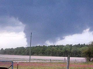
From April 14–16, 2011, a tornado outbreak, among the largest recorded tornado outbreaks in U.S. history, produced 178 confirmed tornadoes across 16 states, resulting in severe destruction on all three days of the outbreak. A total of 38 people were killed from tornadoes and an additional five people were killed as a result of straight-line winds associated with the storm system. The outbreak of severe weather and tornadoes led to 43 deaths in the Southern United States. This was the largest number of fatalities in an outbreak in the United States since the 2008 Super Tuesday tornado outbreak. It is locally referred to as the "Forgotten Outbreak" in Alabama as it was vastly overshadowed by the 2011 Super Outbreak less than two weeks later.

<span class="mw-page-title-main">Tornado outbreak of November 17, 2013</span> Natural disaster

On November 17, 2013, the deadliest and costliest November tornado outbreak in Illinois history took shape, becoming the fourth-largest for the state overall. With more than 30 tornadoes in Indiana, it was that state's largest tornado outbreak for the month of November, and the second largest outbreak recorded in Indiana. Associated with a strong trough in the upper levels of the atmosphere, the event resulted in 77 tornadoes tracking across regions of the Midwest United States and Ohio River Valley, impacting seven states. Severe weather during the tornado outbreak caused over 100 injuries and eleven fatalities, of which eight were tornado related. Two tornadoes—both in Illinois and rated EF4 on the Enhanced Fujita Scale—were the strongest documented during the outbreak and combined for five deaths. In addition to tornadoes, the system associated with the outbreak produced sizeable hail peaking at 4.00 in (10.2 cm) in diameter in Bloomington, Illinois, as well as damaging winds estimated as strong as 100 mph (160 km/h) in three locations.

<span class="mw-page-title-main">North Carolina tornado outbreak of April 2014</span>

On April 25, 2014, a localized tornado outbreak struck North Carolina, resulting in the first tornado-related fatality during that year in the United States. The event marked the latest formation of the first EF3 or stronger tornado during a calendar year and latest date for the first tornadic death.

<span class="mw-page-title-main">Tornado outbreak of February 23–24, 2016</span>

An unusually prolific and very destructive late-winter tornado outbreak resulted in significant damage and numerous casualties across the southern and eastern half of the United States between February 23–24, 2016. Lasting over a day and a half, the outbreak produced a total of 61 tornadoes across eleven states, which ranked it as one of the largest February tornado outbreaks in the United States on record, with only the 2008 Super Tuesday tornado outbreak having recorded more. In addition, it was also one of the largest winter tornado outbreaks overall as well. The most significant and intense tornadoes of the event were four EF3 tornadoes that struck southeastern Louisiana, Pensacola, Florida, Evergreen, Virginia, and Tappahannock, Virginia. Tornadoes were also reported in other places like Texas, Florida, and Pennsylvania. Severe thunderstorms, hail and gusty winds were also felt in the Northeastern United States and Mid-Atlantic states on February 24 as well.

<span class="mw-page-title-main">Tornado outbreak of January 21–23, 2017</span>

A prolific and deadly winter tornado outbreak struck areas across the Southeast United States between January 21–23, 2017. Lasting just under two days, the outbreak produced a total of 81 tornadoes, cementing its status as the second-largest January tornado outbreak and the third-largest winter tornado outbreak since 1950. Furthermore, it was the largest outbreak on record in Georgia with 42 tornadoes confirmed in the state. The most significant tornadoes were three EF3 tornadoes that heavily damaged or destroyed portions of Hattiesburg, Mississippi, and Albany and Adel, Georgia. A total of 20 people were killed by tornadoes—mainly during the pre-dawn hours of the outbreak—making it the second-deadliest outbreak in January since 1950, behind the 1969 Hazlehurst, Mississippi tornado outbreak that killed 32 people. In addition, the tornado death toll was higher than the entire previous year. In the aftermath of the outbreak, relief organizations assisted in clean-up and aid distribution. Total economic losses from the event reached at least $1.3 billion.

<span class="mw-page-title-main">April 2018 North American storm complex</span>

The April 2018 North American storm complex brought a wide swath of severe and winter weather that affected much of Midwest across to the East Coast of the United States. This particular outbreak led to at least 73 confirmed tornadoes over a three-day period, most of which occurred across Arkansas and Louisiana during the evening hours of April 13. The most significant tornadoes were an EF1 that caused a fatality in Red Chute, Louisiana, early on April 14, an upper-end EF2 tornado that impacted eastern sections of Greensboro, North Carolina on April 15, causing 17 injuries, and a significant EF3 tornado that impacted areas from Lynchburg to Elon, Virginia, causing severe damage and at least 10 injuries.

<span class="mw-page-title-main">Tornado outbreak of April 13–15, 2019</span> Severe weather effect in the Southeastern United States

A significant severe weather and tornado outbreak affected multiple regions of the Eastern United States in mid-April 2019. Over the course of 40 hours, 75 tornadoes touched down. The outbreak produced numerous strong tornadoes throughout portions of the Deep South, while additional significant tornadoes occurred as far north as Ohio, Pennsylvania, and Delaware. The most significant tornado of the event was a long-tracked, high-end EF3 tornado that struck Alto, Texas and killed two people. Numerous weak tornadoes were also confirmed, along with numerous reports of hail and damaging straight line winds.

<span class="mw-page-title-main">Tornado outbreak of April 17–19, 2019</span> Weather event in the southern United States of early 2019

The tornado outbreak of April 17–19, 2019 was a multi-day, widespread severe weather event stretching from the South-Central United States to the East Coast of the United States. On the heels of a significant tornado outbreak just a few days prior, another potent upper-level trough progressed eastward and served as the impetus for widespread, damaging thunderstorms. The outbreak began on April 17 with several short-lived, generally weak tornadoes across Kansas, Oklahoma, and Texas. The following day, a total of 43 tornadoes were recorded across central Mississippi, tying the Hurricane Rita tornado outbreak as the largest in Mississippi state history. On April 19, the event spread eastward. North Carolina recorded 12 tornadoes, the state's sixth largest outbreak in a single day, while Virginia recorded 16 tornadoes, its third-most in a 24-hour period. Overall, 97 tornadoes were confirmed, the strongest of which was a high-end EF3 tornado that heavily damaged or destroyed homes and outbuildings near Rocky Mount, Virginia. There were no fatalities recorded in association with tornadic activity, but four people were killed by trees that were downed by strong straight-line winds.

<span class="mw-page-title-main">Tornado outbreak of January 10–11, 2020</span> American severe weather outbreak

The tornado outbreak of January 10–11, 2020 was a two-day severe weather event stretching from the South-Central Plains eastward into the Southeast United States. An eastward-moving shortwave trough tracked across the continental United States through that two-day period, combining with abundant moisture, instability, and wind shear to promote the formation of a long-lived squall line. Hundreds of damaging wind reports were received, and 80 tornadoes occurred within this line, making it the third largest January tornado outbreak on record. Three tornadoes—an EF1 in eastern Texas, an EF2 in northern Louisiana, and an EF2 in western Alabama—led to a total of seven deaths, all in mobile homes. There were five other storm related deaths, including two due to icy roads in Lubbock, Texas, one due to drowning in Oklahoma, and one due to icy roads in Iowa. The system also brought a monthly record high temperature to Boston and Bridgeport. Extensive damage and several other injuries occurred as well. The severe weather event was notable in that it was forecast well in advance, with the Storm Prediction Center first highlighting the risk area a full week beforehand. Total damage from the event reached $1.1 billion according to the National Centers for Environmental Information.

<span class="mw-page-title-main">Tornado outbreak of February 5–7, 2020</span> 2020 tornado outbreak in the United States

There was a multi-day severe weather and tornado outbreak impacted the Southeastern and Mid-Atlantic United States from February 5–7. A powerful upper-level trough progressed eastward across the country, intersecting an abundant supply of moist air to produce severe weather. An eastward-propagating cold front supported a damaging squall line across the Southeast U.S. on February 5–6; supercell thunderstorms ahead of this line also produced numerous tornadoes. One EF1 tornado in the pre-dawn hours of February 6 killed one person in Demopolis, Alabama. On the morning of February 7, a secondary front progressed across Maryland and Virginia, unexpectedly leading to hundreds of damaging wind reports across Virginia, Maryland, Delaware, New Jersey, New York, Connecticut, Rhode Island, and Massachusetts. Five tornadoes were reported in the Washington, D.C., area, the most on record for a wintertime severe weather event. Across the three-day outbreak, 37 tornadoes were confirmed, including several that were strong and long-tracked.

<span class="mw-page-title-main">2020 Easter tornado outbreak</span> Tornado outbreak in southeast US

A widespread and deadly tornado outbreak affected the Southeastern United States on Easter Sunday and Monday, April 12–13, 2020. Several tornadoes were responsible for prompting tornado emergencies, including the first one to be issued by the National Weather Service in Charleston, South Carolina. A large squall line formed and tracked through the mid-Atlantic on April 13, prompting more tornado warnings and watches. A total of 15 watches were produced during the course of the event, two of which were designated Particularly Dangerous Situations.

<span class="mw-page-title-main">Tornado outbreak of April 4–7, 2022</span> Tornadoes in the Southeastern U.S.

From April 4–5, 2022, a mesoscale convective system and numerous discrete supercells produced a swath of severe weather and several tornadoes in the Southeastern United States, including several strong, long tracked tornadoes. An EF3 tornado damaged or destroyed several homes in Bonaire, Georgia while a large EF3 tornado prompted a tornado emergency for Allendale and Sycamore, South Carolina. A violent EF4 tornado in Black Creek, Georgia resulted in one fatality as it destroyed several neighborhoods, and another large EF3 tornado caused widespread heavy tree damage northeast of Ulmer, South Carolina. More severe storms occurred across a large portion of the Southeast ahead of a cold front on April 6–7, with more tornadoes reported in South and Central Georgia and further south into Florida, all of which were weak. Along with the one tornadic death, trees felled by straight-line winds killed one person each in Louisiana and Texas.

References

  1. 1 2 3 4 5 6 Tim Armstrong (March 22, 2013). Carolinas Tornado Outbreak: March 28, 1984 (Report). National Weather Service. Retrieved April 2, 2022.
  2. 1 2 3 4 5 6 Chris Collins. "Major Tornado Outbreak March 28, 1984". National Weather Service. Retrieved April 2, 2022.
  3. 1 2 3 4 5 Phillip Badgett; Barrett Smith; Jonathan Blaes; Rod Gonski; Kermit Keeter (March 18, 2009). March 28, 1984 Carolina's Tornado Outbreak (Report). North Carolina State University. Retrieved April 2, 2022.
  4. Georgia Event Report: F1 Tornado (Report). National Centers for Environmental Information. 1984. Retrieved April 3, 2022.
  5. 1 2 3 4 5 6 7 8 9 10 11 12 13 14 15 16 17 18 19 20 21 22 23 24 Storm Data (PDF) (Report). Vol. 26. National Centers for Environmental Information. March 1984. Archived from the original (PDF) on April 4, 2022. Retrieved April 3, 2022.
  6. Georgia Event Report: F0 Tornado (Report). National Centers for Environmental Information. 1984. Retrieved April 3, 2022.
  7. South Carolina Event Report: F1 Tornado (Report). National Centers for Environmental Information. 1984. Retrieved April 3, 2022.
  8. South Carolina Event Report: F2 Tornado (Report). National Centers for Environmental Information. 1984. Retrieved April 3, 2022.
  9. 1 2 Sparks, Peter R. (1985). Building Damage in South Carolina Caused by the Tornadoes of March 28, 1984. National Academy Press. p. 3. Retrieved June 10, 2014.
  10. South Carolina Event Report: F2 Tornado (Report). National Centers for Environmental Information. 1984. Retrieved April 3, 2022.
  11. South Carolina Event Report: F3 Tornado (Report). National Centers for Environmental Information. 1984. Retrieved April 3, 2022.
  12. South Carolina Event Report: F3 Tornado (Report). National Centers for Environmental Information. 1984. Retrieved April 3, 2022.
  13. 1 2 Grazulis, Thomas P. (1991). Significant Tornadoes 1880–1989. St. Johnsbury, Vermont: Environmental Films.
  14. South Carolina Event Report: F4 Tornado (Report). National Centers for Environmental Information. 1984. Retrieved April 3, 2022.
  15. North Carolina Event Report: F1 Tornado (Report). National Centers for Environmental Information. 1984. Retrieved April 3, 2022.
  16. South Carolina Event Report: F4 Tornado (Report). National Centers for Environmental Information. 1984. Retrieved April 3, 2022.
  17. South Carolina Event Report: F4 Tornado (Report). National Centers for Environmental Information. 1984. Retrieved April 3, 2022.
  18. South Carolina Event Report: F2 Tornado (Report). National Centers for Environmental Information. 1984. Retrieved April 3, 2022.
  19. South Carolina Event Report: F4 Tornado (Report). National Centers for Environmental Information. 1984. Retrieved April 3, 2022.
  20. South Carolina Event Report: F4 Tornado (Report). National Centers for Environmental Information. 1984. Retrieved April 3, 2022.
  21. South Carolina Event Report: F4 Tornado (Report). National Centers for Environmental Information. 1984. Retrieved April 3, 2022.
  22. South Carolina Event Report: F4 Tornado (Report). National Centers for Environmental Information. 1984. Retrieved April 3, 2022.
  23. North Carolina Event Report: F4 Tornado (Report). National Centers for Environmental Information. 1984. Retrieved April 3, 2022.
  24. North Carolina Event Report: F4 Tornado (Report). National Centers for Environmental Information. 1984. Retrieved April 3, 2022.
  25. North Carolina Event Report: F4 Tornado (Report). National Centers for Environmental Information. 1984. Retrieved April 3, 2022.
  26. "Carolinas Tornado Outbreak: March 28, 1984". National Weather Service. Retrieved May 4, 2023.
  27. North Carolina Event Report: F3 Tornado (Report). National Centers for Environmental Information. 1984. Retrieved April 3, 2022.
  28. North Carolina Event Report: F3 Tornado (Report). National Centers for Environmental Information. 1984. Retrieved April 3, 2022.
  29. North Carolina Event Report: F3 Tornado (Report). National Centers for Environmental Information. 1984. Retrieved April 3, 2022.
  30. North Carolina Event Report: F2 Tornado (Report). National Centers for Environmental Information. 1984. Retrieved April 3, 2022.
  31. North Carolina Event Report: F4 Tornado (Report). National Centers for Environmental Information. 1984. Retrieved April 3, 2022.
  32. North Carolina Event Report: F4 Tornado (Report). National Centers for Environmental Information. 1984. Retrieved April 3, 2022.
  33. North Carolina Event Report: F4 Tornado (Report). National Centers for Environmental Information. 1984. Retrieved April 3, 2022.
  34. North Carolina Event Report: F3 Tornado (Report). National Centers for Environmental Information. 1984. Retrieved April 3, 2022.
  35. North Carolina Event Report: F3 Tornado (Report). National Centers for Environmental Information. 1984. Retrieved April 3, 2022.
  36. North Carolina Event Report: F3 Tornado (Report). National Centers for Environmental Information. 1984. Retrieved April 3, 2022.
  37. North Carolina Event Report: F3 Tornado (Report). National Centers for Environmental Information. 1984. Retrieved April 3, 2022.
  38. North Carolina Event Report: F3 Tornado (Report). National Centers for Environmental Information. 1984. Retrieved April 3, 2022.
  39. North Carolina Event Report: F3 Tornado (Report). National Centers for Environmental Information. 1984. Retrieved April 3, 2022.
  40. North Carolina Event Report: F3 Tornado (Report). National Centers for Environmental Information. 1984. Retrieved April 3, 2022.
  41. North Carolina Event Report: F2 Tornado (Report). National Centers for Environmental Information. 1984. Retrieved April 3, 2022.
  42. North Carolina Event Report: F2 Tornado (Report). National Centers for Environmental Information. 1984. Retrieved April 3, 2022.
  43. North Carolina Event Report: F1 Tornado (Report). National Centers for Environmental Information. 1984. Retrieved April 3, 2022.
  44. North Carolina Event Report: F2 Tornado (Report). National Centers for Environmental Information. 1984. Retrieved April 3, 2022.
  45. North Carolina Event Report: F2 Tornado (Report). National Centers for Environmental Information. 1984. Retrieved April 3, 2022.
  46. North Carolina Event Report: F3 Tornado (Report). National Centers for Environmental Information. 1984. Retrieved April 3, 2022.
  47. North Carolina Event Report: F2 Tornado (Report). National Centers for Environmental Information. 1984. Retrieved April 3, 2022.
  48. North Carolina Event Report: F2 Tornado (Report). National Centers for Environmental Information. 1984. Retrieved April 3, 2022.
  49. Maddox, Robert A.; Gilmore, M. S.; Doswell III, C. A.; Johns, R. H.; Crisp, C. A.; W. Burgess, D.; Hart, J. A.; Piltz, S. F. (2013). "Meteorological Analyses of the Tri-State Tornado Event of March 1925". e-Journal of Severe Storms Meteorology. 8 (1).