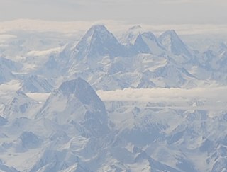
Chogolisa is a trapezoidal mountain located in the Karakoram range within the Gilgit-Baltistan region of Pakistan. It is situated near the Baltoro Glacier in the Concordia region, which is renowned for hosting some of the world's tallest peaks.

Terich Mir is the highest mountain of the Hindu Kush range, and the highest mountain in the world outside of the Himalayas–Karakoram range, at 7,708 meters (25,289 ft) above sea level. It is located in the Chitral District of Khyber Pakhtunkhwa, Pakistan.

Kula Kangri is a mountain in the Eastern Himalayas that has an elevation of 7,538 metres making it the 45th highest mountain on Earth and one of the Ultras of the Himalayas. It is disputed between Bhutan and China, with China claiming that Kula Kangri is fully in the Tibet Autonomous Region.

Zard-Kuh is a sub-range in the central Zagros Mountains, Iran.

Tebulosmta is the highest mountain of the Eastern Caucasus and the highest mountain of the Chechen Republic at an elevation of 4,493 meters above sea level. The mountain is located on the border of Georgia and Chechnya to the east of Mount Kazbek. The glaciers of the mountain are not large.

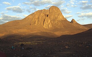
Mount Tahat is the highest mountain in Algeria. It sits at an elevation of 2,908 metres. Other sources indicate an elevation of 3,003 metres (9,852 ft). Tahat is also the highest peak in the Hoggar Mountains. Its nearest city is Tamanrasset which is located 56 kilometres (35 mi) to the south.

Mount Pandim is a Himalayan mountain located in Sikkim, India. It has an elevation of 6,691 m (21,952 ft) above sea level.

Hathi Parbat, also known as Elephant Peak, is a mountain in the Garhwal Himalayas in India. It is located in the Chamoli district of Uttarakhand state. Its summit has an elevation of 6,727 metres (22,070 ft).
Shah Dhar is a mountain in the Hindu Kush mountains. It has an elevation of 7,038 metres (23,091 ft) and sits on the international boundary between Afghanistan and Pakistan. Shah Dhar is at a distance of 337 km from Islamabad.
Tongshanjiabu, also called Gyalbu Kangri, is a mountain in the Himalayas.
Mount Farnham is British Columbia's 17th highest peak, and 21st most prominent. It was named after Paulding Farnham from New York. It is the highest peak in the Purcells.

Pauhunri is a mountain in the Eastern Himalayas. It is located on the border of Sikkim, India and Tibet and is situated about 75 km northeast of Kangchenjunga. It marks the origin of Teesta river.

Kangto at 7,090 metres (23,261 ft) is a mountain of the Eastern Himalayas located in the Indian state of Arunachal Pradesh and it shares its border with the Tibet Autonomous Region of China. It is the highest point in Arunachal Pradesh. The area in which Kangto is located lies in the Lada circle of East Kameng district of the state. On the Chinese side, it lies in Cona County of Shannan Prefecture, Tibet.

The Crown, also known as Huang Guan Shan and sometimes Crown Peak, is a mountain in the Karakoram mountain range in China. It is located in the Xinjiang Uyghur Autonomous Region of China. About 42 kilometers from Chogori Peak. Its summit has an elevation of 7,295 metres (23,934 ft) and it is the highest peak in the Yengisogat subrange of the Karakoram.
Kezhen Peak, also known as Karpogo Sar, is a mountain in the Karakoram mountain range. It is located in the Xinjiang Autonomous Region of China.

Udren Zom is a mountain in the Hindu Kush mountain range in Pakistan. Its summit has an elevation of 7,140 metres (23,425 ft) and a topographic prominence of 1,620 metres (5,315 ft). It is one of the highest peaks in the world located outside of the Himalaya and Karakoram ranges. Udren Zom is located in the Khyber Pakhtunkhwa province of Pakistan.

Nyegyi Kangtsang is a mountain of the Eastern Himalayas located in East Kameng district of Arunachal Pradesh state of India on the border with Tibet.
Kubi Gangri is a mountain in the Himalayas of Asia. It has a summit elevation of 6,859 meters above sea level and is located on the international border between Nepal and Tibet, China.

Ghamubar Zom is a mountain in the Hindu Raj mountain range of Asia. Located in Gilgit–Baltistan, Pakistan, it has a summit elevation of 6,518 m above sea level. The mountain is close to the border of Gilgit–Baltistan and Khyber Pakhtunkhwa. The nearest village from the mountain is Darkot in Yasin valley.
Shayaz is a mountain in the Hindu Kush mountain range of Asia. Located in Khyber Pakhtunkhwa, Pakistan, it has a summit elevation of 6,026 m above sea level.


