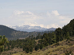
This is a list of all the ultra-prominent peaks (with topographic prominence greater than 1,500 metres) in the Himalayas. Listed separately, to the west and north-west are the Karakoram and Hindu Kush Ultras, and while to the north-east and east are the ultras of Tibet.9 of the 10 Himalayan 8,000m peaks are ultras (the exception is Lhotse), and there are a further 28 peaks over 7000m.
No | Peak | Country | Elevation (m) | Prominence (m) | Col (m) |
---|---|---|---|---|---|
1 | Nanga Parbat | Pakistan | 8,125 | 4,608 | 3517 |
2 | Nun | India | 7,135 | 2,404 | 4731 |
3 | Shikar Beh | India | 6,200 | 2,223 | 3977 |
4 | Parbati Parbat | India | 6,633 | 2,093 | 4540 |
5 | Reo Purgyil | India / China | 6,816 | 1,978 | 4838 |
6 | Sunset Peak | India | 4,745 | 1,942 | 2803 |
7 | Miranjani | Pakistan | 2,981 | 1,911 | 1070 |
8 | Gya | India / China | 6,794 | 1,910 | 4884 |
9 | Dofana | Pakistan | 5,940 | 1,875 | 4065 |
10 | Point 5608 | Pakistan / India | 5,608 | 1,850 | 3758 |
11 | Manirang | India | 6,593 | 1,727 | 4866 |
12 | Point 5800 | Pakistan | 5,800 | 1,682 | 4118 |
13 | Point 6086 | India | 6,086 | 1,618 | 4468 |
14 | Bharanzar | India | 6,574 | 1,606 | 4968 |
15 | Mulkila | India | 6,517 | 1,586 | 4931 |
16 | Kolahoi | India | 5,425 | 1,585 | 3840 |
17 | Point 5971 | India | 5,971 | 1,566 | 4405 |
18 | Junkor | Pakistan / India | 5,373 | 1,563 | 3810 |
19 | Doda | India | 6,573 | 1,504 | 5069 |
No | Peak | Country | Elevation (m) | Prominence (m) | Col (m) |
---|---|---|---|---|---|
1 | Nanda Devi | India | 7,816 | 3,139 | 4677 |
2 | Kamet | India | 7,756 | 2,825 | 4931 |
3 | Rangrik Rang | India | 6,684 | 1,674 | 5010 |
4 | Hathi Parbat | India | 6,727 | 1,673 | 5054 |
5 | Trisul | India | 7,120 | 1,616 | 5504 |
6 | Panchchuli | India | 6,904 | 1,614 | 5290 |
7 | Chaukhamba | India | 7,138 | 1,594 | 5544 |
8 | Nanda Kot | India | 6,861 | 1,592 | 5269 |
No | Peak | Country | Elevation (m) | Prominence (m) | Col (m) |
---|---|---|---|---|---|
1 | Dhaulagiri | Nepal | 8,167 | 3,357 | 4810 |
2 | Gurla Mandhata | China | 7,694 | 2,788 | 4906 |
3 | Dhaulagiri II | Nepal | 7,752 | 2,397 | 5355 |
4 | Api | Nepal | 7,132 | 2,040 | 5092 |
5 | Kanjiroba | Nepal | 6,883 | 1,870 | 5013 |
6 | Saipal | Nepal | 7,031 | 1,824 | 5207 |
7 | Kubi Gangri | Nepal / China | 6,859 | 1,699 | 5160 |
8 | Badi malika | Nepal | 4,390 | 1,678 | 2712 |
9 | Changla | Nepal / China | 6,721 | 1,657 | 5064 |
10 | Bhalu Lek | Nepal | 5,425 | 1,643 | 3782 |
11 | Jethi Bahurani | Nepal | 6,850 | 1,558 | 5292 |
The Kali Gandaki River is normally considered to mark the divide between the Western and Eastern Himalayas.
No | Peak | Country | Elevation (m) | Prominence (m) | Col (m) |
---|---|---|---|---|---|
1 | Mount Everest | China / Nepal [2] | 8,848 | 8,848 | 0 |
2 | Manaslu | Nepal | 8,163 | 3,092 | 5071 |
3 | Annapurna I | Nepal | 8,091 | 2,984 | 5107 |
4 | Shishapangma | China | 8,027 | 2,897 | 5130 |
5 | Annapurna II | Nepal | 7,937 | 2,437 | 5500 |
6 | Makalu | Nepal | 8,485 | 2,378 | 6107 |
7 | Yangra | Nepal | 7,422 | 2,352 | 5070 |
8 | Cho Oyu | Nepal | 8,188 | 2,340 | 5848 |
9 | Chamar | Nepal | 7,165 | 2,061 | 5104 |
10 | Labuche Kang | China | 7,367 | 1,957 | 5410 |
11 | Nemjung | Nepal | 7,140 | 1,920 | 5220 |
12 | Tsanglha Ri (Zang La) | China | 6,495 | 1,712 | 4783 |
13 | Himalchuli | Nepal | 7,893 | 1,633 | 6260 |
14 | Pangpoche | Nepal | 6,620 | 1,622 | 4998 |
15 | Gauri Sankar | Nepal | 7,146 | 1,600 | 5546 |
16 | Melungtse | China | 7,181 | 1,551 | 5630 |
17 | Langtang Lirung | Nepal | 7,234 | 1,534 | 5700 |
No | Peak | Country | Elevation (m) | Prominence (m) | Col (m) |
---|---|---|---|---|---|
1 | Kangchenjunga | Nepal / India | 8,586 | 3,922 | 4664 |
2 | Pauhunri | India / China | 7,128 | 2,035 | 5093 |
3 | Nyonno Ri | China | 6,724 | 1,805 | 4919 |
4 | Pandim | India | 6,691 | 1,762 | 4929 |
5 | Chomo Yummo | China / India | 6,829 | 1,559 | 5270 |
No | Peak | Country | Elevation (m) | Prominence (m) | Col (m) |
---|---|---|---|---|---|
1 | Namcha Barwa | China | 7,782 | 4,106 | 3676 |
2 | Gangkhar Puensum | Bhutan / China | 7,570 | 2,995 | 4575 |
3 | Kangto | India / China | 7,060 | 2,195 | 4865 |
4 | Noijin Kangsang | China | 7,191 | 2,145 | 5046 |
5 | Chomolhari | Bhutan / China | 7,326 | 2,077 | 5249 |
6 | Yarla Shampo | China | 6,636 | 1,805 | 4831 |
7 | Tongshanjiabu | Bhutan / China | 7,207 | 1,757 | 5450 |
8 | Nyegyi Kansang | India / China | 6,970 | 1,752 | 5295 |
9 | Khyarisatam | India / China | 6,870 | ||
10 | Point 5980 | India / China | 5,980 | 1,747 | 4233 |
11 | Tarlha Ri | China | 6,777 | 1,697 | 5080 |
12 | HP Dafla Range | India | 3,776 | 1,684 | 2092 |
13 | Point 5641 | India / China | 5,641 | 1,681 | 3960 |
14 | Kula Kangri | Bhutan / China | 7,553 | 1,669 | 5884 |
15 | Tarka La | Bhutan | 4,735 | 1,624 | 3111 |
16 | Kazi Razi | China | 6,505 | 1,561 | 4944 |
17 | Point 6215 | China | 6,215 | 1,521 | 4694 |
18 | Point 5840 | China | 5840 | 1,511 | 4329 |
India is situated north of the equator between 8°4' north to 37°6' north latitude and 68°7' east to 97°25' east longitude. It is the seventh-largest country in the world, with a total area of 3,287,263 square kilometres (1,269,219 sq mi). India measures 3,214 km (1,997 mi) from north to south and 2,933 km (1,822 mi) from east to west. It has a land frontier of 15,200 km (9,445 mi) and a coastline of 7,516.6 km (4,671 mi).
China has great physical diversity. The eastern plains and southern coasts of the country consist of fertile lowlands and foothills. They are the location of most of China's agricultural output and human population. The southern areas of the country consist of hilly and mountainous terrain. The west and north of the country are dominated by sunken basins, rolling plateaus, and towering massifs. It contains part of the highest tableland on earth, the Tibetan Plateau, and has much lower agricultural potential and population.
The Himalayas, or Himalaya is a mountain range in Asia, separating the plains of the Indian subcontinent from the Tibetan Plateau. The range has some of the Earth's highest peaks, including the highest, Mount Everest. More than 100 peaks exceeding elevations of 7,200 m (23,600 ft) above sea level lie in the Himalayas.
The Karakoram is a mountain range in the Kashmir region spanning the border of Pakistan, China, and India, with the northwestern extremity of the range extending to Afghanistan and Tajikistan. Most of the Karakoram mountain range falls under the jurisdiction of Gilgit-Baltistan, which is controlled by Pakistan. Its highest peak, K2, is located in Gilgit-Baltistan, Pakistan. It begins in the Wakhan Corridor (Afghanistan) in the west, encompasses the majority of Gilgit-Baltistan, Pakistan and extends into Ladakh and Aksai Chin. It is part of the larger Trans-Himalayan mountain ranges.
The Indo-Gangetic Plain, also known as the Northern Plain or North Indian River Plain, is a fertile plain spanning 700,000 km2 (270,000 sq mi) across the northern and north-eastern part of the Indian subcontinent. It encompasses northern and eastern India, eastern Pakistan, southern Nepal, and almost all of Bangladesh. It is named after the two major river systems that drain the region–Indus and Ganges.
Nanda Devi is the second-highest mountain in India, after Kangchenjunga, and the highest located entirely within the country. Nanda Devi is the 23rd-highest peak in the world.
Anamudi is a mountain located in Ernakulam district and Idukki district of the Indian state of Kerala. With an elevation of 2,695 metres (8,842 ft) and a topographic prominence of 2,479 metres (8,133 ft), it is the highest peak in the Western Ghats and in South India.
K12 is the second highest peak in the Saltoro Mountains, a subrange of the Karakoram range in the Siachen region and is administered as a part of Ladakh territory. Its name comes from its designation given during the original survey of the Karakoram range. In 1984, an Indian army expedition under Colonel Prem Chand took hold of this peak, from the side of Siachen glacier by traversing from the west.
The Geography of West Bengal, a state in eastern India, is primarily defined by plains and plateaus, with the high peaks of the Himalayas in the north and the Bay of Bengal to the south.
Darjeeling Himalayan hill region, also known as the Darjeeling Hills or Darjeeling Himalaya, is a mountainous area on the north-western side of the state of West Bengal in India. This region belongs to the Eastern Himalaya range. The Darjeeling district except the Siliguri subdivision and the entire Kalimpong district constitute this region. It arises abruptly from the Terai region. The region slopes from a south to north direction. The river Teesta divides the region in two parts — the region to the east of Teesta and the region to the west of Teesta.
The state of Himachal Pradesh is spread over an area 55,673 km2 (21,495 sq mi) and is bordered by Jammu and Kashmir and Ladakh on the north, Punjab on the southwest, Haryana on the south, Uttarakhand on the southeast, a small border with Uttar Pradesh in the south, and Tibet on the east. Entire Himachal Pradesh lies in the mountainous Himalaya region, rich in natural resources
Ladakh is an administrative territory of India that has been under its control since 1947. The geographical region of Ladakh union territory is the highest altitude plateau region in India, incorporating parts of the Himalayan and Karakoram mountain ranges and the upper Indus River and valley.
An ultra-prominent peak, or ultra for short, is a mountain summit with a topographic prominence of 1,500 metres (4,900 ft) or more; it is also called a P1500. The prominence of a peak is the minimum height of climb to the summit on any route from a higher peak, or from sea level if there is no higher peak. There are approximately 1,524 such peaks on Earth. Some well-known peaks, such as the Matterhorn and Eiger, are not ultras because they are connected to higher mountains by high cols and thus do not achieve enough topographic prominence.
Indira Col West is a mountain pass at 5,988 metres (19,646 ft)) altitude on the Indira Ridge of Siachen Muztagh in Karakoram Range. It is on the border between Indian-controlled Siachen Glacier and the Chinese-controlled Trans-Karakoram Tract, close to the tripoint of India, Pakistan, and China. The India-Pakistan Actual Ground Position Line (AGPL) in the Siachen area ends near the pass. It is possible to ascend the pass from both the north and south sides controlled by China and India respectively.
Noijin Kangsang is the highest peak of Lhagoi Kangri mountain range in the Tibet Autonomous Region in China. It lies between the Yarlung Tsangpo River, Yamdrok Lake and the Himalayas mountain range.
Sickle Moon Peak or Bharanzar Peak is located in the Kishtwar Himalaya and is the highest summit of the range. It lies in the western Himalayan range, and is 12 km (7 mi) north of Brammah massif in Kishtwar, 55 kilometers east of Kishtwar town and 195 kilometers east of Srinagar, the summer capital of the Indian union territory of Jammu and Kashmir.
Lists of mountains can be organized by continent and more specifically by country and province/state: