Labuche Kang

Last updated
Labuche Kang
Labuche Kang and Shishapangma from Cho Oyu.jpg
Labuche Kang (Centre) and Shishapangma (left) as seen from Cho Oyu
Highest point
Elevation 7,367 m (24,170 ft) [1]
Ranked 75th
Prominence 1,957 m (6,421 ft) [1]
Listing Ultra
Coordinates 28°18′15″N86°21′03″E / 28.30417°N 86.35083°E / 28.30417; 86.35083 Coordinates: 28°18′15″N86°21′03″E / 28.30417°N 86.35083°E / 28.30417; 86.35083 [1]
Geography
China Tibet Autonomous Region rel location map.svg
Red triangle with thick white border.svg
Labuche Kang
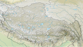
Location in Tibet, China
Country China
Region Tibet
Parent range Labuche Himal, Himalaya
Climbing
First ascent October 26, 1987 by A. Deuchi, H. Furukawa, K. Sudo (Japanese); Diaqiog, Gyala, Lhaji, Wanjia (Chinese)
Easiest route West Ridge: glacier/snow climb

Labuche Kang (or Lapche Kang, Lobuche Kang I, Choksiam) is a northern outlier of the Himalayas inside Tibet. It rises northwest of Rolwaling Himal and east of Shishapangma. The peak belongs to a little-known section of the Himalaya variously called Labuche Himal, Pamari Himal and Lapchi Kang. [2] that extends from the valley of the Tamakosi River west to the valley of the Sun Kosi and Nyalam Tong La pass where Arniko-Friendship Highway cross the Himalaya. This section extends south into Nepal east of Arniko Highway. It is wholly within the catchment of the Kosi, a Ganges tributary.

Labuche Kang was first climbed in 1987 by a Sino-Japanese expedition, via the West Ridge. No other attempts are recorded [3] until September 2010 when American climber Joe Puryear fell to his death during an unsuccessful attempt. [4]

See also

Related Research Articles

Kangchenjunga Third highest mountain in the world

Kangchenjunga, also spelled Kanchenjunga, is the third highest mountain in the world. It rises with an elevation of 8,586 m (28,169 ft) in a section of the Himalayas called Kangchenjunga Himal delimited in the west by the Tamur River, in the north by the Lhonak Chu and Jongsang La, and in the east by the Teesta River. It lies between India and Nepal, with three of the five peaks, namely Main, Central and South, directly on the border, and the peaks West and Kangbachen in Nepal's Taplejung District.

Himalayas Mountain range in Asia

The Himalayas, or Himalaya, are a mountain range in Asia separating the plains of the Indian subcontinent from the Tibetan Plateau. The range has some of the planet's highest peaks, including the highest, Mount Everest. Over 100 peaks exceeding 7,200 m (23,600 ft) in elevation lie in the Himalayas. By contrast, the highest peak outside Asia is 6,961 m (22,838 ft) tall.

Dhaulagiri Mountain in Nepal; 7th highest in world

The Dhaulagiri massif in Nepal extends 120 km (70 mi) from the Kaligandaki River west to the Bheri. This massif is bounded on the north and southwest by tributaries of the Bheri River and on the southeast by the Myagdi Khola. Dhaulagiri is the seventh highest mountain in the world at 8,167 metres (26,795 ft) above sea level, and the highest mountain within the borders of a single country (Nepal). It was first climbed on 13 May 1960 by a Swiss/Austrian/Nepali expedition.

Gaurishankar Mountain in the Nepal Himalayas

Gaurishankar is a mountain in the Nepal Himalayas, the second highest peak of the Rolwaling Himal, behind Melungtse (7,181m). The name comes from the Hindu goddess Gauri, a manifestation of Parvati, and her consort Shankar, denoting the sacred regard to which it is afforded it by the people of Nepal. The Sherpas name the mountain as Jomo Tseringma. The Nepal Standard Time (GMT+05:45) is based on the meridian of this mountain peak.

Melungtse

Melungtse is the highest mountain of the Rolwaling Himal in the Himalayas.

Rolwaling Himal Mountain range on Nepal/Tibet border

Rolwāling Valley , knows as a (Gaurishankar) rural municipality, is a section of the Himalayas in east-central Nepal along the Tibet border. Rolwaling Himal includes Melungtse 7181m and Melungtse II 7023m inside Tibet and Gaurishankar 7134m on the Nepal border with some 50 additional peaks over 6000m, all extending from the Nangpa La pass where the Mahalangur section begins, southwest to the Tamakosi River. The Labuche Himal section rises beyond the Tamakosi to the northwest. Rolwaling Himal is bounded on the south by the Rolwaling Valley which contain several small sherpa villages Tasi Nam, Simigau and Beding under rolwaling valley, Tasi Nam is the largest town of the area. Five to six days are required to reach Namche Bazaar after Tasilapcha pass. Visitors can trek to Everest base camp by crossing Tasilapcha or fly from Kathmandu to Lukla.

Namcha Barwa Mountain in Tibet, China

Namcha Barwa or Namchabarwa is a mountain peak lying in Tibet in the region of Pemako. The traditional definition of the Himalaya extending from the Indus River to the Brahmaputra would make it the eastern anchor of the entire mountain chain, and it is the highest peak of its own section as well as Earth's easternmost peak over 7,600 metres (24,900 ft). It lies in the Nyingchi Prefecture of Tibet. It is the highest peak in the 180 km long Namcha Barwa Himal range, which is considered the easternmost syntaxis/section of the Himalaya in southeastern Tibet and northeastern India where the Himalaya are said to end, although high ranges actually continue another 300 km east.

Ganesh Himal

Ganesh Himāl is a sub-range of the Himalayas located mostly in north-central Nepal, but some peaks lie on the border with Tibet. The Trisuli Gandaki valley on the east separates it from the Langtang Himal; the Budhi (Buri) Gandaki valley and the Shyar Khola valley on the west separate it from the Sringi Himal and the Mansiri Himal. The range lies about 70 km north-northwest of Kathmandu.

Langtang Lirung

Langtang Lirung is the highest peak of the Langtang Himal, which is a subrange of the Nepalese Himalayas, southwest of the Eight-thousander Shishapangma. The List of the world's highest 100 mountains puts it at number 99.

Api (mountain) Mountain in Darchula District, Nepal

Api is the highest peak in the Yoka Pahar Section of Gurans Himal, part of the Himalayas in the extreme northwest corner of Nepal, near the border with Tibet. It is a little-known peak in a rarely visited part of the Himalayas, but it rises dramatically over the low surrounding terrain.

Bhotekoshi River River in Nepal

The Bhote Koshi is the upper river course of the Sun Kosi, known as Poiqu in Tibet. It is part of the Koshi River system in Nepal.

Mahalangur Himal

Mahālangūr Himāl is a section of the Himalayas in northeast Nepal and south-central Tibet of China extending east from the pass Nangpa La between Rolwaling Himal and Cho Oyu, to the Arun River. It includes Mount Everest, Lhotse, Makalu, and Cho Oyu — four of Earth's six highest peaks. On the Tibetan side it is drained by the Rongbuk and Kangshung Glaciers and on the Nepali side by Barun, Ngojumba and Khumbu Glaciers and others. All are tributaries to the Koshi River via Arun River on the north and east or Dudh Kosi on the south.

Indian Himalayan Region Region in northern India

The Indian Himalayan Region is the section of the Himalayas within India, spanning 12 Indian states and union territories, namely Ladakh, Jammu and Kashmir, Himachal Pradesh, Uttarakhand, Sikkim, West Bengal, Arunachal Pradesh, Nagaland, Manipur, Mizoram, Tripura, Meghalaya and Assam. The region is responsible for providing water to a large part of the Indian subcontinent and contains various flora and fauna.

Araniko Highway

The Araniko Highway connects Kathmandu with Kodari, 115 kilometres (71 mi) northeast of the Kathmandu Valley, on the Nepal-China border. It is among the most dangerous of highways in Nepal due to extremely steep slopes on each side of the road from Barabise onwards; massive landslides and bus plunges are not uncommon, especially after rains. At the Sino-Nepal Friendship Bridge, it connects with China National Highway 318 to Lhasa, and eventually to Shanghai.

Indravati River (Nepal) River in Nepal

The Indravati River in Nepal is a tributary of the Sun Koshi River. It used to be called "Melamchi" or "Melamchu" until the 19th century.

Sunkoshi River River in Nepal

The Sunkoshi, also called Sunkosi, is a trans-boundary river that originates in Tibet Autonomous Region and is part of the Koshi or Saptkoshi River system in Nepal.

Nyalam Tong La

Nyalam Tong La or Yakrushong La is a Mountain pass in China on the Matsung Tsangpo-Phung Chhu watershed divide where the Friendship Highway connecting Kathmandu, Nepal and Lhasa, Tibet crosses at 5,150 metres (16,900 ft) elevation.

Karjiang

Karjiang is a mountain in Tibet Autonomous Region, located near the Bhutan–China border. The highest peak of the Karjiang group is Karjiang I or Karjiang South, with an elevation of 7,221 metres (23,691 ft); it remains unclimbed. Other peaks include Karjiang North, Karjiang II/Central, Karjiang III or Taptol Kangri and the top of the north-eastern shoulder.

Joseph Nicholi Puryear was an American mountain climber.

Labuche Kang III/East

Labuche Kang III, also known as Labuche Kang East, is a mountain located on the Labuche Kang massif in Tibet Autonomous Region and is one of the highest unclimbed mountains in the world after Gangkhar Puensum. The former second highest unclimbed mountain, Saser Kangri II East was first climbed on August 24, 2011.

References

  1. 1 2 3 "China I: Tibet - Xizang". Peaklist.org. Retrieved 2014-05-30.
  2. Carter, H. Adams (1985). "Classification of the Himalaya" (PDF). American Alpine Journal. American Alpine Club. 27 (59): 122. Retrieved May 1, 2011.
  3. "Himalayan Index". London: Alpine Club. Retrieved May 18, 2011.
  4. Puryear's accident Archived 2010-10-31 at the Wayback Machine