Papua New Guinea has 326 local-level governments (LLGs) comprising 6,112 wards as of 2018.

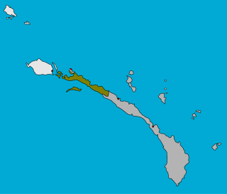
Tikana Rural LLG is a local government area in New Ireland Province, Papua New Guinea. The LLG administers the northern section of the island of New Ireland, as well as Djaul Island and some Tigak islands in the strait between New Ireland and New Hanover.

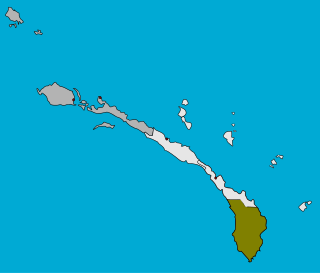
Konoagil Rural LLG is a local government area in New Ireland Province, Papua New Guinea. The LLG administers the southern peninsula of the island of New Ireland. The LLG is located in Namatanai District and its population is 10,503. Languages in the area are Siar-Lak language, Kandas language, and Label language.

This page is a list of districts of Papua New Guinea.
Kairuku-Hiri District is a district of Central Province in Papua New Guinea. It is one of the four administrative districts that make up the province, and surrounds the national capital, Port Moresby.
Morobe Rural LLG is a local-level government (LLG) of Morobe Province, Papua New Guinea.

Bamu Rural LLG is a local-level government (LLG) of Western Province, Papua New Guinea. The Kamula language is spoken in the LLG, near the Wawoi Falls area.
Vanimo Rural LLG is a local-level government (LLG) of Sandaun Province, Papua New Guinea.
Wasu Rural LLG is a local-level government (LLG) of Morobe Province, Papua New Guinea.
Finschhafen Urban LLG is a local-level government (LLG) of Morobe Province, Papua New Guinea.

Kainantu Urban LLG is a local-level government (LLG) of Eastern Highlands Province, Papua New Guinea. Ukarumpa, an important SIL International base in Papua New Guinea, is located in the LLG.
Mosa Rural LLG is a local-level government (LLG) of West New Britain Province, Papua New Guinea.
Hiri Rural LLG is a local-level government (LLG) of Central Province, Papua New Guinea.
Wabag Urban LLG is a local-level government (LLG) of Enga Province, Papua New Guinea.
Lower Wage Rural LLG a local-level government (LLG) of [Magarima District] in Hela Province, Papua New Guinea.
Bomai/Gumai Rural LLG is a local-level government (LLG) of Chimbu Province, Papua New Guinea.
Gumine Rural LLG is a local-level government (LLG) of Chimbu Province, Papua New Guinea.
Nomane Rural LLG is a local-level government (LLG) of Chimbu Province, Papua New Guinea. The Nomane language is spoken in the LLG.

Watabung Rural LLG is a local-level government (LLG) of Eastern Highlands Province, Papua New Guinea.

Kamano No. 2 Rural LLG is a local-level government (LLG) of Eastern Highlands Province, Papua New Guinea. The Kamano language is spoken in the LLG.


