Kaiser Franz Joseph Fjord

Last updated
Kaiser Franz Joseph Fjord
Kejser Franz Josef Fjord
Franz Josef Fjord at sunshine.jpg
Landscape at Kaiser Franz Joseph Fjord
Greenland edcp relief location map.jpg
Red pog.svg
Kaiser Franz Joseph Fjord
Location within Greenland
Coordinates 73°27′N25°00′W / 73.450°N 25.000°W / 73.450; -25.000
Ocean/sea sources Greenland Sea
Basin  countries Greenland
Max. length190 km (120 mi)
Max. width25 km (16 mi)

Kaiser Franz Joseph Fjord (Danish : Kejser Franz Josef Fjord; Greenlandic : Kangerluk Kejser Franz Joseph) is a major fjord system in the NE Greenland National Park area, East Greenland.

Contents

Geography

The Kaiser Franz Joseph Fjord has its mouth in the Foster Bay of the Greenland Sea, between Cape Mackenzie at the eastern end of Geographical Society Island and Cape Franklin, the southern end of the mainland's Gauss Peninsula; Bontekoe Island lies in the bay off its mouth. It extends westwards for about 100 km, then at Eleonore Bay in an NNE/SSW direction for about 32 km, bending again westwards at Cape Mohn, the western end of Ymer Island, branching again with the Isfjord extending northwestwards for over 60 km.

Two tributary fjords, the wide Nordfjord —with the large Waltershausen Glacier at its head and the Muskox Fjord (Moskusokse Fjord) branching eastwards— and the narrower Geologfjord —with the Nunatak Glacier, branch from the northern side of the fjord, about 70 km from the entrance. Dusen Fjord in Ymer Island joins the fjord on the southern side, nearer its mouth. The Devil's Castle (Teufelsschloss) is a prominent mountain of reddish rock with a lighter stripe extending diagonally across its face that stands close to the southern side of Cape Petersens, the NW extremity of Ymer Island. [1]

The Nordenskiold Glacier flows into the head of the Kaiser Franz Joseph Fjord, just 7 km (4.3 mi) west of the mouth of Kjerulf Fjord, marking the southern limit of Fraenkel Land and the northern of Goodenoughland. [2]

The fjord is bounded by the Suess Land Peninsula and Ymer Island to the South, with the Antarctic Sound separating them and connecting with the King Oscar Fjord system to the south. Frænkel Land, Andrée Land and the Gauss Peninsula lie to the North of the fjord. [3]

The branches of Kaiser Franz Joseph Fjord are:

Since its structure is made up by deep, drowned valleys, the Kaiser Franz Joseph Fjord has almost no small islands in its interior. Small and rocky Bjorne Island (Bjørneø) is located near the mouth of Geologfjord, [1] north of Cape Weber, the easternmost end of Andrée Land. [4] Ättestupan is a cliff rising to a height of 1,300 m (4,300 ft) from the southern shore of Frænkel Land, on the northern side of Kaiser Franz Joseph Fjord. [5]

Glacier tongues at the shore of Kaiser Franz Josef Fjord Franz Josef Fjord, gacier tongues.jpg
Glacier tongues at the shore of Kaiser Franz Josef Fjord
Iceberg in Kaiser Franz Josef Fjord Iceberg, Franz Josef Fjord (js)7.jpg
Iceberg in Kaiser Franz Josef Fjord

History

This fjord was first surveyed and partially explored by the Second German North Polar Expedition 1869–70 and named Kaiser Franz Joseph Fjord for Franz Joseph, Emperor of Austria-Hungary, who had made substantial donations to the expedition. [5]

See also

Related Research Articles

<span class="mw-page-title-main">Ymer Island</span> Island in Greenland

Ymer Island is an island in northeastern Greenland. The island is a part of Northeast Greenland National Park.

<span class="mw-page-title-main">King Oscar Fjord</span>

King Oscar Fjord is a fjord in East Greenland, marking the northern border of the Scoresby Land Peninsula.

Gauss Peninsula is a peninsula in eastern Greenland. Administratively this peninsula is part of the Northeast Greenland National Park zone.

Frænkel Land is a peninsula in King Christian X Land, East Greenland. Administratively it is part of the Northeast Greenland National Park.
<span class="mw-page-title-main">Andrée Land (Greenland)</span> Peninsula in King Christian X Land, East Greenland

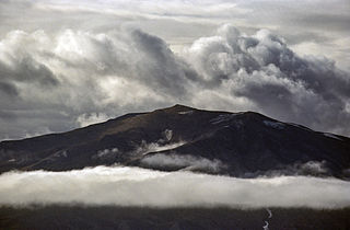
Andrée Land is a peninsula in King Christian X Land, East Greenland that is bounded by Kejser Franz Joseph Fjord, Isfjord and Geologfjord.

Foster Bay is a large bay of the Greenland Sea in King Christian X Land, Eastern Greenland. Administratively it belongs to the NE Greenland National Park area.

Isfjord, meaning 'Ice Fjord' in the Danish language, is a fjord in King Christian X Land, eastern Greenland. The Isfjord is part of the Kaiser Franz Joseph Fjord complex in the area of the Northeast Greenland National Park.

The Devil's Castle is a conspicuous mountain rising above the Kaiser Franz Josef Fjord at the SE end of Andrée Land in eastern Greenland. The feature is within the boundaries of Northeast Greenland National Park, currently the largest park on earth.
<span class="mw-page-title-main">Nordfjord (Greenland)</span>

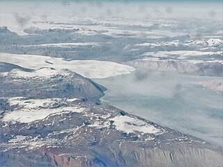
Nordfjord is a fjord in the NE Greenland National Park area, East Greenland.

Akuliarutsip Sermerssua, also known as Nordenskiöld Glacier,, is a large glacier located on the east coast of Greenland.

<span class="mw-page-title-main">Antarctic Sound, Greenland</span>

The Antarctic Sound is a sound in King Christian X Land, Northeast Greenland. Administratively it is part of the Northeast Greenland National Park zone.

<span class="mw-page-title-main">Suess Land</span> Peninsula in King Christian X Land, East Greenland

Suess Land is a peninsula in King Christian X Land, East Greenland. Administratively it is part of the Northeast Greenland National Park.

Louise Boyd Land is an area in King Christian X Land, Eastern Greenland. Administratively it lies in the Northeast Greenland National Park zone. The area is remote and uninhabited.

<span class="mw-page-title-main">Bjorne Island</span>

Bjorne Island, Danish: Bjørneø, meaning 'Bear Island', is an island in NE Greenland. Administratively it belongs to the Northeast Greenland National Park.

<span class="mw-page-title-main">Geologfjord</span>

Geologfjord is a fjord in King Christian X Land, East Greenland. Administratively it belongs to the Northeast Greenland National Park.

<span class="mw-page-title-main">Dusen Fjord</span>

Dusen Fjord or Dusén Fjord is a fjord in the NE Greenland National Park area, East Greenland.

<span class="mw-page-title-main">Muskox Fjord</span>

Muskox Fjord is a fjord in King Christian X Land, East Greenland. Administratively it lies in the Northeast Greenland National Park area. This fjord is part of the Kaiser Franz Joseph Fjord system.

Kjerulf Fjord is a fjord in King Christian X Land, eastern Greenland.

References

  1. 1 2 Prostar Sailing Directions 2005 Greenland and Iceland Enroute, p. 120
  2. "Kjerulf Fjord". Mapcarta. Retrieved 10 October 2019.
  3. "Kejser Franz Josef Fjord". Mapcarta. Retrieved 25 May 2019.
  4. "Bjørneø". Mapcarta. Retrieved 25 July 2019.
  5. 1 2 Place names, NE Greenland