
Hubli is a city in the Indian state of Karnataka. The twin cities Hubli–Dharwad form the second largest city in the state by area and population and the largest city in North Karnataka. Hubli is in Dharwad district of Karnataka and is the taluk headquarters of Hubli City and Hubli Rural. Although it hosts the HDMC office, the district headquarters is in Dharwad.

Dharwad, also known as Dharwar, is a city located in the northwestern part of the Indian state of Karnataka. It is the headquarters of the Dharwad district of Karnataka and forms a contiguous urban area with the city of Hubballi. It was merged with Hubballi in 1962 to form the twin cities of Hubballi-Dharwad. It covers an area of 213 km2 (82 sq mi) and is located 430 km (270 mi) northwest of Bangalore, on NH-48, between Bangalore and Pune.

Haveri is a district in the state of Karnataka, India. As of 2011, it had a population of 1,597,668, out of which 20.78% were urban residents. The district headquarters is Haveri. Ranebennur is the biggest city in Haveri district with population and the commercial city and business headquarters and seeds production hub.
Arasikere is a city and taluka in the Hassan district in the state of Karnataka, India. It is the second largest city in Hassan district, demographically. Arsikere city municipal council consists of 35 wards. This region is known for its coconut production and is also called Kalpataru Nadu. Arsikere Junction is a major railway junction in the South Western Railway which links Mangalore and Mysore to North Karnataka and a central place for tourists who visit nearby places that do not have rail access, such as Belur, Halebidu and Shravanabelagola, Harnahalli, and Kodimata.

North Karnataka is a geographical region in Deccan plateau from 300 to 730 metres elevation that constitutes the region of the Karnataka state in India and the region consists of 14 districts. It is drained by the Krishna River and its tributaries the Bhima, Ghataprabha, Malaprabha, and Tungabhadra. North Karnataka lies within the Deccan thorn scrub forests ecoregion, which extends north into eastern Maharashtra.
Dharwad or Dharawada is an administrative district of the state of Karnataka in southern India. The administrative headquarters of the district is the city of Dharwad, also known as Dharwar. Dharwad is located 425 km northwest of Bangalore and 421 km southeast of Pune, on the main highway between Chennai and Pune, the National Highway 4 (NH4).

Kundgol also spelled as Kundagola is a panchayat town in Dharwad district in the Indian state of Karnataka.

Lakshmeshwara is a town, and newly created Taluk place along with Gajendragad in Gadag district, in the Indian state of Karnataka. It is about 40 km from Gadag and 55 km from Hubli. It is an agricultural trading town. Lakshmeshwara Temple dedicated to Shiva. There are many important temples in this historic town, including the other Shiva temple, the Someshwara Temple. There are two ancient Jain temples in the town, as well as a notable Jamma Masjid. Lakshmeshwara is also home for many smaller shrines, a dargah, the Kodiyellamma temple, the Mukha Basavanna shrine, and a gigantic idol of Suryanarayana.
Shiggaon, also known as Shiggavi is a municipal town in Haveri district in the Indian state of Karnataka.

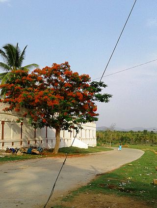
Hubli and Dharwad are twin cities in the Indian state of Karnataka. Hubli-Dharwad form the second-largest municipality and urban agglomeration of Karnataka in terms of population, after the capital Bangalore. While Dharwad is the administrative headquarters, the city of Hubli, situated about 20 km (12 mi) south-east of Dharwad, is the commercial centre and business hub of North Karnataka. The cities have a single municipal corporation called Hubli-Dharwad Municipal Corporation (HDMC).
Gudgeri is a village in the Kundgol taluk of Dharwad district in the Indian state of Karnataka. It is located in the Kundgol taluk of Dharwad district in Karnataka.
Kamadolli is a village in the southern state of Karnataka, India. It is located in the Kundgol taluk of Dharwad district in Karnataka. It is located about 30 km from the city of Hubli and about 200 km from the city of Panjim in Goa.
Saunshi is a village in the northern state of Karnataka, India. It is located in the Kundgol taluk of Dharwad district in Karnataka. largest gram Panchayat in Dharwad District.
Shelawadi or Shelavadi is a panchayat town in the southern state of Karnataka, India. It is located in the Navalgund taluk of Dharwad district in Karnataka.
Balehosur is a village in the Lakshmeshwar taluk of Gadag district in the Indian state of Karnataka.
Shigli is a city located in the Shirhatti taluk of Gadag district in Karnataka. It is situated 52 kilometres (32 mi) to the south of district headquarters Gadag, 26 km (16 mi) from Shirhatti, and 382 km (237 mi) from state capital Bangalore. Shigli's pin code is 582210, and the postal head office is Shigli.
Shishuvinahala also known as Shishunala is a village in Shiggaon taluk of Haveri district in the state of Karnataka, India
Ingalagi is a village in the Kundgol taluk of Dharwad district in the Indian state of Karnataka. Ingalagi is 30 km from Hubli and Shishuvinahala is 6 km from here.

The following outline is provided as an overview of and topical guide to Karnataka:
Gudgeri is a village in the Kundgol taluk of Dharwad district in the Indian state of Karnataka.
