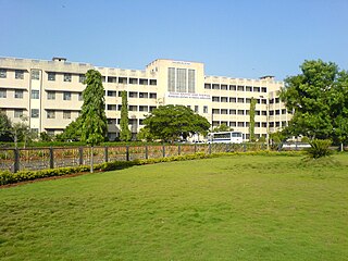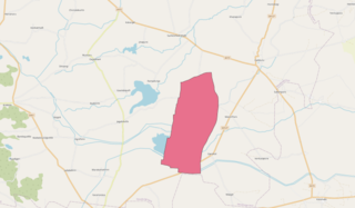
Bagalakote district, is an administrative district in the Indian state of Karnataka. The district headquarters is located in the town of Bagalakote. The district is located in northern Karnataka and borders Belgaum, Gadag, Koppal, Raichur and Bijapur. The new Bagalakote district was carved out of Vijayapura in 1997 via Government of Karnataka directive Notification RD 42 LRD 87 Part III. The bifurcated Bagalakote district consists of ten taluks — Badami, Bagalakote, Bilagi, Guledgudda, Rabkavi Banhatti, Hunagund, Ilkal, Jamakhandi and Mudhol,Teradal.

Ulikkal is a growing town in Kannur District in Kerala. It is the HQ of Ulikkal Grama Panchayat in Iritty Taluk. Kerala State Hill highway SH 59 passes through Ulikkal Town.

Dharwad is an administrative district of the state of Karnataka in southern India.
Hukkeri is a Town Municipal Council and taluka in Belgavi district in the Indian state of Karnataka.
Kalaghatagi is an administrative division, or Taluka, in the Dharwad district of the Indian state of Karnataka.
Shiggaavi is a municipal town in Haveri district in the Indian state of Karnataka.
Inchal is a village in the southern state of Karnataka, India. It is located in the Saundatti taluk of Belgaum district in Karnataka.
Kunnur is a village in the southern state of Karnataka, India. It is located in the Chikodi taluk of Belgaum district in Karnataka.
Shiraguppi is a village in the southern state of Karnataka, India. It is located in the Athni taluk of Belgaum district in Karnataka.
Ugar Budruk is a village in the southern state of Karnataka, India. It is located in the Athni taluk of Belgaum district in Karnataka. It is around 38 km from the city of Sangli, Maharashtra. Ugar comes under the Kagwad constituency.
Ajjipura is a village in the southern state of Karnataka, India. It is located in the Hanur taluk of Chamarajanagar district. It is surrounded by Hanur, Ramapura, Cowdalli and Male Mahadeshwra Hills. Ajjipura is closely surrounded by Kurubaradoddi, Suleripalya (Kanchalli), Basappanadoddi and K Gundapura. Dommanagadde, G R Nagara, Naganna Nagara, Vaddaradoddi, Ambikapura are sub-villages.
Garag is a village in the northern part of Karnataka of India. India. It is located in the Dharwad taluk of Dharwad district in Karnataka.
Gudgeri is a village in the Kundgol taluk of Dharwad district in the Indian state of Karnataka. It is located in the Kundgol taluk of Dharwad district in Karnataka.
Kalas is a village in the southern state of Karnataka, India. It is located in the Kundgol taluk of Dharwad district in Karnataka. This is the native place of Guru Govindabhatta, who is the guru of Santha Shishunal Sharif. Today we can find Samadhi of Guru Govindabhatta here. His aradhana takes place every year during summer.
Saunshi is a village in the northern state of Karnataka, India. It is located in the Kundgol taluk of Dharwad district in Karnataka. largest gram Panchayat in Dharwad District.
Yadoga is a village in Uttar kannada district in the state of Karnataka, India.
Patrame is a small, rural panchayat village on the left (east) bank of the Netravati River in Karnataka, India. Administratively, it is under Belthangady taluk, Dakshina Kannada district, Karnataka. Patrame is the only village in its gram panchayat. The village of Patrame is 26 km from its taluk headquarters Belthangady, and 8 km by road from Dharmasthala.
Kammanahalli is a small village located in Tumkur District, Turuvekere Taluk, Mayasandra Hobli and Vittalapura Post in India's Karnataka State. The village is about 12 km from Yadiyur which is famous for the Lord Siddalingeshwara Temple and is about 100 km from Bangalore.
Kurugodu Thammanahalli is a village in the southern state of Karnataka, India. It is located in the Gauribidanur taluk of Chikkaballapura district in Karnataka. It is situated 9 km away from sub-district headquarter Gauribidanur and 44 km away from district headquarter Chikkaballapura

Maladkal is a village in Karnataka state, comes under Raichur District, Devadurga Taluk and Gabbur hobli. Maladkal lies in northern part of Karnataka(Kalyana Karnataka Division). Maladkal shares its boundary with Gabbur, Ramadurga, Jagatakal, N Ganekal, Maseedpur and Atnur. Maladakal is one of the Gram Panchayat in Raichur District.


