
Hubli, officially known as Hubballi, is a city in the Indian state of Karnataka. The twin cities Hubli–Dharwad form the second largest city in the state by area and population and the largest city in North Karnataka. Hubli is in Dharwad district of Karnataka and is the taluk headquarters of Hubli City and Hubli Rural. Although it hosts the HDMC office, the district headquarters is in Dharwad.
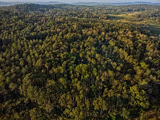
Malnad is a region in the state of Karnataka in India. Malenadu covers the western and eastern slopes of the Western Ghats or Sahyadri mountain range, and is roughly 100 kilometers in width.

Gadag is a district in the state of Karnataka, India. It was formed in 1997, when it was split from Dharwad district. As of 2011, it had a population of 1064570. The overall population increased by 13.14 percent from 1991 to 2001. Gadag district borders Bagalkot district on the north, Koppal district on the east, Vijayanagara district on the southeast, Haveri district on the southwest, Dharwad district on the west and Belgaum District on the northwest. It is famous for the many monuments from the Western Chalukya Empire. It has seven talukas: Gadag, Gajendragad, Ron, Shirhatti, Nargund, Lakshmeshwar and Mundargi.
Dharwad is an administrative district of the state of Karnataka in southern India.

Gadag-Betageri is a city municipal council in Gadag district in the state of Karnataka, India. It is the administrative headquarters of Gadag District. The original city of Gadag and its sister city Betageri have a combined city administration. The municipality of Gadag-Betageri has a population of 172,813 and an area of 54.0956 km2 (20.8864 sq mi). Kanaginahal of Gadag is the birthplace of the first co-operative society in Asia. The temples of Veera Narayana and Trikuteshwara are places of religious and historic importance.
Hosanagara is a panchayat town in Shimoga district in the Indian state of Karnataka. It is nested in western ghats of India. The World Cattle Conference with main emphasis on cow was held in month of April 2007 in Hosanagar. The different uses of cow were exhibited. Near Hosanagar there is a mutt named Sri Ramachandrapura Math, 6 km from the town.
Mundaragi is a municipal town in Gadag district in the Indian state of Karnataka. Mundargi is close to two district headquarters, being 36 kilometres (22 mi) from Gadag and 50 kilometres (31 mi) from Koppal. It is 99 kilometers from Gajendragad. Mundargi is also the taluka headquarter of the same name. Pin code of Mundaragi is 582118.
Shiggaavi is a municipal town in Haveri district in the Indian state of Karnataka.

Hubli and Dharwad are twin cities in the Indian state of Karnataka. Hubli-Dharwad form the second-largest municipality of Karnataka in terms of area, after capital and second largest city in Karnataka state. Hubli–Dharwad makes up for the second largest urban agglomeration in the state after capital. While Dharwad is the administrative headquarters, the city of Hubli, situated about 20 km (12 mi) south-east of Dharwad, is the commercial centre and business hub of North Karnataka. The cities have a single municipal corporation called Hubli-Dharwad Municipal Corporation (HDMC).
Alagawadi is a village in the southern state of Karnataka, India. It is located in the Navalgund taluk of Dharwad district in Karnataka.
Tirlapur is a village in the southern state of Karnataka, India. It is located in the Navalgund taluk of Dharwad district in Karnataka.

Belavanaki is a village in southern state of Karnataka, India. It is located in Ron Taluka of Gadag district in Karnataka. It belongs to Belagavi Division.
Shigli is a city located in the Shirhatti taluk of Gadag district in Karnataka. It is situated 52 kilometres (32 mi) to the south of district headquarters Gadag, 26 km (16 mi) from Shirhatti, and 382 km (237 mi) from state capital Bangalore. Shigli's pin code is 582210, and the postal head office is Shigli.
Adnur is a village in the southern state of Karnataka, India. It is located in the Navalgund taluk of Dharwad district.
Ahetti is a village in the southern state of Karnataka, India. It is located in the Navalgund taluk of Dharwad district in Karnataka.
Dharwad North Lok Sabha constituency was a Lok Sabha (parliamentary) constituency in Karnataka state in southern India. With the implementation of the delimitation of parliamentary constituencies in 2008, it ceased to exist.
Yamanur is a village in the southern state of Karnataka, India. It is located in the Navalgund taluk of Dharwad district in Karnataka.
Yammihatti is a village in the southern state of Karnataka, India. Yammihatti is located in the Navalgund taluk of Dharwad district in Karnataka.
Khannur is a village in the southern state of Karnataka, India. Khannur is located in the Navalgund taluk of Dharwad district in Karnataka.
Manakawad is a village in Dharwad district of Karnataka, India.