Kalokol Pillar Site

Last updated

Nasura Pillar Site
Namoratunga in Turkana, Kenya.jpg
Nasura Pillar Site in Turkana, Kenya
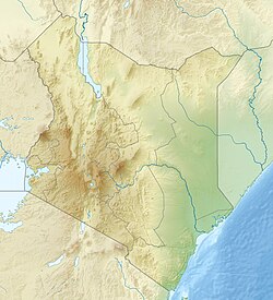
Kenya relief location map.jpg
Archaeological site icon (red).svg
Nasura Pillar Site in Nasura kangatotha ward Turkana, Kenya
Location Lake Turkana, Kenya
Regionkangatotha ward
Coordinates 3°25′22″N35°48′10″E / 3.422778°N 35.802778°E / 3.422778; 35.802778

The Nasura Pillar Site, registered as GcJh3 and also known as Namoratunga II, is an archaeological site on the west side of Lake Turkana in Kenya dating to the Pastoral Neolithic. Namoratunga means "people of stone" in the Turkana language. The site was originally believed to have been created around 300 BC, but recent excavations have yielded an older radiocarbon sample dating to 2398 +/- 44 years BC. [1]

Contents

Background

The site is located 50 Kilometres off the Lodwar – Kalokol highway, an it is easily visible on 30 metres (98 ft) from the road. The Kalokol Pillar Site contains 19 basalt pillars which are surrounded by a circular formation of stones. A number of other pillar sites surround Lake Turkana as well and date to the same time period; Lothagam North and Manemanya, for example, are communal cemeteries. These sites were likely built by the region's earliest herders. [2] Another burial site with stone cairns, Namoratunga I, [3] [4] also known as Lokori, does not have stone pillars. [5] [6] [7]

Archaeologists Mark Lynch and L.H. Robbins described the Kalokol Pillar Site in 1978 and identified it as a possible archaeoastronomical site. [8] Lynch believed the basalt pillars tie the constellations or stars to the 12-month 354-day lunar calendar of Cushitic speakers of southern Ethiopia. The pillars were said to align with seven star systems: Triangulum, Pleiades, Bellatrix, Aldebaran, Central Orion, Saiph, and Sirius. Other archaeologists have reanalyzed the archaeoastronomical evidence, [9] and an older radiocarbon date from the Kalokol Pillar Site now calls into question these interpretations. [1]

Further reading

See also

Related Research Articles

<i>Kenyanthropus</i> Oldest-known tool-making hominin

Kenyanthropus is a genus of extinct hominin identified from the Lomekwi site by Lake Turkana, Kenya, dated to 3.3 to 3.2 million years ago during the Middle Pliocene. It contains one species, K. platyops, but may also include the 2 million year old Homo rudolfensis, or K. rudolfensis. Before its naming in 2001, Australopithecus afarensis was widely regarded as the only australopithecine to exist during the Middle Pliocene, but Kenyanthropus evinces a greater diversity than once acknowledged. Kenyanthropus is most recognisable by an unusually flat face and small teeth for such an early hominin, with values on the extremes or beyond the range of variation for australopithecines in regard to these features. Multiple australopithecine species may have coexisted by foraging for different food items, which may be reason why these apes anatomically differ in features related to chewing.

The Nilotic peoples are people indigenous to the Nile Valley who speak Nilotic languages. They inhabit South Sudan, Sudan, Ethiopia, Uganda, Kenya, the Democratic Republic of the Congo, Rwanda, Burundi and Tanzania. Among these are the Burun-speaking peoples, Teso people also known as Iteso or people of Teso, Karo peoples, Luo peoples, Ateker peoples, Kalenjin peoples, Datooga, Dinka, Nuer, Atwot, Lotuko, and the Maa-speaking peoples.

<span class="mw-page-title-main">Prehistoric North Africa</span> Prehistory of North African region

The prehistory of North Africa spans the period of earliest human presence in the region to gradual onset of historicity in the Maghreb during classical antiquity. Early anatomically modern humans are known to have been present at Jebel Irhoud, in what is now Morocco, approximately 300,000 years ago. The Nile Valley region, via ancient Egypt, contributed to the Neolithic, Bronze Age and Iron Age periods of the Old World, along with the ancient Near East.

<span class="mw-page-title-main">Lake Turkana</span> Alkaline lake on the border of Ethiopia and Kenya

Lake Turkana formerly known as Lake Rudolf, is a lake in the Kenyan Rift Valley, in northern Kenya, with its far northern end crossing into Ethiopia. It is the world's largest permanent desert lake and the world's largest alkaline lake. By volume it is the world's fourth-largest salt lake after the Caspian Sea, Issyk-Kul, and Lake Van, and among all lakes it ranks 24th.

<span class="mw-page-title-main">African archaeology</span> Archaeology conducted in Africa

Africa has the longest record of human habitation in the world. The first hominins emerged 6-7 million years ago, and among the earliest anatomically modern human skulls found so far were discovered at Omo Kibish, Jebel Irhoud, and Florisbad.

<span class="mw-page-title-main">Eliye Springs</span>

Eliye Springs, also known as Ille Springs, is a remote village on the western shore of Lake Turkana in Kenya, near the mouth of Turkwel River. It is located 50 kilometres east of Lodwar and 40 kilometres south of Kalokol.

<span class="mw-page-title-main">Koobi Fora</span> Kenyan archeological site

Koobi Fora refers primarily to a region around Koobi Fora Ridge, located on the eastern shore of Lake Turkana in the territory of the nomadic Gabbra people. According to the National Museums of Kenya, the name comes from the Gabbra language:

In the language of the Gabbra people who live near the site, the term Koobi Fora means a place of the commiphora and the source of myrrh...

<span class="mw-page-title-main">Lothagam</span> Geological formation in Kenya

Lothagam is a geological formation located in Kenya, near the southwestern shores of Lake Turkana, 55 km (34 mi) from Kanapoi. It is located between the Kerio and Lomunyenkuparet Rivers on an uplifted fault block.

The Borana calendar is a calendrical system once thought to have been used by the Borana Oromo, a people living in southern Ethiopia and northern Kenya. The calendar has been claimed to be based on an earlier Cushitic calendar, developed around 300 BC found at Namoratunga. However, reconsideration of the Namoratunga site led astronomer and archaeologist Clive Ruggles to conclude that there is no relationship. The Borana calendar consist of 29.5 days and 12 months for a total 354 days in a year. The calendar has no weeks but name for each day of the month. It is a lunar-stellar calendar system.

Lokitaung is a settlement in Kenya's Turkana County, a few miles inland of northwest Lake Turkana. Lokitaung is the site of the 36-million year old Lokitaung Basalt lava flows, which lay atop Cretaceous sediments including dinosaur bones. The basalts are over 1 kilometer thick, and approximately 100 kilometers wide.

Lokori is a Turkana settlement in Kenya's North Eastern Province, adjacent to the Kerio River. The settlement's inhabitants are traditionally pastoralists. Lokori is home to a number of prehistoric Namoratunga rock art and burial sites.

<span class="mw-page-title-main">Turkana Basin</span> Large endorheic basin mainly in Kenya and Ethiopia

The greater Turkana Basin in East Africa determines a large endorheic basin, a drainage basin with no outflow centered around the north-southwards directed Gregory Rift system in Kenya and southern Ethiopia. The deepest point of the basin is the endorheic Lake Turkana, a brackish soda lake with a very high ecological productivity in the Gregory Rift.

<span class="mw-page-title-main">Pastoral Neolithic</span> Historic site in Tanzania

The Pastoral Neolithic refers to a period in Africa's prehistory, specifically Tanzania and Kenya, marking the beginning of food production, livestock domestication, and pottery use in the region following the Later Stone Age. The exact dates of this time period remain inexact, but early Pastoral Neolithic sites support the beginning of herding by 5000 BP. In contrast to the Neolithic in other parts of the world, which saw the development of farming societies, the first form of African food production was nomadic pastoralism, or ways of life centered on the herding and management of livestock. The shift from hunting to food production relied on livestock that had been domesticated outside of East Africa, especially North Africa. This period marks the emergence of the forms of pastoralism that are still present. The reliance on livestock herding marks the deviation from hunting-gathering but precedes major agricultural development. The exact movement tendencies of Neolithic pastoralists are not completely understood.

<span class="mw-page-title-main">Aiyangiyang</span> Stone Age archaeological site in Kenya

Aiyangiyang is a basin in southern Turkana, Kenya, southeast of Lodwar. It is known by nomadic pastoralists for its seasonal water availability, and is an important archaeological and paleontological site with artifacts and remains from the African Middle and Late Stone Ages.

<span class="mw-page-title-main">Karsa, Kenya</span>

Karsa is a basalt geological formation, archaeological site, and watering hole in Turkana County, Kenya, on the southeast margin of Lake Turkana. Karsa volcanic flows lie at the base of important sedimentary formations in the Turkana Basin and are an example of columnar jointed basalt.

<span class="mw-page-title-main">Nataruk</span> Archaeological site in Turkana County, Kenya

Nataruk in Turkana County, Kenya, is the site of an archaeological investigation which uncovered the remains of 27 people. It dates between 9,500 and 10,500 BP. The remains have garnered wide media attention for possible bioarchaeological evidence of interpersonal violence, i.e. prehistoric warfare.

<span class="mw-page-title-main">Lothagam North Pillar Site</span> Archaeological site in Kenya

The Lothagam North Pillar Site, registered as GeJi9, is an archaeological site at Lothagam on the west side of Lake Turkana in Kenya dating to the Pastoral Neolithic and the Holocene. It is a communal cemetery, built between 3000 BCE and 2300 BCE by the region's earliest herders as rainfall in the area decreased and Lake Turkana receded. It is thought to be eastern Africa's largest and earliest monumental cemetery.

<span class="mw-page-title-main">Nderit pottery</span> Ceramics from some African archaeological sites

Nderit pottery is a type of ceramic vessel found at archaeological sites in Africa, particularly Tanzania and Kenya. Nderit pottery, previously known as ceramic tradition "Gumban A ware," was initially documented by Louis Leakey in the 1930s at sites in the Central Rift Valley of Kenya.Stylistic characteristics of Nderit pottery discovered in the Central Rift Valley include an exterior decoration of basket-like and triangular markings into the clay’s surface. The vessels here also have intensely scored interiors that do not appear to follow a distinct pattern. Nderit Ware exemplifies the transition from Saharan wavy-line early Holocene pottery towards the basket-like designs of the middle Holocene. Lipid residue found on Nderit pottery can be used to analyze the food products stored in them by early pastoralist societies.

The Jarigole pillar site is one of the megalithic communal cemetery sites in Lake Turkana Basin in Northern Kenya associated with the Pastoral Neolithic period. The site is located on the eastern shores of Lake Turkana in the southeastern edge of the Sibiloi National Park. Situated in a recessional beach which is 70 meters above the 1973 lake level, the site includes oval platforms >1000 sq m with a circular mound, and 28 basalt pillars each weighing about 200 kg and moved over a distance of 2 km from the site. The site is believed to have been constructed by the first wave of ancient herders who migrated to the region down from the Sahara around 5000 years ago, a period marked by rapid climatic, economic and social change.

Manemanya (GcJh5) is an archaeological site within the Lake Turkana basin in northern Kenya. It is a communal burial site built almost 5,000 years ago and is associated with the advent of pastoralism in eastern Africa during the Pastoral Neolithic period. Manemanya is located 1 km east of Lesodok hill, on the western shores of Lake Turkana. Comprising nine pillar clusters situated across two distinct zones, this site lacks evident platform mounds or cairns. However, its distinctiveness is marked by the presence of cobbles in the central area, a distinguishing feature that sets it apart from the natural surface surrounding the site, presenting a notable contrast with other pillar sites in the Lake Turkana basin.

References

  1. 1 2 Hildebrand, Elisabeth A.; Shea, John J.; Grillo, Katherine M. (2011). "Four middle Holocene pillar sites in West Turkana, Kenya". Journal of Field Archaeology. 36 (3): 181–200. doi:10.1179/009346911X12991472411088. S2CID   54739651.
  2. Hildebrand, Elisabeth; et al. (2018). "A monumental cemetery built by eastern Africa's first herders near Lake Turkana, Kenya". PNAS. 115 (36): 8942–8947. doi: 10.1073/pnas.1721975115 . PMC   6130363 . PMID   30127016.
  3. 2°23′0.04″N36°8′2.52″E / 2.3833444°N 36.1340333°E
  4. Kubiak, M. (1982). "Eclipse at Namoratunga". The Observatory. 102: 211. Bibcode:1982Obs...102..210K.
  5. Helaine, Seline (1997). Encyclopaedia of the History of Science, Technology, and Medicine in Non-Western Cultures . Springer. p. 55. ISBN   978-0-7923-4066-9.
  6. Krupp, Edwin C. (2003). Echoes of the Ancient Skies: The Astronomy of Lost Civilizations. Dover. pp. 170–172. ISBN   978-0-486-42882-6.
  7. Dvorsky, George (20 August 2018). "Ancient Cemetery Packed With Hundreds of Bodies Discovered in Kenya".
  8. Robbins, L. H.; Lynch, B. M. (19 May 1978). "Namoratunga: The First Archeoastronomical Evidence in Sub-Saharan Africa". Science. 200 (4343): 766–768. Bibcode:1978Sci...200..766L. doi:10.1126/science.200.4343.766. ISSN   1095-9203. PMID   17743241. S2CID   31531630.
  9. Doyle, Laurance R.; Wilcox, Thomas J. (1986). "Statistical Analysis of Namoratunga: An Archaeoastronomical Site in Sub-Saharan Africa?". Azania. 21 (1): 125–129. doi:10.1080/00672708609511373.