Kalule

Last updated
Kalule
Kalule Municipality
Uganda location map.svg
Red pog.svg
Kalule
Location of Kalule in Uganda
Coordinates: 00°38′24″N32°31′48″E / 0.64000°N 32.53000°E / 0.64000; 32.53000
Country Flag of Uganda.svg Uganda
Region Central Uganda
District Luweero District
Elevation
3,870 ft (1,180 m)

Kalule is a town in Luweero District in Central Uganda.

Contents

Location

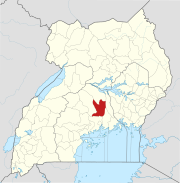
Kalule located approximately 38 kilometres (24 mi), by road, north of Kampala, Uganda's capital and largest city, on the highway to Masindi. [1] The coordinates of the town are: 00 38 24N, 32 31 48E (Latitude:0.6400; Longitude:32.5300). [2]

Overview

Kalule is one of the municipalities in Luweero District, the others being:

Kalule is a rapidly expanding metropolitan area. It is a market town that attracts agricultural produce from farmers in Bbowa, Katende and Kayindu. There are large pig farms in Kwese, a suburb of Kalule. Merchandise that does not find market in Kalule is sent to markets farther south, including to Kampala, the largest city in Uganda, and the capital of the country.

Population

The population of Kalule is not publicly known, as of November 2010.

Landmarks

In Kalule or near the town there are several landmarks, including the following:

See also

Related Research Articles

Luweero District District in Central Region of Uganda, Uganda

Luweero District is a district in the Central Region of Uganda. Luweero is the site of the district headquarters.

Masindi Place in Western Region of Uganda, Uganda

Masindi is a town in the Western Region of Uganda. It is on the road between Kampala and the Murchison Falls National Park. It is the site of the headquarters of the Masindi District.

Luweero is a town in the Central Region of Uganda. It is the main municipal, administrative, and commercial center of Luweero District.

Bombo is a town in Luweero District in the Central Region of Uganda.

Bugema University Private university in Uganda

Bugema University (BMU) is a private, co-educational Ugandan university affiliated with the Seventh-day Adventist Church. It is a part of the Seventh-day Adventist education system, the world's second largest Christian school system.

Stanbic Bank Uganda Limited (SBU) is a commercial bank in Uganda and is licensed by the Bank of Uganda, the national banking regulator.

Wobulenzi is a municipality in Katikamu sub-county, in Luweero District in the Central Region of Uganda.

Kiwoko is a small town in the Central Region of Uganda. It is one of the municipalities in Nakaseke District.

Bamunanika, whose correct phonetic spelling is Baamunaanika is a town in, Luweero District in Central Uganda.

Ziroobwe is a town in Luweero District in the Central Region of Uganda. The correct phonetic spelling in the native Luganda language is "Ziroobwe".

Gayaza–Ziroobwe Road is a road in central Uganda, connecting the towns of Gayaza in Wakiso District and Ziroobwe in Luweero District.

Ndejje is a hill in Central Uganda. The hill rises 1,240 metres (4,070 ft) above sea level. Ndejje also refers to the trading center that has developed along the southern slopes of Ndejje Hill.

Kalagala is a town in Central Uganda. It is one of the metropolitan areas in Luweero District. Other towns in the district include: Bamunanika, Bombo, Luweero, Wobulenzi and Ziroobwe.

Kiryandongo is a town in the Western Region of Uganda. It is the main municipal, administrative, and commercial center of Kiryandongo District.

Ziroobwe–Wobulenzi Road is a road in Central Uganda, connecting the towns of Ziroobwe to Bamunanika and Wobulenzi, all in Luweero District.

The Kampala–Bombo Expressway is a proposed four-lane, dual carriage highway in the Central Region of Uganda, connecting, Kampala, the capital city, and Bombo, in Luweero District.

The Kampala–Gayaza Road is a road in the Central Region of Uganda, connecting the capital city of Kampala to the town of Gayaza in the Wakiso District. The road is part of the 44 kilometres (27 mi) Kampala–Gayaza–Ziroobwe Road Project.


The Luweero–Butalangu Road is a road in the Central Region of Uganda, connecting the town of Luweero, the political headquarters of Luweero District, with the town of Butalangu, the political and administrative headquarters of Nakaseke District.

Lillian Nakate Segujja commonly Lillian Nakate, is a Ugandan civil engineer and politician who serves as the Member of Parliament representing the Luweero District Women' Constituency in the 10th Parliament.

The Kampala–Gulu Highway, also Kampala–Gulu Road, is a road connecting the capital city of Kampala, in the Buganda Region, with the city of Gulu, the largest urban centre in the Northern Region of Uganda.

References

  1. "Road Distance Between Kampala And Kalule With Map". globefeed.com. 24 August 2015. Retrieved 24 August 2015.
  2. Google (24 August 2015). "Location of Kalule At Google Maps" (Map). Google Maps . Google. Retrieved 24 August 2015.

Coordinates: 00°38′24″N32°31′48″E / 0.64000°N 32.53000°E / 0.64000; 32.53000