Olszanka is a village in the administrative district of Gmina Przywidz, within Gdańsk County, Pomeranian Voivodeship, in northern Poland. It lies approximately 6 kilometres (4 mi) south-east of Przywidz, 20 km (12 mi) south-west of Pruszcz Gdański, and 28 km (17 mi) south-west of the regional capital Gdańsk.
Lesińce is a settlement in the administrative district of Gmina Kartuzy, within Kartuzy County, Pomeranian Voivodeship, in northern Poland. It lies approximately 10 kilometres (6 mi) north-west of Kartuzy and 35 km (22 mi) west of the regional capital Gdańsk.
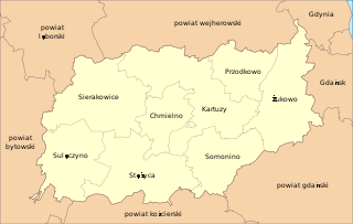
Szade Góry is a settlement in the administrative district of Gmina Kartuzy, within Kartuzy County, Pomeranian Voivodeship, in northern Poland. It lies approximately 12 kilometres (7 mi) north-west of Kartuzy and 37 km (23 mi) west of the regional capital Gdańsk.
Szklana Huta is a settlement in the administrative district of Gmina Kartuzy, within Kartuzy County, Pomeranian Voivodeship, in northern Poland. It lies approximately 9 kilometres (6 mi) south-west of Kartuzy and 37 km (23 mi) west of the regional capital Gdańsk.
Chmieleńskie Chrósty is a settlement in the administrative district of Gmina Chmielno, within Kartuzy County, Pomeranian Voivodeship, in northern Poland. It lies approximately 3 kilometres (2 mi) south-west of Chmielno, 9 km (6 mi) west of Kartuzy, and 37 km (23 mi) west of the regional capital Gdańsk.
Koszkania is a settlement in the administrative district of Gmina Chmielno, within Kartuzy County, Pomeranian Voivodeship, in northern Poland. It lies approximately 2 kilometres (1 mi) west of Chmielno, 9 km (6 mi) west of Kartuzy, and 37 km (23 mi) west of the regional capital Gdańsk.
Młyn Górny is a settlement in the administrative district of Gmina Chmielno, within Kartuzy County, Pomeranian Voivodeship, in northern Poland. It lies approximately 4 kilometres (2 mi) north-west of Chmielno, 9 km (6 mi) west of Kartuzy, and 37 km (23 mi) west of the regional capital Gdańsk.
Węgliska is a settlement in the administrative district of Gmina Chmielno, within Kartuzy County, Pomeranian Voivodeship, in northern Poland. It lies approximately 2 kilometres (1 mi) west of Chmielno, 9 km (6 mi) west of Kartuzy, and 37 km (23 mi) west of the regional capital Gdańsk.
Czarna Huta is a village in the administrative district of Gmina Przodkowo, within Kartuzy County, Pomeranian Voivodeship, in northern Poland. It lies approximately 6 kilometres (4 mi) west of Przodkowo, 6 km (4 mi) north of Kartuzy, and 28 km (17 mi) west of the regional capital Gdańsk.
Masłowo is a village in the administrative district of Gmina Przodkowo, within Kartuzy County, Pomeranian Voivodeship, in northern Poland. It lies approximately 7 kilometres (4 mi) west of Przodkowo, 7 km (4 mi) north of Kartuzy, and 29 km (18 mi) west of the regional capital Gdańsk.
Piekiełko is a settlement in the administrative district of Gmina Przodkowo, within Kartuzy County, Pomeranian Voivodeship, in northern Poland. It lies approximately 4 kilometres (2 mi) north of Przodkowo, 11 km (7 mi) north-east of Kartuzy, and 23 km (14 mi) west of the regional capital Gdańsk.
Stanisławy is a village in the administrative district of Gmina Przodkowo, within Kartuzy County, Pomeranian Voivodeship, in northern Poland. It lies approximately 4 kilometres (2 mi) west of Przodkowo, 7 km (4 mi) north of Kartuzy, and 27 km (17 mi) west of the regional capital Gdańsk.
Szarłata is a village in the administrative district of Gmina Przodkowo, within Kartuzy County, Pomeranian Voivodeship, in northern Poland. It lies approximately 4 kilometres (2 mi) west of Przodkowo, 6 km (4 mi) north of Kartuzy, and 27 km (17 mi) west of the regional capital Gdańsk.
Wilanowo is a village in the administrative district of Gmina Przodkowo, within Kartuzy County, Pomeranian Voivodeship, in northern Poland. It lies approximately 4 kilometres (2 mi) north-west of Przodkowo, 8 km (5 mi) north of Kartuzy, and 27 km (17 mi) west of the regional capital Gdańsk.
Załęskie Piaski is a settlement in the administrative district of Gmina Przodkowo, within Kartuzy County, Pomeranian Voivodeship, in northern Poland. It lies approximately 4 kilometres (2 mi) north-west of Przodkowo, 9 km (6 mi) north-east of Kartuzy, and 25 km (16 mi) west of the regional capital Gdańsk.
Karłowo is a village in the administrative district of Gmina Sierakowice, within Kartuzy County, Pomeranian Voivodeship, in northern Poland. It lies approximately 6 kilometres (4 mi) south-west of Sierakowice, 23 km (14 mi) west of Kartuzy, and 52 km (32 mi) west of the regional capital Gdańsk.
Rębienica is a village in the administrative district of Gmina Sierakowice, within Kartuzy County, Pomeranian Voivodeship, in northern Poland. It lies approximately 6 kilometres (4 mi) south-west of Sierakowice, 23 km (14 mi) west of Kartuzy, and 52 km (32 mi) west of the regional capital Gdańsk.
Srocze Góry is a village in the administrative district of Gmina Sierakowice, within Kartuzy County, Pomeranian Voivodeship, in northern Poland. It lies approximately 6 kilometres (4 mi) south-east of Sierakowice, 18 km (11 mi) west of Kartuzy, and 46 km (29 mi) west of the regional capital Gdańsk.
Pierszczewko is a village in the administrative district of Gmina Stężyca, within Kartuzy County, Pomeranian Voivodeship, in northern Poland. It lies approximately 9 kilometres (6 mi) north-east of Stężyca, 14 km (9 mi) south-west of Kartuzy, and 40 km (25 mi) west of the regional capital Gdańsk.
Sikorzyno is a village in the administrative district of Gmina Stężyca, within Kartuzy County, Pomeranian Voivodeship, in northern Poland. It lies approximately 6 kilometres (4 mi) east of Stężyca, 20 km (12 mi) south-west of Kartuzy, and 45 km (28 mi) south-west of the regional capital Gdańsk.