
Catholic Relief Services (CRS) is the international humanitarian agency of the Catholic community in the United States. Founded in 1943 by the United States Conference of Catholic Bishops, the agency provides assistance to 130 million people in more than 110 countries and territories in Africa, Asia, Latin America, the Middle East and Eastern Europe.

Parbat District (Nepali: पर्वत जिल्ला[pʌɾbʌt], is a hilly area of Nepal. It is a part of Gandaki Province and one of the seventy-seven districts of Nepal. The district, with Kusma as its district headquarters, covers an area of 494 km2 and has a population of 157,826. It is the fourth smallest district of Nepal with 47 VDCs currently. It is mainly known for the Gupteshwar Cave, which is visited by thousands of pilgrims during Shivaratri. Patheshwari Temple a notable temple in Kushma located at Katuwa Chaupari of Kushma-09. Patheshwori Mandir has many sub-temples inside like Ram Janaki Mandir, Bhagwati, Devi, Hanuman, and others. Alapeshwar cave is a cave in this district. It is also noted for the Dahere Deurali Temple, which is visited by thousands of pilgrims during Balachaturdanshai. Kamadhenu Mandir is another temple of Parbat district which is located in Khurkot development committee. Recently the Modi hydro project of 10 M.W. has been constructed in this district. Parbat's biggest playground lies in Phalewas village named Majhi Chour and Indra Chour.

Sindhupalchowk District is a part of Bagmati Province and one of the seventy-seven districts of Nepal, with an area of 2,542 km2 (981 sq mi). The district's headquarters is in Chautara. In 2006, 336,478 people resided in 79 village development committees, in 2011 there were 287,798.
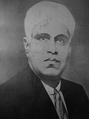
Pandit Karuppan was a poet, dramatist, and social reformer who lived in Kerala, India.

Literacy in India is a key for social-economic progress. Despite government programmes, India's literacy rate increased only 77%. The 2011 census, indicated a 2001–2011 literacy growth of 9.2%, which is slower than the growth seen during the previous decade. An old analytical 1990 study estimated that it would take until 2060 for India to achieve universal literacy at then-current rate of progress.
The status of women in Nepal has varied throughout history. In the early 1990s, like in some other Asian countries, women in Nepal were generally subordinate to men in virtually every aspect of life. Historically, Nepal has been a predominantly patriarchal society where women are generally subordinate to men. Men were considered to be the leader of the family and superior to women. Also, social norms and values were biased in favor of men. This strong bias in favor of sons in society meant that daughters were discriminated against from birth and did not have equal opportunities to achieve all aspects of development. Daughters were deprived of many privileges, including rights, education, healthcare, parental property rights, social status, last rites of dead parents, and were thought to be other's property and liabilities. In the past century, there has been a dramatic positive change in the role and status of women in Nepal, reducing gender inequality. While the 1990 Constitution guaranteed fundamental rights to all citizens without discrimination on the basis of ethnicity, caste, religion, or sex, the modernization of society, along with increased education of the general population, have also played an important role in promoting gender equality. The roles of women have changed in various ways in the modern Nepalese society.
Nepal is a secular state under the Constitution Of Nepal 2015, which was promulgated on 20 September 2015. The Constitution provides for freedom to practice one's religion. The Constitution also specifically denies the right to convert another person. The now-defunct constitution of 1990, which was in effect until 15 January 2007, described the country as a "Hindu Kingdom," although it did not establish Hinduism as the state religion. The Government generally did not interfere with the practice of other religious groups, and religious tolerance was broadly observed; however, there were some restrictions.

Besishahar is a municipality and the district headquarters of Lamjung District in Gandaki Province, Nepal. The Besishahar Municipality was formed by merging the existing Village Development Committees i.e. Besishahar, Gaunshahar, Udipur, Chandisthan, Baglungpani, Bajhakhet, Hiletaksar and Chiti and have 11 wards. Here are different castes and religions. So they have different culture. This municipality has a sub-tropical climate with deciduous forests. Annapurna II, Machhapuchhre, Lamjung Himal can be viewed from north of Besishahar Municipality.

Sisautiya सिसौटिया is a small and most populated village in the southernmost part of Nepal commonly known as Madhesh or Terai. Sisautiya is 9 km north of the Indian border, 18 km south from Brahathawa municipality 9 km west from district headquarters Malangawa. It is located at 26°52'0N 85°34'0E with an altitude of 79 metres(262 feet) There is a customs checkpoint at the border crossing. It is part of the Sarlahi district and Province No. 2. It forms the main part of the Sisautiya village development committee. At the time of the 2011 Nepal census it had a population of 13,729 people living in 2259 individual households.
Narayansthan is a village development committee in Baglung District in the Dhaulagiri Zone of central Nepal.It is located above the bank of Kali gandaki River. Now, it has become one of the major important place in baglung. They have planned to construct the domestic Airport. At the time of the 2011 Nepal census it had a population of 2,876 and had 781 houses in the town. The major castes living in the VDC are Brahman, Chhetry and Newar. There are 2 high schools - Janatadhan Higher School and Ganesh Secondary School and one campus. Krishna Gandaki Campus is at the premises of Janatadhan HSS. Ganesh Secondary School, one of the best schools in the region is known for its quality education movement. Established in 1957 [2014 BS] by Soldier Board (India), Ganesh Secondary School is one of the oldest schools. In 1964 [2021 BS], the Indian Soldier Board stopped its grant. Since there was no school support mechanism developed from the Government of Nepal, the school passed through many ups and downs. After Modern Education Act came in effect in 1971 BS [2028 BS], the school merged with Janatadhan Higher Secondary School. In 1980 [2037 BS], the school was reopened.

Banau is a village development committee in Parbat District in the Dhawalagiri Zone of central Nepal. At the time of the 1991 Nepal census it had a population of 1432 people living in 251 individual households.
Bhangara, Nepal is a village development committee of the Parbat District of the Dhawalagiri Zone in central Nepal. It is located approximately 75 km from Pokhara City and 15 km from the district headquarters Kusma. At the time of the 1991 Nepal census, it had a population of 2242 people living in 421 households.
Pakhapani is a Village Development Committee in Parbat District in the Dhawalagiri Zone of central Nepal. At the time of the 1991 Nepal census it had a population of 2969 people residing in 556 individual households. This village has three high schools located at; Pakhapani, Simley and Lamtun. It has nine wards and has a health post centre in each ward. The majority of the people have gone abroad for employment and remittance from them represents the economy. There are also numerous people who work in the British Army and Indian Army. Now this village has roads connecting all localities. Major village inside it are Kokhe(Chhetri community), Simle and Sarthan and Lamtun and many smaller villages.
Thulipokhari is a village development committee in Parbat District in the Dhawalagiri Zone of central Nepal. At the time of the 1991 Nepal census it had a population of 2753 people living in 557 individual households. Thulipokhari is one of the academic center of Parbat District. Janata Sudarshan Secondary School and Janata Sudarshan multiple campus are the major education foundation of the region. Janata Sudarshan School situated at Thulipokhari served as a major educational institution for the people of Thulipokhari and surrounding villages for years. Alumni of this school are now around the globe working as Engineers, Doctors and are successful entrepreneurs.
Manthali is a municipality and the headquarters of Ramechhap District in Bagmati Province, Nepal that was established on 2 December 2014 by merging the former village development committees Old-Manthali, Bhatauli, Chisapani, Kathjor, Bhaluwajor, Salupati and Sunarpani. It was declared the headquarters of the district on 9 March 1989. It lies on the bank of the Tamakoshi River. At the time of the 2011 Nepal census it had a population of 45,416 people living in 10,099 individual households.

Padampur is a municipality in Chitwan District in the Narayani Zone of southern Nepal. At the time of the 1991 Nepal census it had a population of 8,884 people living in 1,559 individual households. It was transferred in new location named Saguntol by Government of Nepal and completed with in 8 years i.e. from 2050 BS to 2058 BS. Previously it was at the lap of Rapati river and inside the Chitwan National Park. Flood of Rapati river in monsoon season destroy farmers crops. Wild animals also harmed their crops. Transportation, electricity, road and educational facilities were beyond people's access. It was known as one of the remote areas of the Chitwan district. In a view of agriculture, It was the best place for farmers. After the new dawn of democracy in 2046, New government was asked to shift this village for peoples safety and conservation of forest and wild animal. The cabinet of Girija Prasad Koirala was assured to shift in a convenience place soon and started the task immediately. This task was successfully done by the politician Baburam Puri of the Nepali Congress. The late Sailaja Acharya visited the people and understood their griefs and proposed to shift it next to Sagoontol near Jutpani VDC. This was a very difficult task to accomplish successfully. People from the Western Chitwan were stood against it but government took bold decision in favour of people of Padampur. Now it is about 2.5 km (1.6 mi) east to Bharatpur, district headquarters of Chitwan. Electricity, roads and transportation facility are comparatively better here. 2,800 households were there now. According to the 2001 census, the total population of the VDC was 11,336 with total households 2,137. Tharus are the dominant ethnic group with 45.89% of the total VDC population. Brahman, Kshetri, Tamang, Gurung and Newar are other castes here. Mainly banana, maize and oil are farmed here. Except ward no 1 there are deep tubewells to Irrigate farmlands. Poultry, dairy, epiculture, mushroom farming and goat keeping have great potentials here. A campus, A higher secondary school, a secondary boarding school and other 7 primary and lower secondary schools are providing education here. Health post, and Post office are too doing their best for providing services to locals. Drinking water is provided in better and modern way. Pipelines of drinking water are available within all roads (113 km) of Padampur. An NGO veterinary office is also serving and helping farmers. Since last 5 years this VDC is starting to be known as one of pocket areas of commercial banana farming of the nation. Nobody is landless here and this is the special feature here. Padampur is very attractive location for migratory view and daily people are migrating here. It is like a colonial place for settlement of people. Government has sifted it in a well planned way and that is why it is the second model VDC of Nepal. Now this village has merged in Kalika Municipality and shares 4 wards in it i.e. Kalika -9, Kalika-10, Kalika-11 and Kalika-12.
Banganga is a municipality in Kapilvastu District in the Lumbini Zone of southern Nepal. Banganga Municipality has total of 233.6 km2. According to the 2011 census, total population of the municipality is 75, 242 with population density of 322 person per km2 and density without forest is 804 persons per km2.
Tevel b’Tzedek is a non-governmental organization (NGO) based in Israel that promotes sustainable development in developing countries through the formation of thematic-based groups and community mobilization. It was established in 2007 by Rabbi Micha Odenheimer, who wanted to provide young Jewish people with meaningful social justice experience abroad with the intention of creating strong Jewish leaders invested in the idea of Tikkun Olam. Since 2007, hundreds of Jewish volunteers from communities in Israel, the United States, Germany, Ukraine, South Africa, Australia and other countries have traveled to Nepal and Haiti to participate in community development projects.
The National Dalit Commission is an Nepali constitutional body established with a view to provide safeguards against the exploitation of Dalits to promote and protect their social, educational, economic and cultural interests, special provisions were made in the Constitution. About 20 per cent of Nepal's population are Dalit.
Gender inequality in Nepal refers to disparities and inequalities between men and women in Nepal, a landlocked country in South Asia. Gender inequality is defined as unequal treatment and opportunities due to perceived differences based solely on issues of gender. Gender inequality is a major barrier for human development worldwide as gender is a determinant for the basis of discrimination in various spheres such as health, education, political representation, and labor markets. Although Nepal is modernizing and gender roles are changing, the traditionally patriarchal society creates systematic barriers to gender equality.


