Lunkhu Deurali

Last updated
Lunkhu Deurali
लुङ्खु देउराली
Mahashila 5
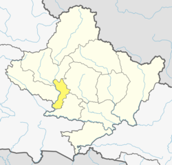
Nepal Gandaki adm location map.svg
Red pog.svg
Lunkhu Deurali
Location in Nepal
Nepal adm location map.svg
Red pog.svg
Lunkhu Deurali
Lunkhu Deurali (Nepal)
Coordinates: 28°07′N83°41′E / 28.11°N 83.68°E / 28.11; 83.68
CountryFlag of Nepal.svg    Nepal
Zone Dhawalagiri Zone
District Parbat District
Government
  Ward ChairmanChandra Bahadur Malla
Population
 (2021)
  Total3,276
Time zone UTC+5:45 (Nepal Time)

Lunkhu Deurali was a Village Development Committee in Parbat District in the Gandaki Province Nepal. At the time of the 2011 Nepal census it had a population of 2546 people living in 503 individual households. [1]

Lunkhu Deurali is one of the few VDCs in Parbat District that fully enjoys basic facilities such as electricity, drinkable water, road connection, education, communication and others. It has direct road connection with Pokhara and Kusma the later being the district headquarters. Vendors transport goods from Pokhara and Kathmandu. The majority in Lunkhu are Bramhin, followed by Dalit, Chhetri, Thakuri, Gurung and Others.

Following are the Educational Institutes in Lunkhu

Related Research Articles

<span class="mw-page-title-main">Kaski District</span> District in Gandaki Province, Nepal

Kaski District, a part of Gandaki Province, is one of the seventy-seven districts of Nepal. The name is disambiguated from Kaskikot, the ancient Kaski Kingdom.

<span class="mw-page-title-main">Parbat District</span> District in Gandaki Province, Nepal

Parbat District (Nepali: पर्वत जिल्ला, is a hilly area of Nepal. It is a part of Gandaki Province and one of the seventy-seven districts of Nepal. The district, with Kusma as its district headquarters, covers an area of 494 km2 and has a population of 157,826. It is the fourth-smallest district of Nepal with 47 village development committees currently.

Kushma is a small village and the headquarter of Parbat District in Nepal. Kushma municipality was formed by merging thirteen village development committees Pang, Khurkot, Durlung, Shivalaya, Chuwa, Katuwa Chaupari, Pipaltari and Pakuwa on 18 May 2014.

<span class="mw-page-title-main">Rupakot Gulmi</span> Village Development Committee in Lumbini Zone, Nepal

Rupakot is a Village Development Committee (VDC) in Gulmi District in the Lumbini Zone of central Nepal. Its headquarters is in Myal pokhara. It is located in about the center of Gulmi District. It is surrounded by hills. Its main religion is Hinduism. There are many temples like Chhatra Thaan, Shiddababa temple, Shiva Temple, Ram Temple, Debi deurali temple etc. The main sources of revenue for the village are agriculture and foreign employment. At the time of the 2001 Nepal census, it had a population of 3521 persons residing in 704 individual households. 76.48% of students attend school. The most populated parts of this VDC is Damuka, Sota & Ekle Pipal.

Dipsung is a village and Village Development Committee in Khotang District in the Sagarmatha Zone of eastern Nepal. At the time of the 1991 Nepal census, it had a population of 950 living in 205 individual households.

Dhikurpokhari is a suburb and former Village Development Committee in Kaski District in the Gandaki Province of northern-central Nepal. At the time of the 1991 Nepal census it had a population of 7,392 persons living in 1,427 individual households.

Bhalam was a Village Development Committee, north of Pokhara in the Valam Municipality of Kaski District, situated in the Gandaki Zone of the Western Development Region, located in northern-central Nepal. In 2015, the VDC was amalgamated with Pokhara. Bhalam is located around 950 m above sea level, 5 km from the city of Pokhara.

<span class="mw-page-title-main">Kaskikot</span> Subdivision of Pokhara Metropolitan City in Gandaki Province, Nepal

Kaskikot, commonly known as Kaski, is a Ward no. 24 of the Pokhara metropolitan city. It was earlier a part of the village development committee in Kaski District, a region in northern-central Nepal.

Bhangara, Nepal is a village development committee of the Parbat District of the Dhawalagiri Zone in central Nepal. It is located approximately 75 km from Pokhara City and 15 km from the district headquarters Kusma. At the time of the 1991 Nepal census, it had a population of 2242 people living in 421 households.

Bhuk Deurali is a village development committee in Parbat District in the Dhawalagiri Zone of central Nepal.

Deurali, Dhawalagiri is a village development committee in Parbat District in the Dhaulagiri Zone of central Nepal. At the time of the 1991 Nepal census it had a population of 2146 people living in 454 individual households.

Karkineta is a village development committee in Parbat District in the Dhawalagiri Zone of central Nepal. At the time of the 1991 Nepal census it had a population of 2166 people living in 432 individual households. Karkineta is at the height of 1609.3 meters from the sea level. The Village has one high school and college. Students from nearby villages attend the schools and college in Karkineta.

Ramja Deurali is a village development committee in Parbat District in the Dhawalagiri Zone of central Nepal. At the time of the 1991 Nepal census it had a population of 2549 people living in 497 individual households.

Santapur is a village development committee in Rautahat District in the Narayani Zone of south-eastern Nepal. At the time of the 2011 Nepal census it had a population of 25000.

<span class="mw-page-title-main">Tahu, Palpa</span> Village very development committee in Lumbini Zone, Nepal

Tahoon is a village very development committee in Palpa District in the Lumbini Zone of southern Nepal. At the time of the 1991 Nepal census it had a population of 3776.

Giruwari is one of the village located in north part of Nawalparasi district of Lumnini Zone in the western development region of Nepal. Lumbinī is a Buddhist pilgrimage site in the Rupandehi district of Nepal.[1] It is the place where Queen Mayadevi gave birth to Siddhartha Gautama, who is the Buddha. Gautama founded the Buddhist tradition. Buddha lived between roughly 563 and 483 BC. Lumbini is one of four magnets for pilgrimage that sprang up in places pivotal to the life of the Buddha, the others being at Kushinagar, Bodh Gaya and Sarnath.

<span class="mw-page-title-main">Paudhur</span> Village in Nepal in Gandaki Province

Paundur (पाउँदुर) is a central village in Kaski district of Gandaki Province of Nepal. It lies about 28 km west of the Pokhara valley and 38 km east of Kushma, Parbat. It is a part of ward no. 3 of Annapurna Gaupalika of Gandaki Province of Nepal, and was the ward no.5 and 8 of the former Dhikurpokhari VDC.It lies west of Nagdanda; nearest sub urban area. There are more than 100 houses in this village.

Mahashila Rural Municipality is a Gaunpalika in Parbat District in Gandaki of Nepal. On 12 March 2017, the government of Nepal implemented a new local administrative structure, with the implementation of the new local governance structure, Village Development Committees have been merged to form Municipalities and Gaunpalikas.

Chandra Prakash Baniya is a Nepali writer, columnist, educator and politician. He was elected as a representative from Communist Party of Nepal (Marxist–Leninist) (1978) in 1991 general election for Myagdi. He won the Madan Puraskar for his novel Maharani in 2019.

References

  1. "Nepal Census 2001", Nepal's Village Development Committees, Digital Himalaya, archived from the original on 12 October 2008, retrieved 15 November 2009.