Kushma

Last updated
KUSHMA Municipality
कुश्मा नगरपालिका
Kushma Parbat.jpg
Nepal Gandaki adm location map.svg
Red pog.svg
KUSHMA Municipality
Location in Nepal
Nepal adm location map.svg
Red pog.svg
KUSHMA Municipality
KUSHMA Municipality (Nepal)
Coordinates: 28°14′N83°41′E / 28.23°N 83.69°E / 28.23; 83.69 Coordinates: 28°14′N83°41′E / 28.23°N 83.69°E / 28.23; 83.69
CountryFlag of Nepal.svg    Nepal
Province Gandaki Province
District Parbat District
Settled18 May 2014
Government
   Mayor Ram Chandra Joshi (NC)
   Deputy Mayor Sita Kafle Lamichane (NC)
Population
 (2011)
  Total6,758
Time zone UTC+5:45 (NST)
Website http://kushmamun.gov.np
Kushma and various other sources in the mountain terrains of Nepal.

Kushma is a small village and the headquarter of Parbat District in Nepal. Kushma municipality was formed by merging thirteen village development committees Pang, Khurkot, Durlung, Shivalaya, Chuwa, Katuwa Chaupari, Pipaltari and Pakuwa on 18 May 2014. [1] [2]

Contents

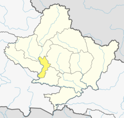
This city lies in the western part of Nepal just about 57 km from Pokhara and 12 km from Baglung. Kushma falls under Western Development Region and Dhaulagiri Zone of Nepal. It is located at 28°13'06N 83°40'45E at an altitude of 1294  meters. Kusma Bazaar straddling a narrow and high strip of land between the banks of Kaligandaki and Modi is the main market centre of the municipality. A bridge joins Kushma with Gyadichour located on the other side of the deep Modi river canyon.

History

From early times Kusma has been an important stop for travellers from Baglung on their way to Pokhara, Palpa and Butwal. Businesses catering to these travelers started to spring up leading to the establishment of a small market. As more settlers arrived Kusma was declared the headquarters of Parbat district.

Demographics

At the time of the 2011 Nepal census, Kushma Municipality had a population of 40,374. Of these, 94.9% spoke Nepali, 2.8% Gurung, 1.1% Newar, 0.3% Magar, 0.2% Maithili, 0.2% Bhojpuri, 0.1% Hindi, 0.1% Tamang and 0.3% other languages as their first language.

In terms of ethnicity/caste, 42.0% were Hill Brahmin, 13.9% Chhetri, 9.1% Sarki, 8.6% Kami, 7.6% Damai/Dholi, 4.2% Magar, 3.7% Gurung, 3.6% Newar, 2.9% Sanyasi/Dasnami and 4.4% others.

In terms of religion, 93.9% were Hindu, 4.8% Buddhist, 0.7% Muslim, 0.4% Christian and 0.2% others. [3]

Transportation

Kushma Bazaar is linked with the national road network by Pokhara Baglung Highway. Buses are the primary means of transportation in Kushma. Small size automobiles and jeeps are used for cab services within Kushma Bazar and surrounding settlements. Motorbikes are popular among the youth. Ownership of private cars in Kushma has increased in recent years. The Baglung Airport located across the Kaligandaki river in Balewa of Baglung provided air travel before its closing. Now re-opening of the airport is under consideration. [4] Recently a cable car bridge has come into operation connecting Kushma Bazar and Balewa reducing two long hours of walking to a five-minute ride.

The mechanized bridge connecting Kushma to Balewa. Getaway to paradise.jpg
The mechanized bridge connecting Kushma to Balewa.

See also

Mauja village. Tilahar

Related Research Articles

<span class="mw-page-title-main">Baglung District</span> District in Gandaki Province, Nepal

Baglung District, a part of Gandaki Province, is one of the seventy-seven districts of Nepal. The district, with Baglung as its district headquarters, covers an area of 1,784 km2 (689 sq mi) and has a population (2011) of 268,613.

<span class="mw-page-title-main">Dhading District</span> District in Bagmati Province, Nepal

Dhading District, a part of Bagmati Province, is one of the seventy-seven districts of Nepal. The district, with Dhading Besi as its district headquarters, covers an area of 1,926 square kilometres (744 sq mi), had a population of 338,658 in 2001 and 336,067 in 2011.

<span class="mw-page-title-main">Gulmi District</span> District in Lumbini Province, Nepal

Gulmi District, a part of Lumbini Province, is one of the seventy-seven districts of Nepal. The district, with Tamghas as its headquarters, covers an area of 1,149 km2 (444 sq mi), had a population of 296,654 in 2001, 280,160 in 2011 and 268,597 in 2016.

<span class="mw-page-title-main">Kaski District</span> District in Gandaki Province, Nepal

Kaski District, a part of Gandaki Province, is one of the seventy-seven districts of Nepal. The name is disambiguated from Kaskikot, the ancient Kaski Kingdom.

<span class="mw-page-title-main">Parbat District</span> District in Gandaki Province, Nepal

Parbat District (Nepali: पर्वत जिल्ला[pʌɾbʌt], is a hilly area of Nepal. It is a part of Gandaki Province and one of the seventy-seven districts of Nepal. The district, with Kusma as its district headquarters, covers an area of 494 km2 and has a population of 157,826. It is the fourth smallest district of Nepal with 47 VDCs currently.

<span class="mw-page-title-main">Syangja District</span> District in Gandaki Pradesh, Nepal

Syangja District, a part of Gandaki Province, is one of the seventy-seven districts of Nepal. The district, with Syangja bazaar as its district headquarters, covers an area of 1,164 km2 (449 sq mi) and had a population of 289,148 It lies in the hilly region at an altitude ranging from about 300 meters along the banks of Kaligandaki river up to a couple of thousands meters above the sea level. It lies at about latitude 28°4'60 North and longitude 83°52'0 East.

<span class="mw-page-title-main">Baglung</span> Place in Dhaulagiri Zone, Nepal

Baglung is a municipality in western Nepal, 275 km (171 mi) west of Kathmandu. It is the administrative headquarters of Baglung District and Dhaulagiri Zone. Baglung serves as the major center for business, finance, education, service and healthcare for the people of mid-Kali Gandaki valley that encompass Beni, Jaljala, Baglung, Kushma, Kathekhola, Galkot, Phalewas and Jaimuni local bodies. The city is located at the cross-section of Kaligandaki corridor highway and midhill highway that transverse Nepal in north–south and east–west directions respectively.

<span class="mw-page-title-main">Waling</span> Municipality in Gandaki Province, Nepal

Waling Municipality, the heart of Syangja, is a small valley covered with hills formed on 27 January 1997 by merging of the then three VDCs namely Waling, Dhanubase and Pekhubaaghkhor. It is a town and municipality in the western hilly region of Nepal. It is in the Aadhikhola valley in Syangja District, Gandaki Zone of Nepal. Waling will be the first municipality to have houses all coloured with pink and will be named as Pink City. Waling has grabbed an award for the best municipality of the country.

<span class="mw-page-title-main">Tansen, Nepal</span> Place in Western, Nepal

Tansen is a Municipality and the administrative center of Palpa District in the "hills" of central Nepal. It is located on the highway between Butwal and Pokhara, on the crest of the Mahabharat Range or Lesser Himalaya overlooking the valley of the Kaligandaki River to the north. The highway bypasses the town center on the west, protecting pedestrian amenities in the central maze of steep, narrow, winding alleys lined with Newari shop-Houses and temples.

Amalachaur is a village development committee in Baglung District in the Dhaulagiri Zone of central Nepal. At the time of the 1991 Nepal census it had a population of 5,055 and had 943 houses.

Narayansthan is a village development committee in Baglung District in the Dhaulagiri Zone of central Nepal.It is located above the bank of Kali gandaki River. Now, it has become one of the major important place in baglung. They have planned to construct the domestic Airport. At the time of the 2011 Nepal census it had a population of 2,876 and had 781 houses in the town. The major castes living in the VDC are Brahman, Chhetry and Newar. There are 2 high schools - Janatadhan Higher School and Ganesh Secondary School and one campus. Krishna Gandaki Campus is at the premises of Janatadhan HSS. Ganesh Secondary School, one of the best schools in the region is known for its quality education movement. Established in 1957 [2014 BS] by Soldier Board (India), Ganesh Secondary School is one of the oldest schools. In 1964 [2021 BS], the Indian Soldier Board stopped its grant. Since there was no school support mechanism developed from the Government of Nepal, the school passed through many ups and downs. After Modern Education Act came in effect in 1971 BS [2028 BS], the school merged with Janatadhan Higher Secondary School. In 1980 [2037 BS], the school was reopened.

<span class="mw-page-title-main">Nilkantha, Nepal</span> Municipality in Bagmati Zone, Nepal

Nilkantha or Neelkantha is one of two Municipalities in Dhading District in the Bagmati Province of central Nepal. The municipality is located around the center of the district and holds the majority of the population and facilities of the entire district. The municipality was established on 18 May 2014, merging with the existing places such as Nilkantha, Sunaula Bazar, Murali Bhanjyang, and Sangkosh VDC Nilkantha municipality is the most developed place of the dhading district as the economic and social conditions are greater than other parts of the district.

Bhangara, Nepal is a village development committee of the Parbat District of the Dhawalagiri Zone in central Nepal. It is located approximately 75 km from Pokhara City and 15 km from the district headquarters Kusma. At the time of the 1991 Nepal census, it had a population of 2242 people living in 421 households.

Katuwa Chaupari is a market center in Kushma Municipality in Gyandi of Parbat District in the Dhawalagiri Zone of central Nepal. The formerly Village Development committee was annexed to form the municipality since 18 May 2014. At the time of the 1991 Nepal census it had a population of 1838 people living in 361 individual households.

Gupteswor cave is one of the major attractions of Kusma, Parbat.

<span class="mw-page-title-main">Gandaki Province</span> Province of Nepal

Gandaki ProvinceListen ), is one of the seven federal provinces established by the current constitution of Nepal which was promulgated on 20 September 2015. Pokhara is the province's capital city. It borders the Tibet Autonomous Region of China to the north, Bagmati Province to the east, Karnali Province to the west, and Lumbini Province and Bihar of India to the south. The total area of the province is 21,504 km2 - about 14.57% of the country's total area. According to the latest census, the population of the province was 2,479,745. The newly elected Provincial Assembly adopted Gandaki Province as the permanent name by replacing its initial name Province no. 4 in July 2018. Krishna Chandra Nepali is the present chief minister of Gandaki Province.

<span class="mw-page-title-main">Jaljala Rural Municipality</span> Rural Municipality in Gandaki Province, Nepal

Jaljala is a rural municipality in Parbat District of Gandaki Province, of Nepal. It was mapped by merging the pre-existing rural development committees of Parbat District including Baskharka, Mallaj Majhphant, Lekhphant, Dhairing, Nagliwang, Banau and Salija.

<span class="mw-page-title-main">Annapurna Rural Municipality, Kaski</span> Gaunpalika in Gandaki, Nepal

Annapurna Rural Municipality, Kaski is a Gaunpalika in Kaski District in Gandaki Province of Nepal named after the Annapurna Mountain. On 12 March 2017, the Government of Nepal implemented a new local administrative structure. With the implementation of the new local administrative structure, VDSs have been replaced with Municipal and Village Councils. Annapurna Gaupalika is one of these 753 local units.

Mahashila Rural Municipality is a Gaunpalika in Parbat District in Gandaki of Nepal. On 12 March 2017, the government of Nepal implemented a new local administrative structure, with the implementation of the new local governance structure, Village Development Committees have been merged to form Municipalities and Gaunpalikas.

Modi is a Rural municipality located within the Parbat District of the Gandaki Province of Nepal. The rural municipality spans 143.6 square kilometres (55.4 sq mi) of area, with a total population of 21,284 according to a 2011 Nepal census.

References

  1. 72 new municipalities announced Archived 2014-06-18 at the Wayback Machine My Republica
  2. Govt announces 72 new municipalities Archived 2014-10-06 at the Wayback Machine The Kathmandu Post
  3. NepalMap Demographics
  4. Location of Kusma - Falling Rain Genomics