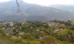
Siraha is the headquarters and municipality of Siraha District, a part of Madhesh Province, Nepal. Siraha had a population of 28,442 according to the census of 2011. and a population of 82,531 as of 2015. The current population of Siraha municipality as of census 2022, is 96,543. It has a male population of 47,306 and female population of 49,237. The present mayor of Siraha Municipality is Dr. Nabin Kumar Yadav and Deputy Mayor is Babita Kumari Sah. Both assumed office on 25 May 2022. His predecessor mayor was Asheswor Yadav and the deputy mayor was Dr. Namita Yadav. Both assumed office on 25 September 2017 and their last working day was on 24 May 2022. The town is at 80 metres (260 ft) altitude, 29 kilometres (18 mi) ESE of Janakpur.
Maneshwara is a village in Sindhupalchok District in the Bagmati Zone of central Nepal. At the time of the 1991 Nepal census, it had a population of 3,065, and had 642 houses in the village. By 2011 the population had become 3,393 in 789 households.
Pagretar is a village development committee in Sindhupalchowk District in the Bagmati Zone of central Nepal. Kothe is a populated location within the committee area. In 1991, there were 633 houses, and at the time of the 2001 Nepal census Pagretar had a population of 3,352. By 2011, the population had become 2,952 in 762 households.
Pedku is a village in Sindhupalchok District in the Bagmati Zone of central Nepal. At the time of the 2013 Nepal census it had a population of 2284 and had 408 houses in the village. In 2011 the population was 1600 in 391 households.
Chunikhel is a village and former Village Development Committee that is now part of Budanilkantha Municipality in Kathmandu District in Province No. 3 of central Nepal. At the time of the 2011 Nepal census it had a population of 4,449 living in 859 households. Chunikhel it has 15 VDC in total. It is located in 27°45'31.1"N 85°22'17.0"E just few kilometre away from heart of kathmandu. Chunikhel is gate for entering Shivapuri National park.
Goldhunga is a village and former Village Development Committee that is now part of Tarakeshwar Municipality in Kathmandu District in Province No. 3 of central Nepal. According to National Population and Housing Census 2011, there are 3,806 households in the VDC and the total population is 16,174.
Jorpati is a village and former Village Development Committee that is now part of Gokarneshwar Municipality in Kathmandu District in Province No. 3 of central Nepal. At the 2011 census it had a population of 84,567 making it one of the largest villages in the world. At the time of the 1991 Nepal census it had a population of 10,796 and had 1,988 households in it.
Gadhawa (Gadawa) is a village in the Gadhawa Rural Municipality of Dang Deukhuri District in Lumbini Province, south-western Nepal. It was, prior to September 2015, also a Village Development Committee in Dang Deukhuri District, Rapti Zone. At the time of the 2011 Nepal census the VDC had a population of 11,430 persons living in 2,176 households, up from the 2001 Nepal census of 7,877 persons living in 1,188 households.
Dhikurpokhari is a suburb and former Village Development Committee in Kaski District in the Gandaki Province of northern-central Nepal. At the time of the 1991 Nepal census it had a population of 7,392 persons living in 1,427 individual households.
Arjun Chaupari is a rural municipality in Syangja District in Gandaki Province, central Nepal. On 12 March 2017, the government of Nepal implemented a new local administrative structure consisting of 744 local units. With the implementation of the new local administrative structure, VDCs have been replaced with municipal & village councils. Arjun Chaupari is one of these 744 local units. Arjun Chaupari is created by merging Rapakot, Aruchaur, Sataudarau & (3,7) Wards of Panchamul.
Parsa is a rural municipality in Sarlahi District, a part of Province No. 2 in Nepal. It is situated 10 km East from Malangwa which is headquarter of Sarlahi. It was formed in 2016 occupying current 6 sections (wards) from previous 6 former VDCs. It occupies an area of 23.12 km2 with a total population of 21,650. The major language spoken in the rural municipality are Maithili and Bajjika.
Pipariya is a village development committee in Sarlahi District in the Janakpur Zone of south-eastern Nepal. At present it's part of Kabilasi Municipality. It includes 2 wards of Kabilasi i.e. 1&2. According to the CBS 2011 it is carrying 1,218 households and total population 6,991 including 3,581 males and 3,410 females.

Rampur is a municipality in Palpa District in Lumbini Province of West southern Nepal. According to hindu mythology, Maharishi Vasistha taught Yogavasistha to lord Rama in the cave of Rampur. Rampur is 65 km northeast from the headquarter city Tansen. The valley is bounded by Syangja District in the north, Tanahun District in the northeast, and Nawalparasi District in the east. The popular religious river Kaligandaki disconnects the boundary in the northern part.
Birendranagar is a village development committee (VDC) in Chitwan District in the Narayani Zone of southern Nepal. At the time of the 2011 Nepal census it had a population of 14,934 people living in 3,374 individual households.
Gunjanagar is a town in Bharatpur, Chitwan in Bagmati Province of southern Nepal. The former Gunjanagar VDC and Saradanagar VDC were merged on 18 May 2014 to form new Chitrawan Municipality, which later was merged with Bharatpur. At the time of the 1991 Nepal census it had a population of 11,076 people living in 2025 individual households.
Shivasatakshi is a municipality in the southeastern part of Jhapa District in the Koshi Province of eastern Nepal. The new municipality was formed by merging four existing VDCs—Shivaganj, Satasidham, Dharampur, and Panchgachhi—on 2 Dec 2014. The office of the municipality is that of the former Satasidham village development committee (VDC).

Madhyabindu is a municipality of Nawalpur District in Lumbini Zone of southern Nepal. The municipality was established on 19 September 2015 by merging the existing Tamasariya, Naya Belahani and Kolhuwa village development committees (VDCs). The center of the municipality is established in the former Tamasariya VDC of Chormara Bazaar. After merging the three VDCs population it had a total population of 28,224 according to 2011 Nepal census. After the government decision the number of Sub Metropolitan cities and municipalities has reached 12 and 217 respectively in Nepal.
Galyang is a Municipality in Syangja District in Gandaki Province, central Nepal. On 12 March 2017, the government of Nepal implemented the new local administrative structure consisting of 744 local units. With the implementation of this new local administrative structure, VDCs have been replaced with village councils. Galyang is one of these 744 local municipal units. Galyang is created by merging Malunga, Jagatradevi, (1-6,9) Wards of Pakwadi, (1,6-9) Wards of Tindobate, Tulsibhanjyang, Nibuwakharka, Pindikhola, Batuwa & (1-4,7-9) Wards of Pelakot.
Sundar Haraicha is a municipality in Morang District of Koshi Province in Nepal. It is centered around Biratchowk town which is the gateway to Biratnagar. It borders Itahari Sub- Metropolitan city to the West, Dharan Sub- Metropolitan city to the Northwest and Belbari municipality to the East and is connected by the Mahendra Highway. It is one of the fastest growing cities in the Eastern Nepal and the second largest city of Morang district after Biratnagar with 121,305 inhabitants living in 26,677 households. It consists the town centres of Biratchowk and Gothgaun which are parts of the Greater Birat Development Area which incorporates the cities of Biratnagar-Itahari-Gothgau-Biratchowk-Dharan primarily located on the Koshi Highway in Eastern Nepal, with an estimated total urban agglomerated population of 804,300 people living in 159,332 households.
Brindaban is a municipality in Rautahat District, a part of Province No. 2 in Nepal. It was formed in 2016 occupying current 9 sections (wards) from previous 9 former VDCs. It occupies an area of 95.40 km2 with a total population of 49742. It is bounded on the east by Sarlahi district, on the west by Chandrapur and Gujara municipalities, on the north by Chandrapur municipality and on the south by Gadhimai and Garuda municipalities.