Karsdorf

Last updated
Karsdorf
Karsdorf.jpg
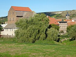
View of Karsdorf
Wappen Karsdorf.png
Location of Karsdorf within Burgenlandkreis district
Karsdorf in BLK.svgFreyburgFinneFinneKaiserpfalzKaiserpfalzNebra
Germany adm location map.svg
Red pog.svg
Karsdorf
Saxony-Anhalt location map.svg
Red pog.svg
Karsdorf
Coordinates: 51°17′N11°39′E / 51.283°N 11.650°E / 51.283; 11.650
Country Germany
State Saxony-Anhalt
District Burgenlandkreis
Municipal assoc. Unstruttal
Subdivisions3
Government
   Mayor (201926) Olaf Schumann [1]
Area
  Total19.84 km2 (7.66 sq mi)
Elevation
149 m (489 ft)
Population
 (2021-12-31) [2]
  Total1,394
  Density70/km2 (180/sq mi)
Time zone UTC+01:00 (CET)
  Summer (DST) UTC+02:00 (CEST)
Postal codes
06638
Dialling codes 034461
Vehicle registration BLK
Website www.karsdorf.de

Karsdorf is a municipality in the Burgenlandkreis district, in Saxony-Anhalt, Germany.

Contents

Geography

Karsdorf is located between Nebra (Unstrut) and Burgscheidungen on the Unstrut. In Steigra branches off in southwest direction a side road from the state road 180, which leads to Karsdorf. Districts of the municipality are Karsdorf, Wetzendorf and Wennungen.

History

Karsdorf remains

Recently, Karsdorf became known for its genetic testimonies. Haak et al. published the DNA of an older, male individual "KAR6a" from Karsdorf. He belonged to the Human mitochondrial DNA haplogroup H1 and the Y-haplogroup R, and was dated ca 5207-5070 BC, which was the time of the Early-Neolithic Linear Pottery.

The other, female individual was dated ca 2564-2475 cal. BC, the time of the Corded Ware culture (German Schnurkeramik); she belonged to the mitochondrial haplogroup H. [3] [4]

Post-Christian settlements

Evangelical Church of St. Lawrence in Karsdorf. Karsdorf-St-Laurentius.jpg
Evangelical Church of St. Lawrence in Karsdorf.

Saint Lawrence, the patron saint of the Karsdorf village church, and St. Martin of Tours for the church of the defunct village Bünisdorf (also Pinsdorf ) stand for this early origin. Karsdorf is first mentioned as a tithing place Coriledorpf in the Hersfeld Abbey tithing document dating from between 881 and 899.

Founded as a Franconian foundation on the old Franconia, Wein- or Kupferstraße Karsdorf is mentioned in 1109 as Karlestorph in a document. The name "Karlestorph" has nothing to do with the karst, which is shown in the seal, but rather is to be understood as "village of a Karl", the well-known Frankish name. The seal of the place, however, clearly refers to the local wine, which was already widespread among the Franks and in the 12th century first documented.

It was built directly on the ford by the Unstrut, to whose protection soon a castle was built on the high ridge, which was initially owned by the Counts of Mansfeld, then passed to the Noble Lords of Querfurt and their legacy after extinction in The second half of the 15th century fell largely to the House of Wettin. The research also starts from a second castle site.

Decisive for the establishment of the town and its further development was the location on the Unstrut and the Unstrutfurt, which existed only a few meters from the present Karsdorfer bridge. This ford crossed the Kupferstrasse, that old traffic artery that was a continuation of the Königsstrasse. The large copper transports went from Mansfeld to Eisleben to Nuremberg and further south.

In Karsdorf had the family of Rockhausen, gentlemen on Kirchscheidungen from 1428 to 1608 held a noble court.

At least since 1469 had Duke William III. Karsdorf as Amtsdorf completely integrated into the office Freyburg. The town was the seat of a separate district court chair with special judges and jury members. Here court was held and representatives of the associated villages summoned.

1589 lived 61 landlords in the village, including 20 Anspänner and 41 Hintersättler. After the devastating fire of 1608, which fell victim to 117 houses "including the beautiful, newly built church, parish, school, mill, brewery, bakery and Keltern", those of Rockhausen gave up their goods lying there. On 29 April 1823 a fire started by a arsonist devastated 16 houses in the village, together with numerous cattle.

By desolate villages in the area, the village center of Karsdorf was substantially enlarged, these include Siegerstedt (881/899: Sigiristat, 1589: Seigerstett ), Bünsdorf ( Bunisdorp, 1589: Bunßdorf ) and Wölbitz ( Wülbiz, 1589: Welfitz ).

Even the church is in the core of late Gothic, but the present form received it after the reconstruction in 1701 and in the 19th century. The baroque cart above the tower clock has the year of construction 1701 inscribed. The bell in the tower dates from 1666 and was made in the workshop of the Magdeburg foundry Jakob Wenzel.

In 1767, Robert Schumann's mother was baptized in the church, a plaque on the church commemorates it.

In 1815 Karsdorf arrived at the district of Querfurt in the administrative district of Merseburg in the Prussian province of Saxony . At GDR time the place belonged to the circle Nebra .

Karsdorf cement works

1927 was founded in the Karsdorf cement works. A location advantage was the presence of limestone and various clay minerals at Karsdof.

During the Second World War, many women and men from German-occupied countries had to do forced labor in the cement factory, many of whom died.

The great demand for cement in the GDR led to the plant deactivating its environmental technology, which would have made production more expensive or slower. The result was a pollution of the environment with cement dust and ashes from the firing system.

With the takeover of the work by Lafarge Group in 1990, the plant became one of the most modern and efficient plants of the Lafarge Group until the year 2000.

Economy

Industry

Karsdorf cement plant. Zementwerk Karsdorf.JPG
Karsdorf cement plant.

Main employer of the municipality is the cement plant Karsdorf, which belongs to OPTERRA GmbH. Today, about 200 people work in the cement plant, which produces for the national, but also international market. The cement industry, which originated in Karsdorf in 1928, is still influential in this town today. This development was strongly influenced by the many natural deposits of limestone, clay and sand.

Tourism

The Unstrut cycle path leads through the village. A canoe and bicycle station also offers water walkers the necessary infrastructure.

Through the Unstruttal bridge, the nearby castle in Burgscheidungen and the Nebra sky disk, tourists are increasingly driving through the town.

Memorials

Commemorative plaque for the mother of Robert Schumann. Karsdorf, Tafel fur Johanna Christiana Schnabel.jpg
Commemorative plaque for the mother of Robert Schumann.

Personalities

Related Research Articles

<span class="mw-page-title-main">Saxony-Anhalt</span> State in Germany

Saxony-Anhalt is a state of Germany, bordering the states of Brandenburg, Saxony, Thuringia and Lower Saxony. It covers an area of 20,451.7 square kilometres (7,896.4 sq mi) and has a population of 2.17 million inhabitants, making it the 8th-largest state in Germany by area and the 11th-largest by population. Its capital is Magdeburg and its largest city is Halle (Saale).

The Kyffhäuserkreis is a district in the northern part of Thuringia, Germany. Neighboring districts are the districts Mansfeld-Südharz, Saalekreis und Burgenlandkreis in Saxony-Anhalt, and the districts Sömmerda, Unstrut-Hainich-Kreis and Eichsfeld.

<span class="mw-page-title-main">Province of Saxony</span> Province of the Kingdom of Prussia

The Province of Saxony, also known as Prussian Saxony was a province of the Kingdom of Prussia and later the Free State of Prussia from 1816 until 1944. Its capital was Magdeburg.

<span class="mw-page-title-main">Nebra (Unstrut)</span> Town in Saxony-Anhalt, Germany

Nebra (official name: Nebra (Unstrut), pronounced [ˈneːbra ˈʊnʃtʁuːt]) is a town in the district of Burgenlandkreis of Saxony-Anhalt, Germany. It is situated on the river Unstrut. Nebra has become nationally and internationally known as the site where the Nebra sky disc, a notable Bronze Age artifact, was discovered. The town has a population of around 3,300.

<span class="mw-page-title-main">Únětice culture</span> Bronze Age archaeological culture in Central Europe

The Únětice culture, Aunjetitz culture or Unetician culture is an archaeological culture at the start of the Central European Bronze Age, dated roughly to about 2300–1600 BC. The eponymous site for this culture, the village of Únětice, is located in the central Czech Republic, northwest of Prague. There are about 1,400 documented Únětice culture sites in the Czech Republic and Slovakia, 550 sites in Poland, and, in Germany, about 500 sites and loose finds locations. The Únětice culture is also known from north-eastern Austria, and from western Ukraine.
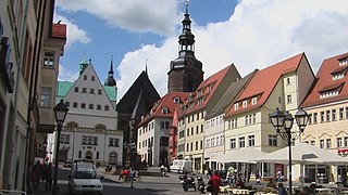
<span class="mw-page-title-main">Eisleben</span> Town in Saxony-Anhalt, Germany

Eisleben is a town in Saxony-Anhalt, Germany. It is famous as both the hometown of the influential theologian Martin Luther and the place where he died; hence, its official name is Lutherstadt Eisleben. First mentioned in the late 10th century, Eisleben is divided into old and new towns, the latter of which was created for Eisleben's miners in the 14th century. As of 2020, Eisleben had a population of 22,668. It lies on the Halle–Kassel railway.

<span class="mw-page-title-main">Querfurt</span> Town in Saxony-Anhalt, Germany

Querfurt is a town in the Saalekreis district, or Kreis, in southern Saxony-Anhalt, Germany. It is located in a fertile area on the Querne, 18 miles (29 km) west from Merseburg. In 2020, the town had a population of 10,454. The town Querfurt consists of Querfurt proper and the following 8 Ortschaften or municipal divisions: Gatterstädt, Grockstädt, Leimbach, Lodersleben, Schmon, Vitzenburg, Weißenschirmbach and Ziegelroda.

<span class="mw-page-title-main">Mansfeld</span> Town in Saxony-Anhalt, Germany

Mansfeld, sometimes also unofficially Mansfeld-Lutherstadt, is a town in the district of Mansfeld-Südharz, in Saxony-Anhalt, Germany.

<span class="mw-page-title-main">Schraplau</span> Town in Saxony-Anhalt, Germany

Schraplau is a town in the Verbandsgemeinde Weida-Land, part of the district of Saalekreis, in the State of Sachsen-Anhalt, Germany. It is situated approximately 8 km (5 mi) northeast of Querfurt. It is also considered part of the Halle-Leipzig metropolitan area.

Burgenlandkreis is a district in Saxony-Anhalt, Germany. Its area is 1,414.0 km2 (545.9 sq mi).

<span class="mw-page-title-main">Balgstädt</span> Municipality in Saxony-Anhalt, Germany

Balgstädt is a municipality in the Burgenlandkreis district, in Saxony-Anhalt, Germany. Since 2009 it has incorporated the former municipalities of Burkersroda, Größnitz and Hirschroda.

Röblingen am See is a village and a former municipality in the Mansfeld-Südharz district, Saxony-Anhalt, Germany. Since 1 January 2010, it is part of the municipality Seegebiet Mansfelder Land, of which it is the administrative centre.

<span class="mw-page-title-main">Brücken-Hackpfüffel</span> Municipality in Saxony-Anhalt, Germany

Brücken-Hackpfüffel is a municipality in the Mansfeld-Südharz district, Saxony-Anhalt, Germany. It was formed on 1 January 2009 by the merger of the former municipalities Brücken and Hackpfüffel.

<span class="mw-page-title-main">Helme</span> River in Germany

The Helme is river in central Germany that is about 65 kilometres (40 mi) long and which forms a left-hand, western tributary of the Unstrut in the states of Thuringia and Saxony-Anhalt.

<span class="mw-page-title-main">Hassegau</span>

The Hassegau was a medieval shire (Gau) in the Eastphalia region of the Duchy of Saxony. It was located in the duchy's southeastern corner; confined by the Saale river to the east and its Unstrut and Wipper tributaries to the south and north. Its most important town was Merseburg. In present-day borders, it is in the southeastern part of Saxony-Anhalt.

<span class="mw-page-title-main">Karsdorf remains</span> Neolithic human remains found in Germany

The Karsdorf remains are the bodies of more than 30 Neolithic humans who were buried in the vicinity of Karsdorf, Sachsen-Anhalt, Germany.

<span class="mw-page-title-main">Pettstädt</span>

Pettstädt, formally an independent official village in the Duchy of Saxony, is presently a portion of the city of Weißenfels in the Burgenlandkreis of Sachsen-Anhalt.

<span class="mw-page-title-main">Mitteldeutscher Verkehrsverbund</span> German public transport association

The Mitteldeutscher Verkehrsverbund (MDV) is a transport association in the German Leipzig-Halle (Saale) area. The company is based in Halle (Saale), but its head office is in Leipzig.

The Volkswagen Zwickau-Mosel Plant is an automobile factory, which was founded on 26 September 1990 in today's Zwickau district of Mosel and together with the Chemnitz plant and the Transparent Factory belongs to Volkswagen Sachsen based in Zwickau. Currently, the Zwickau plant has about 8,000 employees. Signalling a milestone the last combustion vehicle was produced on 26 June 2020.
References

  1. Bürgermeisterwahlen in den Gemeinden, Endgültige Ergebnisse, Statistisches Landesamt Sachsen-Anhalt, accessed 8 July 2021.
  2. "Bevölkerung der Gemeinden – Stand: 31. Dezember 2021" (PDF) (in German). Statistisches Landesamt Sachsen-Anhalt. June 2022.
  3. Wolfgang Haak, Iosif Lazaridis, Nick Patterson, et al., Massive migration from the steppe was a source for Indo-European languages in Europe. Nature 522, 207–211 (11 June 2015) doi:10.1038/nature14317
  4. Human skeleton, Germany I0550