
Nieuwegein is a municipality and city in the Dutch province of Utrecht. It is bordered on the north by the city of Utrecht, the provincial capital. It is separated from Vianen to the south by the river Lek and borders on IJsselstein in the southwest and Houten in the east.

The Zambezi Region, until 2013 known as the Caprivi Region, is one of the 14 regions of Namibia, located in the extreme north-east of the country. It is largely concurrent with the Caprivi Strip and takes its name from the Zambezi River that runs along its border. Katima Mulilo is its capital and the largest city, the Governor is Lawrence Sampofu. The self-governed village Bukalo belongs to this region.

Kavango was one of the thirteen regions of Namibia until it was split into the Kavango East and Kavango West Regions in 2013. Its capital was Rundu.
Sekele is the northern language of the ǃKung dialect continuum. It was widespread in southern Angola before the civil war, but those varieties are now spoken principally among a diaspora in northern Namibia. There are also a number of dialects spoken in Northernmost Namibia.

Emerson is an unincorporated community recognized as a local urban district in south central Manitoba, Canada, located within the Municipality of Emerson – Franklin. It has a population of 678 as of the 2016 Canada census.
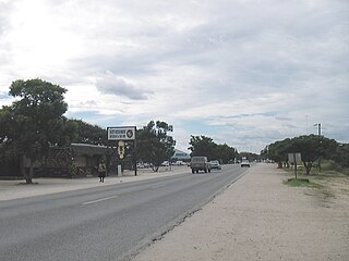
Rundu is the capital of the Kavango-East Region, northern Namibia, on the border with Angola on the banks of the Kavango River about 1,000 metres above sea level. Rundu is growing rapidly. The 2001 census counted 36,964 inhabitants; and for the 2011 census it has climbed to 63,430.
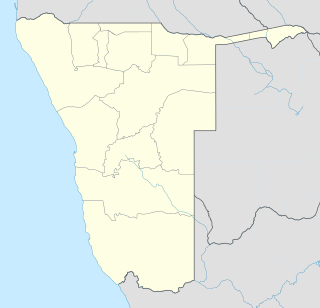
Nkurenkuru is a town on the south-western banks of the Kavango River. It is the capital of the Kavango West Region of northern Namibia, located 140 kilometres (87 mi) west of Rundu. It is also a former mission station of the Finnish Missionary Society.

Mpungu is a constituency in the Kavango West region of Namibia. It had a population of 20,787 in 2011, up from 18,660 in 2001, and 9,121 registered voters in 2020, up from 8,924 in 2004.

Kahenge was a constituency in the Kavango Region of Namibia. The district centre was the settlement of Kahenge. It had a population of 29,799 in 2011, down from 30,903 in 2001.
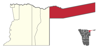
Mukwe is a constituency in the Kavango East region of Namibia. The district centre is the settlement of Mukwe. It had a population of 27,690 in 2011, up from 27,250 in 2001. The constituency contains the major settlements of Bagani, Kangongo and Divundu, and a number of small populated places such as Andara and Diyogha. As of 2020 the constituency had 16,678 registered voters.

Kapako is a constituency in the Kavango West region of Namibia. The district centre is the settlement of Kapako. It had a population of 26,983 in 2011, up from 26,263 in 2001.

Bwabwata National Park is a protected area in northeastern Namibia that was established in 2007 and covers 6,274 km2 (2,422 sq mi). It was created by merging Caprivi Game Park and Mahango Game Reserve. It is situated in the Zambezi and Kavango East regions, extending along the Caprivi Strip. It is bounded by the Okavango River to the west and the Kwando River to the east. Angola lies to the north and Botswana to the south.

Mpungu is a settlement and a former mission station of the Finnish Missionary Society in the Mpungu Constituency in the Kavango West Region in Northern Namibia. It is located ca. 40 km south-west of Nkurenkuru and is inland as opposed to other former Finnish mission stations, which were located along the Kavango River. Today, a tarred highway from Ovamboland to Kavango connects Mpungu to other places in northern Namibia.
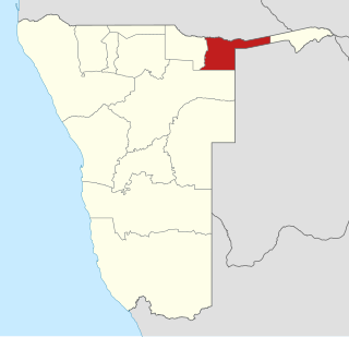
Kavango East is one of the fourteen regions of Namibia. Its capital is Rundu, its governor is Bonifatius Wakudumo. The Region was created in 2013 when the Kavango Region was split into Kavango East and Kavango West. The only self-governed settlements in Kavango East are the capital Rundu and the village of Divundu.

Kavango West is one of the fourteen regions of Namibia. Its capital and only self-governed settlement is Nkurenkuru, its governor is Sirkka Ausiku. The Region was created in 2013 when the Kavango Region was split into Kavango East and Kavango West. In the north, Kavango West borders the Cuando Cubango Province of Angola. Domestically, it borders the following regions:

34 Battalion was a light infantry battalion that was part of the SWATF.

33 Battalion or the Eastern Caprivi Battalion, was a light infantry battalion that was part of the SWATF.
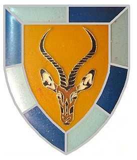
102 Battalion(pronounced as one-o-two Battalion) was a quick-reaction unit of the South West African Territorial Force. The battalion lost 36 men.

Musese is a constituency in the Kavango West region of Namibia. The administrative capital is the settlement of Rupara. As of 2020 the constituency had 6,494 registered voters.


