Mayurbhanj district is one of the 30 districts in the Odisha state of eastern India. It holds the distinction of being the largest district in Odisha by area. The district's headquarters is located in Baripada, with other major towns including Rairangpur, Karanjia, and Bahalda. As of 2011, Mayurbhanj ranks as the third-most populous district in Odisha, following Ganjam and Cuttack.

Angul district; also known as Anugul, is one of the thirty districts of Odisha in eastern India. The city of Angul is the district headquarters of Angul district. A major industrial hub of the state, the district hosts numerous industries relating to coal, bauxite and steel apart from extensive forests including the Satkosia Tiger Reserve.

Jajpur is a district of Odisha state in eastern India. The Odisha Government carried out a re-organisation of districts of Odisha in 1993. The erstwhile Cuttack district was split into multiple districts with Jajpur being one of them. The district came into being on 1 April 1993.
Kendujhar is a town with municipality in Kendujhar District in the Indian state of Odisha. It is the administrative headquarters of the Kendujhar district, and it is one of the fifth scheduled areas of Odisha.
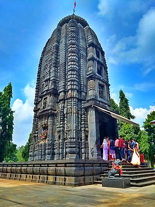
Champua is a notified area council in Kendujhar district in the state of Odisha, India.As per SC & ST department of Odisha, the Champua sub-division is under scheduled areas of Odisha. Nicholson Forest training institute is present here. The suburb has its importance as it provides a major trade route for transport of iron ore and manganese from some of the major mines of the state to the nearest port & out-state depots. It is also known for its pre-independence truss bridge built by British rulers, the judicial buildings of the same period as well as a few educational institutes who have a good reputation in the state. The river Baitarani flows by Champua, which is one of the largest rivers of the state second only to Mahanadi.

Kendujhar District, is an administrative district of Odisha. The district is one of the fifth Scheduled Areas of Odisha. The town of Kendujhar is the district headquarters. The district has three sub-divisions, Anandapur, Champua, and Kendujhar.

Kendujhar is a Lok Sabha parliamentary constituency in Odisha.
Alipore Sadar subdivision is an administrative subdivision of the South 24 Parganas district in the Indian state of West Bengal.
Anandapur is a Vidhan Sabha constituency of Kendujhar district. Area of this constituency includes Anandapur, Hatadihi block and 14 GPs of Anandapur block.
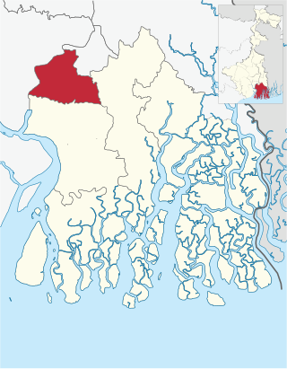
Champua is a Vidhan Sabha constituency of Kendujhar district. Area of this constituency includes Joda, Barbil, Joda block and 17 GPs of Champua block.
Ghasipura is a Vidhan Sabha constituency of Kendujhar district. Area of this constituency include Ghatgaon, Ghatagaon block, Ghasipura block and 2 GPs of Anandapur block.
Keonjhar is a Vidhan Sabha constituency of Kendujhar district. Area of this constituency includes Keonjhar, 12 GPs of Jhumpura block and 5 GPs of Banspal block.
Patna is one of the 147 Legislative Assembly constituencies of Odisha state in India. It is in Kendujhar district" and is reserved for candidates belonging to the Scheduled Tribes. It is a segment of the Kendujhar parliamentary constituency.
Telkoi is an Odisha Legislative Assembly constituency of Kendujhar district, Odisha, India.
Rimuli is a village located in Champua block, Kendujhar district in Odisha, India.
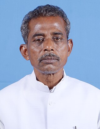
Sanatan Mahakud is a politician from Odisha, India. He represents the Champua since the year 2014.
Purusottampur, is a village in the taluk of Champua, district of Kendujhar, in the Indian state of Odisha. The total geographical area of village is 160 hectares.
Khireitangiri is a village located in Patna Tehsil in the Kendujhar District in the Indian state of Odisha.
Telkoi is a town and community development block in the Kendujhar district of Odisha state in India.

Joda Block is an administrative grouping of villages within the Champua sub-division of Keonjhar District, in Odisha, India. The administrative building is situated at Baneikala Block Square in Joda Town. The Panchayat Samiti established on 1 April 1962. The Block area covered 260.08 sq. km and as per the 2001 census, total population of this block is 1,02,012.

