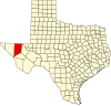
Kent, Texas

Last updated

Kent, Texas
KentTexasPS.jpg
Ruins of Kent Public School
Nickname: 
Kent Ghost Town
Relief map of Texas.png
Red pog.svg
Kent
Location of Kent in West Texas
Usa edcp relief location map.png
Red pog.svg
Kent
Kent (the United States)
Coordinates: 31°04′09″N104°13′02″W / 31.06917°N 104.21722°W / 31.06917; -104.21722
CountryUnited States
State Texas
County Culberson
Elevation
[1]
4,206 ft (1,282 m)
Population
 (2000 [2] )
  Total60
Time zone UTC-6 (Central (CST))
  Summer (DST) UTC-5 (CDT)
ZIP code
79855
Area code 432

Kent is a ghost town in Culberson County, Texas, United States.

Contents

Description

The ghost town lies just north of Interstate 10 at exit 176, 10 miles (16 km) west of the beginning of Interstate 20 and 4 miles (6.4 km) west of the Jeff Davis County line. It is sandwiched between the railroad, immediately to its north, and the Interstate. As of 2023, the store has closed and the gas pumps have been dismantled, and the houses abandoned. There is nothing now at Kent in the way of businesses, services or people.

History

As of 2005, its population was estimated at 60 residents, with three small businesses, a general store, a service station, and a post office, as well as ruins of a public school and other businesses that flourished until the 1960s.

As of 2014, only the general store remained in operation; the nearest service station is in Plateau, 18 miles (29 km) to the west along Interstate 10. It therefore has had no medical, pharmaceutical, public educational, legal, police, fire, or other governmental services beyond the post office within its boundaries; the nearest source of these is in Van Horn, 37 miles (60 km) west.

As of May 9, 2019, the post office closed and redirected customers to Van Horn. [3] No motels, hotels, trailer/RV parks, restaurants, or other tourist services are available. The surrounding county area contains semi-desert land supporting large cattle ranches.

Climate

According to the Köppen climate classification, Kent has a semiarid climate, BSk on climate maps. [4]

Climate data for Kent, Texas, 1991–2020 normals, extremes 1988–present
MonthJanFebMarAprMayJunJulAugSepOctNovDecYear
Record high °F (°C)81
(27)
85
(29)
90
(32)
96
(36)
101
(38)
108
(42)
105
(41)
106
(41)
99
(37)
93
(34)
88
(31)
80
(27)
108
(42)
Mean maximum °F (°C)72.9
(22.7)
76.9
(24.9)
83.7
(28.7)
88.7
(31.5)
95.9
(35.5)
101.1
(38.4)
98.8
(37.1)
96.1
(35.6)
92.9
(33.8)
88.2
(31.2)
80.1
(26.7)
73.9
(23.3)
102.2
(39.0)
Mean daily maximum °F (°C)57.7
(14.3)
62.6
(17.0)
69.6
(20.9)
77.6
(25.3)
85.5
(29.7)
92.5
(33.6)
90.7
(32.6)
89.9
(32.2)
83.6
(28.7)
76.8
(24.9)
66.6
(19.2)
58.6
(14.8)
76.0
(24.4)
Daily mean °F (°C)45.6
(7.6)
50.0
(10.0)
56.1
(13.4)
63.5
(17.5)
71.9
(22.2)
79.1
(26.2)
78.9
(26.1)
77.7
(25.4)
71.8
(22.1)
64.1
(17.8)
54.1
(12.3)
46.8
(8.2)
63.3
(17.4)
Mean daily minimum °F (°C)33.5
(0.8)
37.3
(2.9)
42.6
(5.9)
49.4
(9.7)
58.3
(14.6)
65.7
(18.7)
66.6
(19.2)
65.6
(18.7)
60.0
(15.6)
51.4
(10.8)
41.5
(5.3)
35.0
(1.7)
50.6
(10.3)
Mean minimum °F (°C)17.1
(−8.3)
20.3
(−6.5)
25.0
(−3.9)
32.8
(0.4)
42.8
(6.0)
55.7
(13.2)
59.5
(15.3)
58.6
(14.8)
47.6
(8.7)
34.2
(1.2)
22.9
(−5.1)
17.2
(−8.2)
13.5
(−10.3)
Record low °F (°C)6
(−14)
0
(−18)
11
(−12)
23
(−5)
32
(0)
47
(8)
52
(11)
53
(12)
34
(1)
19
(−7)
10
(−12)
0
(−18)
0
(−18)
Average precipitation inches (mm)0.66
(17)
0.41
(10)
0.42
(11)
0.62
(16)
0.93
(24)
1.26
(32)
2.70
(69)
1.72
(44)
2.01
(51)
1.09
(28)
0.58
(15)
0.66
(17)
13.06
(334)
Average snowfall inches (cm)1.5
(3.8)
0.2
(0.51)
0.1
(0.25)
0.0
(0.0)
0.0
(0.0)
0.0
(0.0)
0.0
(0.0)
0.0
(0.0)
0.0
(0.0)
0.0
(0.0)
0.2
(0.51)
1.9
(4.8)
3.9
(9.87)
Average precipitation days (≥ 0.01 in)2.62.02.21.93.54.67.45.85.34.11.92.543.8
Average snowy days (≥ 0.1 in)0.40.10.00.00.00.00.00.00.00.00.10.51.1
Source 1: NOAA [5]
Source 2: National Weather Service [6]

See also

Related Research Articles

<span class="mw-page-title-main">Van Horn, Texas</span> Town in Texas, United States

Van Horn is a town in and the seat of Culberson County, Texas, United States. According to the 2010 census, Van Horn had a population of 2,063, down from 2,435 at the 2000 census. The 2020 census results detailed a decline in population to 1,941. Van Horn's official newspaper is The Van Horn Advocate. The town is the westernmost incorporated community in the United States that uses the Central Time Zone, located on the same line of longitude as Cheyenne, Wyoming, and Colorado Springs, Colorado. Its earliest sunset in the beginning of December is the latest among incorporated towns in the United States, occurring no earlier than 5:56 pm.

<span class="mw-page-title-main">Greenville, Texas</span> City in Texas, United States

Greenville is a city in Hunt County, Texas, United States, approximately 50 miles (80 km) northeast of Dallas, Texas and 52 miles (84 km) northwest of Canton, Texas. It is the county seat and largest city of Hunt County. As of the 2020 census, the city population was 28,164.

<span class="mw-page-title-main">Valentine, Texas</span> Town in Texas, United States

Valentine is a town in Jeff Davis County, Texas, United States. Its population was 134 at the 2010 census, down from 187 at the 2000 census.

<span class="mw-page-title-main">Junction, Texas</span> City in Texas, United States

Junction is a city in and the seat of Kimble County, Texas, United States. Its population was 2,451 at the 2020 census.

<span class="mw-page-title-main">Brackettville, Texas</span> City in Texas, United States

Brackettville is a city in Kinney County, Texas, United States. The population was 1,341 at the 2020 census, down from 1,688 at the 2010 census. It is the county seat of Kinney County.

<span class="mw-page-title-main">Ferris, Texas</span> City in Texas, United States

Ferris is a city in Dallas and Ellis counties in the U.S. state of Texas. It is 20 miles (32 km) south of downtown Dallas. The population was 2,788 in 2020.

<span class="mw-page-title-main">Glenrio, New Mexico and Texas</span> Unincorporated community in the United States

Glenrio, formerly Rock Island, is an unincorporated community in both Deaf Smith County, Texas, and Quay County, New Mexico, United States. Located on the former U.S. Route 66, the ghost town sits on the Texas–New Mexico state line. It includes the Glenrio Historic District, which was listed on the National Register of Historic Places in 2007.

<span class="mw-page-title-main">Gail, Texas</span> Census-designated place in Borden County, Texas, United States

Gail is a census-designated place in and the county seat of Borden County, Texas, United States, that is ocated at the junction of U.S. Route 180 and Farm to Market Road 669. As of the 2010 Census, the population was 231.

<span class="mw-page-title-main">Imlay, Nevada</span> Unincorporated town in the State of Nevada, United States

Imlay is an unincorporated town in Pershing County, Nevada, United States. It has an elementary school, a general store, a post office, and a trading post. As of the 2010 census, the population was 171.

Wallisville is an unincorporated town in northern Chambers County, Texas, United States. According to the Handbook of Texas, the community had a population of 460 in 2000. It is located within the Greater Houston metropolitan area.

<span class="mw-page-title-main">Dryden, Texas</span> Unincorporated community in Texas, United States

Dryden is an unincorporated community in south central Terrell County, Texas, United States.

<span class="mw-page-title-main">Juno, Texas</span> Unincorporated Community in Texas, United States

Juno was a small unincorporated community in Val Verde County, Texas, United States, in the southwestern part of the state. Its last business closed in 1984, and the only remnant of Juno now is a lone ranch. What remains of the village was, by 2013, situated on private ranch land.

<span class="mw-page-title-main">Texon, Texas</span> Unincorporated hamlet in Texas, US

Texon is a small unincorporated desert hamlet in Reagan County, Texas, United States, in the western part of the state about half a mile south of the nearest highway. The town was originally an oil boomtown but is now near abandonment. There may be only one or two homes left in Texon, and no businesses or services.

Pottsville is an unincorporated community located in western Hamilton County in Central Texas, United States.

<span class="mw-page-title-main">Lobo, Texas</span> Ghost town in Culberson County, Texas, United States

Lobo is a ghost town in Culberson County, Texas, United States, that was abandoned in 1991.

Flomot is an unincorporated community in Motley County, Texas, United States. According to the Handbook of Texas, the community had an estimated population of 181 in 2000.

Dundee is an unincorporated community located in Archer County, Texas, United States. According to the Handbook of Texas, the community had a population of 12 in 2010. Dundee is located within the Wichita Falls Metropolitan Statistical Area.

<span class="mw-page-title-main">Whiteflat, Texas</span> Ghost town in Texas, United States

Whiteflat is a ghost town in Motley County, Texas, United States. The population was estimated to be 3 at the 2000 census.

Plateau is an unincorporated community in Culberson County, Texas, United States, located along the Toyah Subdivision of the Union Pacific Railroad and Interstate 10, 16 mi (26 km) east of Van Horn.

Hasima is a ghost town in Brazoria County, Texas, United States. It is located within the Greater Houston metropolitan area.

References

  1. "Kent". Geographic Names Information System . United States Geological Survey, United States Department of the Interior.
  2. Kent at TSHA
  3. American Decay - The Modern Frontiersman. "Exploring The Erie Ghost Town of Kent, TX". Youtube. Archived from the original on December 21, 2021. Retrieved July 11, 2021.
  4. Climate Summary for Kent, Texas
  5. "U.S. Climate Normals Quick Access – Station: Kent 8SE, TX". National Oceanic and Atmospheric Administration. Retrieved August 10, 2023.
  6. "NOAA Online Weather Data – NWS Midland". National Weather Service. Retrieved August 10, 2023.