Kentucky Route 32

Last updated

Elongated circle 32.svg

Kentucky Route 32

Kentucky Route 32
KY 32; mainline in red, business route in blue
Route information
Maintained by KYTC
Length174.381 mi [1]  (280.639 km)
Major junctions
West endUS 62.svg US 62 in Georgetown
Major intersections
East endElongated circle 3.svg KY 3 in Louisa
Location
Country United States
State Kentucky
Counties Scott, Harrison, Bourbon, Nicholas, Fleming, Rowan, Elliott, Lawrence
Highway system
  • Kentucky State Highway System
US 31W.svg US 31W Elongated circle 33.svg KY 33

Kentucky Route 32 (KY 32) is a 161.773-mile state highway in Kentucky that runs from US 62 in Georgetown to KY 3 in Louisa.

Contents

Route description

Major intersections

CountyLocationmi [1] kmDestinationsNotes
Scott Georgetown 0.0000.000US 62.svg US 62 (Cherry Blossom Way)Western terminus
2.3143.724US 25.svg US 25 (Cincinnati Road)
3.2165.176South plate.svg
Elongated circle 1143.svg
KY 1143 south (Georgetown Bypass)
Northern terminus of KY 1143
Stamping Ground 7.93412.769West plate.svg
Elongated circle 1688.svg
KY 1688 west (Sebree Road)
Eastern terminus of KY 1688
Sadieville 18.93030.465South plate.svg
Elongated circle 1636.svg
KY 1636 south (Indian Creek Road)
Northern terminus of KY 1636
22.31635.914South plate blue.svg
I-75.svg
I-75 south
Exit 136 from I-75 south and ramp to I-75 south
22.72336.569North plate blue.svg
I-75.svg
I-75 north
Exit 136 from I-75 north and ramp to I-75 north
23.00337.020South plate.svg
US 25.svg
US 25 south
Southern end of overlap with US 25
23.25937.432North plate.svg
US 25.svg
US 25 north
Northern end of overlap with US 25
Harrison 30.76749.515South plate.svg
Elongated circle 3044.svg
KY 3044 south (Coppage Road)
Northern terminus of KY 3044
Connersville 32.48852.284South plate.svg
Elongated circle 1842.svg
KY 1842 south (Leeslick-Connerville Pike)
Southern end of KY 1842 overlap
32.74452.696North plate.svg
Elongated circle 1842.svg
KY 1842 north (White Oak Tricum Pike)
Northern end of KY 1842 overlap
Cynthiana 34.78655.983North plate.svg
Elongated circle 3018.svg
KY 3018 north (Mill Creek Road)
Southern terminus of KY 3018
37.97561.115US 27.svg US 27 Cynthiana bypass
38.35261.722Business plate.svg
US 27.svg
South plate.svg
US 62.svg
US 27 Bus.  / US 62 south
Former route of US 27 prior to bypass. Southern end of overlap with US 27Bus/US 62. [2]
38.72262.317West plate.svg
Elongated circle 3016.svg
KY 3016 west
South end of KY 3016 overlap
38.89362.592West plate.svg
Elongated circle 3016.svg
KY 3016 west
North end of KY 3016 overlap
39.52063.601Business plate.svg
US 27.svg
North plate.svg
US 62.svg
West plate.svg
Elongated circle 36.svg
US 27 Bus.  / US 62 north / KY 36 west (Paris Pike)
Northern end of overlap with US 27-Business/US 62. West end of KY 36 overlap. [2]
40.02064.406South plate.svg
Elongated circle 982.svg
KY 982 south (South Church Street)
Northern terminus of KY 982
43.05269.285South plate.svg
Elongated circle 1940.svg
KY 1940 south (Ruddells Mill Road)
Northern terminus of KY 1940
44.79672.092South plate.svg
Elongated circle 1771.svg
KY 1771 south (Monson Road)
Northern terminus of KY 1771
45.31972.934North plate.svg
Elongated circle 1298.svg
KY 1298 north
Southern terminus of KY 1298
Bourbon 47.67076.717South plate.svg
Elongated circle 1879.svg
KY 1879 south
Northern terminus of KY 1879
Nicholas 49.41379.523West plate.svg
Elongated circle 1298.svg
KY 1298 west
Eastern terminus of KY 1298
Carlisle 54.31887.416South plate.svg
US 68.svg
East plate.svg
Elongated circle 36.svg
US 68 south / KY 36 east (Maysville Road)
Eastern end of KY 36 overlap. South end of overlap with US 68
55.27688.958North plate.svg
Elongated circle 1244.svg
KY 1244 north (Barterville Road)
Southern terminus of KY 1244
55.32889.042North plate.svg
US 68.svg
US 68 north (Maysville Road)
Northern end of US 68 overlap
57.50992.552West plate.svg
Elongated circle 36.svg
KY 36 west (Concrete Road)
West end of KY 36 overlap
57.91593.205South plate.svg
Elongated circle 3316.svg
KY 3316 south (South Elm Street)
Northern terminus of KY 3316
58.04393.411East plate.svg
Elongated circle 36.svg
KY 36 east (East Main Street)
East end of KY 36 overlap
58.78994.612North plate.svg
Elongated circle 1455.svg
KY 1455 north (Lake Road)
Southern terminus of KY 1455
60.37797.167North plate.svg
Elongated circle 1658.svg
KY 1658 north (Stoney Creek Road)
Southern terminus of KY 1658
Myers 64.355103.569South plate.svg
Elongated circle 57.svg
KY 57 south (Cassidy Creek Road)
Northern terminus of KY 57
Fleming Cowan 68.776110.684West plate.svg
Elongated circle 681.svg
KY 681 west (Buchanan Road)
Eastern terminus of KY 681
69.481111.819North plate.svg
Elongated circle 560.svg
KY 560 north (Cowan-Ewing Road)
Southern terminus of KY 560
Ewing 70.202112.979North plate.svg
Elongated circle 165.svg
KY 165 north (Pike Bluff Road)
Southern terminus of KY 165
Elizaville 73.710118.625Elongated circle 170.svg KY 170 (Junction Road)
Flemingsburg 76.488123.096South plate.svg
Elongated circle 1325.svg
KY 1325 south (Energy Road)
Northern terminus of KY 1325
77.684125.020North plate.svg
Elongated circle 11.svg
East plate.svg
Business plate.svg
Elongated circle 32.svg
KY 11 north (Bypass Road) / KY 32 Bus. east (Elizaville Avenue)
KY 32 follows the bypass (KY 11) south; 32-Business follows the former route of 32 east into Flemingsburg. [3]
81.413131.022South plate.svg
Elongated circle 11.svg
North plate.svg
Business plate.svg
Elongated circle 11.svg
KY 11 south (Mt. Sterling Road) / KY 11 Bus. north (Mt. Sterling Avenue)
End of overlap with KY 11; KY 11 continues south; KY 11 Business follows former route of KY 11 into Flemingsburg. [3]
83.475134.340South plate.svg
Elongated circle 697.svg
KY 697 south (Fleming Road)
Northern terminus of KY 697
83.696134.696West plate.svg
Business plate.svg
Elongated circle 32.svg
KY 32 Bus. west (Mockingbird Hill)
Eastern terminus of 32 Business route (former KY 32 prior to bypass being built)
84.564136.093South plate.svg
Elongated circle 111.svg
KY 111 south (Hillsboro Road)
Northern terminus of KY 111
Bluebank 87.800141.300West plate.svg
Elongated circle 156.svg
KY 156 west (Mt. Hope Road)
Eastern terminus of KY 156
Plummers Landing 93.710150.812South plate.svg
Elongated circle 1013.svg
KY 1013 south (Hillsboro-Plummers Landing Road)
West end of KY 1013 overlap
Plummers Mill 94.714152.427North plate.svg
Elongated circle 1013.svg
KY 1013 north (Plummers Landing Road)
East end of KY 1013 overlap
95.259153.305West plate.svg
Elongated circle 3303.svg
KY 3303 west (Plummers Mill Road)
Eastern terminus of KY 3303
Vanceburg 99.625160.331West plate.svg
Elongated circle 1895.svg
KY 1895 west (Maxxy Flats Road)
Eastern terminus of KY 1895
Rowan Morehead 100.683162.034West plate.svg
Elongated circle 158.svg
KY 158 west (Sharkey Road)
Eastern terminus of KY 158
102.305164.644North plate.svg
Elongated circle 785.svg
KY 785 north (Big Brushy Road)
Southern terminus of KY 785
104.132167.584North plate.svg
Elongated circle 377.svg
KY 377 north (Cranston Road)
104.453168.101Elongated circle 3531.svg KY 3531 (Viking Drive) Rowan County Senior High School
105.160169.239West plate blue.svg
I-64.svg
I-64 west Lexington
Exit 136 from I-64 West and ramp to I-64 West
105.299169.462East plate blue.svg
I-64.svg
I-64 east Ashland
Exit 136 from I-64 East and ramp to I-64 East
105.616169.972South plate.svg
Elongated circle 3319.svg
KY 3319 south (Forest Hills Drive)
Northern terminus of KY 3319
108.080173.938West plate.svg
US 60.svg
US 60 west (West Wilkinson Boulevard)
South end of overlap with US 60
108.841175.163 Morehead State University (University Boulevard)
Rodburn 110.149177.268East plate.svg
US 60.svg
US 60 east (Highway 60)
North end of overlap with US 60
116.367187.275North plate.svg
Elongated circle 3318.svg
KY 3318 north (Open Fork Road)
Southern terminus of KY 3318
Elliottville 118.013189.924West plate.svg
Elongated circle 3317.svg
KY 3317 west (CCC Trail)
Eastern terminus of KY 3317
118.419190.577North plate.svg
Elongated circle 504.svg
KY 504 north
Southern terminus of KY 504
119.597192.473South plate.svg
Elongated circle 173.svg
KY 173 south
Northern terminus of KY 173
Elliott Newfoundland 132.092212.581North plate.svg
Elongated circle 7.svg
KY 7 north
Northern end of overlap with KY 7
Sandy Hook 133.642215.076West plate.svg
Elongated circle 557.svg
KY 557 west
Milepoint for KY 7. Eastern terminus of KY 557
135.828218.594South plate.svg
Elongated circle 7.svg
KY 7 south (Main Street)
Southern end of overlap with KY 7
138.631223.105South plate.svg
Elongated circle 719.svg
KY 719 south
Northern terminus of KY 719
Isonville 141.181227.209South plate.svg
Elongated circle 706.svg
KY 706 south
West end of brief overlap of KY 706
141.297227.395North plate.svg
Elongated circle 706.svg
KY 706 north
East end of brief overlap of KY 706
141.926228.408North plate.svg
Elongated circle 486.svg
KY 486 north
Southern terminus of KY 486
Lawrence Martha 151.069243.122South plate.svg
Elongated circle 469.svg
KY 469 south
Northern terminus of KY 469
Blaine 155.058249.542North plate.svg
Elongated circle 3394.svg
KY 3394 north (Cains Creek Road)
Southern terminus of KY 3394
155.269249.881North plate.svg
Elongated circle 2562.svg
KY 2562 north (Blaine School Road)
Southern terminus of KY 2562
155.977251.021South plate.svg
Elongated circle 201.svg
KY 201 south
South end of short overlap of KY 201
156.184251.354North plate.svg
Elongated circle 201.svg
KY 201 north
North end of short overlap of KY 201
166.248267.550South plate.svg
Elongated circle 1760.svg
KY 1760 south
Northern terminus of KY 1760
168.252270.775North plate.svg
Elongated circle 3215.svg
KY 3215 north Yatesville Lake State Park
Southern terminus of KY 3215
Louisa 170.223273.947East plate.svg
Elongated circle 3395.svg
To plate.svg
US 23.svg
KY 3395 east (Isaac Branch Road) to US 23
Western terminus of KY 3395
172.239277.192North plate.svg
Elongated circle 3396.svg
KY 3396 north (Five Forks-Twomile Creek Road)
Southern terminus of KY 3396
172.824278.133Connector plate.svg
Elongated circle 32.svg
To plate.svg
US 23.svg
KY 32 Conn. to US 23 (Louisa Bypass)
Connector to US 23
173.685279.519South plate.svg
Elongated circle 2565.svg
KY 2565 south
South end of brief overlap with KY 2565
174.029280.073North plate.svg
Elongated circle 2565.svg
KY 2565 north
North end of KY 2565 overlap
174.381280.639Elongated circle 3.svg KY 3 Eastern terminus
1.000 mi = 1.609 km; 1.000 km = 0.621 mi

Flemingsburg business route

Business plate.svg

Elongated circle 32.svg

Kentucky Route 32 Business

Location Flemingsburg

Kentucky Route 32 Business (KY 32 Bus.) is a 2.7-mile-long (4.3 km) business route through Flemingsburg.

Major intersections

The entire route is in Fleming County.

Locationmi [1] kmDestinationsNotes
Flemingsburg 0.0000.000Elongated circle 11.svgElongated circle 32.svgElongated circle 57.svg KY 11  / KY 32  / KY 57 (Bypass Road / Elizaville Avenue)Western terminus; west end of KY 57 Bus. overlap
0.9211.482South plate.svg
Elongated circle 2503.svg
KY 2503 south (Clark Street)
Northern terminus of KY 2503
1.1651.875North plate.svg
Business plate.svg
Elongated circle 11.svg
West plate.svg
Elongated circle 559.svg
East plate.svg
Business plate.svg
Elongated circle 57.svg
KY 11 Bus. north / KY 559 west (West Water Street) / KY 57 Bus. east (North Main Cross Street)
East end of KY 57 Bus. overlap ; west end of KY 11 Bus. / KY 559 overlap
1.3002.092South plate.svg
Business plate.svg
Elongated circle 11.svg
East plate.svg
Elongated circle 559.svg
KY 11 Bus. south (Mt. Sterling Avenue) / KY 559 east (Fox Spring Avenue)
East end of KY 11 Bus. / KY 559 overlap
1.7192.766North plate.svg
Elongated circle 2507.svg
KY 2507 north (Rucker Street)
Southern terminus of KY 2507
1.7622.836North plate.svg
Elongated circle 2506.svg
KY 2506 north (Foster Street)
Southern terminus of KY 2506
3.6825.926Elongated circle 32.svg KY 32  / Coskery PikeEastern terminus; continues as Coskery Pike beyond KY 32
1.000 mi = 1.609 km; 1.000 km = 0.621 mi

0.135

Related Research Articles

<span class="mw-page-title-main">Interstate 265</span> Highway in Indiana and Kentucky

Interstate 265 (I-265) is a 31.21-mile (50.23 km) Interstate Highway partially encircling the Louisville metropolitan area. Starting from I-65 in the southern part of Louisville, it runs through Jefferson County, Kentucky, crosses the Ohio River on the Lewis and Clark Bridge into Indiana, meets I-65 for a second time, and then proceeds westbound to terminate at the I-64 interchange.

<span class="mw-page-title-main">Kentucky Route 9</span> Highway in Kentucky

Kentucky Route 9 is a 116.285-mile-long (187.143 km) state highway maintained by the Kentucky Transportation Cabinet (KYTC) in the U.S. state of Kentucky. The highway extends from Grayson to Newport, roughly paralleling the Ohio River between Vanceburg and Newport.

<span class="mw-page-title-main">Kentucky Route 61</span> Highway in Kentucky

Kentucky Route 61 is a 151.333-mile (243.547 km) long Kentucky State Highway extending north from the Tennessee state line in Cumberland County to Columbia in Adair County through to Greensburg in Green County. From there, the route traverses LaRue, Hardin and Bullitt counties to terminate in Jefferson County at the junction of U.S. Route 31E in downtown Louisville.

<span class="mw-page-title-main">Kentucky Route 3</span> State highway in Kentucky

Kentucky Route 3 is a 79.158-mile-long (127.392 km) state highway in the U.S. state of Kentucky.
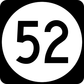
<span class="mw-page-title-main">Kentucky Route 67</span> State highway in Kentucky, USA

Kentucky Route 67 is a Kentucky State Highway originating at a junction with Interstate 64 (I-64) near Grayson, Kentucky in Carter County. The route continues through rural ridgetops in Greenup County and briefly touches Boyd County before terminating at U.S. Route 23 (US 23) in Greenup County in between Wurtland and Greenup. KY 67 is also known as the Industrial Parkway.

<span class="mw-page-title-main">Hal Rogers Parkway</span> Highway in Kentucky

The Hal Rogers Parkway, formerly named the Daniel Boone Parkway, is a freeway connecting Somerset and Hazard in southeastern Kentucky. A former toll road, it opened in November 1971, and the tolls were removed June 1, 2003. The original extent of the highway was to be 65.70 miles (105.73 km) with that mileage to have been included with an unconstructed limited-access London bypass and what is east of this area. The original portion of the road is designated unsigned Kentucky Route 9006. An extension of the Hal Rogers Parkway name west along Kentucky Route 80 (KY 80) to U.S. Route 27 (US 27) in Somerset was made in 2015 bringing the total mileage to 91.135 miles (146.668 km).

<span class="mw-page-title-main">Kentucky Route 11</span> Highway in Kentucky

Kentucky Route 11 (KY 11) is an American highway maintained by the Kentucky Transportation Cabinet that runs from Maysville to Barbourville. The route from Maysville to Mount Sterling is being upgraded on a new alignment as part of a "macro-corridor" within the state of Kentucky.

<span class="mw-page-title-main">Kentucky Route 90</span> State highway in Kentucky, USA

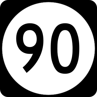
Kentucky Route 90 is a major east–west state highway in southern Kentucky. The route is 134.734 miles (216.833 km) long, and it traverses Barren, Metcalfe, Cumberland, Clinton, Wayne, Pulaski, McCreary and Whitley Counties in southern Kentucky. It runs from the KY 70 junction near Interstate 65 in Cave City to US 25W about 8 miles (13 km) from Interstate 75.

<span class="mw-page-title-main">Kentucky Route 212</span> State highway in Kentucky, United States

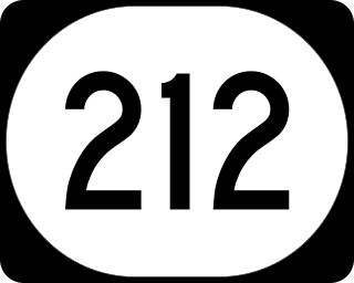
Kentucky Route 212 is a short state highway located in Boone County, in the northern region of the U.S. state of Kentucky. The highway is approximately 1.3 miles (2.1 km) long, and partially constructed as a freeway, with the rest being a divided highway. The roadway links Interstate 275 (I-275) to the Cincinnati/Northern Kentucky International Airport, and has been designated as a connector route by the Federal Highway Administration (FHWA). A road first appeared near the location of KY 212 around 1937. A short road was built in the location of KY 212 when the U.S. Army Air Corps built the predecessor to the CVG Airport. The road was reconstructed to a divided highway in 1972, but was part of KY 1334 until 1974 or later, when KY 212 was designated, and KY 1334 was rerouted via Loomis Road and Whitson Drive to end at KY 20.

<span class="mw-page-title-main">U.S. Route 79 in Kentucky</span>

U.S. Route 79 enters Kentucky from Tennessee in Todd County west of Guthrie and runs northeast into Logan County, terminating at a junction with US 68, US 68 Business, and Kentucky Route 80 in Russellville. US 79 remains a two-lane road throughout Kentucky.

<span class="mw-page-title-main">Kentucky Route 1508</span> Highway in Kentucky

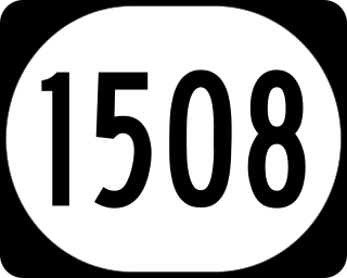
Kentucky Route 1508 is a state highway located in northwestern Kentucky. The route starts at KY 109, west of Sturgis. It travels westward to unincorporated area of Caseyville, and turns north near the Ohio River. KY 1508 then travels through the community of Dekoven, before ending at KY 109, northwest of its southern terminus. The route was designated around 1967, after the KY 130 designation was removed from the section in Caseyville, which was connected to the community since 1939.

The Russellville Bypass is a beltway around Russellville in Logan County in south central Kentucky. The 12.260-mile-long (19.731 km) highway comprises overlapping portions of U.S. Route 68 and Kentucky Route 80, US 79, and US 431. The north side of the circumferential highway was conceived in the 1980s to relieve traffic in downtown Russellville and as part of greater improvements along the US 68 corridor. The first two phases of the ring road, from US 79 on the west side to US 68 on the east side, were constructed in the 1990s. The state decided to complete the orbital road in the 2000s to resolve continuing traffic bottlenecks along US 431 and US 79 on the south side. The second two phases of the beltline were started in 2010 and completed in 2017. Construction of the Russellville Bypass led to a series of route changes over 20 years involving the city's U.S. Highways, special routes, and state-numbered highways.

<span class="mw-page-title-main">Kentucky Route 1977</span> State highway in Kentucky, United States

Kentucky Route 1977 is an urban secondary state highway located entirely in northern Fayette County in East Central Kentucky. The 6.255 miles (10.066 km) mainly traverses the northwestern outskirts of Lexington.

<span class="mw-page-title-main">Kentucky Route 1978</span> State highway in Kentucky, United States

Kentucky Route 1978, known locally as Greendale Road, is an urban secondary state highway located entirely in northern Fayette County in East Central Kentucky. The 2.242 miles (3.608 km) mainly traverses the northwestern outskirts of Lexington.

<span class="mw-page-title-main">Kentucky Route 1968</span> State highway in Kentucky, United States

Kentucky Route 1968, known locally as Parkers Mill Road, is a secondary state highway located entirely in western Fayette County in East Central Kentucky. The 2.242 miles (3.608 km) mainly traverses the western suburbs of Lexington.

<span class="mw-page-title-main">Kentucky Route 3716</span> Highway in Kentucky, United States

Kentucky Route 3716 (KY 3716) is a 4.277-mile-long (6.883 km) state secondary highway in central Kenton County. The highway extends from KY 1501 in Covington north to KY 16 in Taylor Mill. KY 3716 was established in 2015, extended west in 2018, and was extended again in December 2022 after the reroute of KY 1501.

<span class="mw-page-title-main">Kentucky Route 1501</span> Highway in Kentucky, United States

Kentucky Route 1501 (KY 1501) is a 2.496-mile-long (4.017 km) state secondary highway in central Kenton County. Known as Hands Pike, the highway extends from KY 17 east to KY 16 within Covington. KY 1501 was established by 1983 and is expected to be relocated at is western end in 2023.

References

  1. 1 2 3 Commonwealth of Kentucky. "Official DMI Route Log" . Retrieved March 10, 2015.
  2. 1 2 "State Primary Road System Harrison County" (PDF). KYTC. Retrieved 2015-03-10.
  3. 1 2 "State Primary Road System Fleming County" (PDF). KYTC. Retrieved 2015-03-10.
Template:Attached KML/Kentucky Route 32
KML is not from Wikidata