
Lawrence County is a county located in the U.S. state of Kentucky. Its county seat is Louisa. The county is named for James Lawrence, and co-founded by Isaac Bolt, who served as a Lawrence County Commissioner and Justice of the Peace.
Yatesville can refer to these places in the United States:

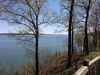
Kentucky Lake is a major navigable reservoir along the Tennessee River in Kentucky and Tennessee. It was created in 1944 by the Tennessee Valley Authority's impounding of the Tennessee River via Kentucky Dam for flood control and hydroelectric power. The 160,309-acre (649 km2) lake is the largest artificial lake by surface area in the United States east of the Mississippi River, with 2,064 miles (3,322 km) of shoreline. Nearby Lake Barkley is larger by volume. Kentucky Lake has a flood storage capacity of 4,008,000 acre⋅ft (4.944 km3), more than 2.5 times the next largest lake in the TVA system.

Kentucky Route 3 is a 79.158-mile-long (127.392 km) state highway in the U.S. state of Kentucky.

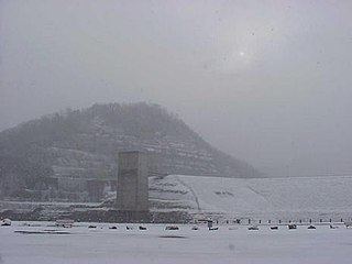
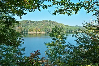
Yatesville Lake is a reservoir in Lawrence County, Kentucky in the far eastern part of the state, close to the town of Louisa.
Dale Hollow Lake State Resort Park is a Kentucky state park located on the Frogue Peninsula on the northern shore of Dale Hollow Reservoir in Clinton and Cumberland counties. The park comprises 3,400 acres (1,400 ha).

Greenbo Lake State Resort Park in Kentucky is a resort park in the northeastern part of the commonwealth, close to the town of Greenup, Kentucky in Greenup County on Kentucky State Route 1. It features a 36-room lodge named for Greenup County resident and writer Jesse Hilton Stuart, a 63-site campground with 35 primitive sites, a swimming pool with slides, two tennis courts, an 18-hole miniature golf course, an amphitheater and a scuba refuge area. The lodge contains a 232-seat dining room. It is centered on the 300-acre (120 ha) Greenbo Lake that features a boat dock and marina. There are over 25 miles (40 km) of hiking, biking and horseback trails. The park hosts a variety of community events each year including a quilt show, murder mystery dinner theaters, scrapbooking, and a 5K race.

Breaks Interstate Park is a bi-state state park located partly in southeastern Kentucky and mostly in southwestern Virginia, in the Jefferson National Forest, at the northeastern terminus of Pine Mountain. Rather than their respective state park systems, it is instead administered by an interstate compact between the states of Virginia and Kentucky. It is one of several interstate parks in the United States, but only one of two operated jointly under a compact rather than as two separate state park units. The Virginia Department of Conservation and Recreation and the Kentucky Department of Parks are still major partner organizations, however.

The Eastern Kentucky Coalfield is part of the Central Appalachian bituminous coalfield, including all or parts of 30 Kentucky counties and adjoining areas in Ohio, West Virginia, Virginia and Tennessee. It covers an area from the Allegheny Mountains in the east across the Cumberland Plateau to the Pottsville Escarpment in the west. The region is known for its coal mining; most family farms in the region have disappeared since the introduction of surface mining in the 1940s and 1950s.
Fishtrap Lake is a 1,130-acre (5 km2) reservoir in Pike County, Kentucky. Dedicated by President Lyndon B. Johnson in 1968, the lake was formed by the impounding of the Levisa Fork of the Big Sandy River at the 195-foot-high Fishtrap Dam by the United States Army Corps of Engineers.
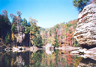
Grayson Lake State Park is a Kentucky state park located in Carter and Elliott counties, near the city of Grayson, Kentucky. The park has an area of 1,512 acres (612 ha). It has facilities for boating, water skiing, swimming, fishing and golfing. It is served by Kentucky Route 7, which was re-routed as a result of the lake's creation.

General Butler State Resort Park is a state park located near Carrollton, Kentucky in Carroll County. The park is named for General William O. Butler, a soldier in both the War of 1812 and the Mexican–American War. The 791-acre (320 ha) park features a lodge, cabins and campground, fishing and canoeing on Butler Lake, trails for hiking and mountain biking.
Kenlake State Resort Park is a park located on the western shore of Kentucky Lake. The park's main entrance and most of its facilities are located in Marshall County; the park also extends into Calloway County. The mailing address of the park is Hardin, Kentucky; however, it is located much closer to the unincorporated community of Aurora, Kentucky. The nearest town of substantial size is Murray. The park encompasses 1,795 acres (726 ha) of land, 160,300 acres (64,900 ha) of water, and features climate-controlled indoor tennis courts. It was Kentucky's first state resort park. Along with Lake Barkley State Resort Park and Kentucky Dam Village State Resort Park, Kenlake State Resort Park is part of the Land Between the Lakes National Recreation Area, originally organized by the Great Depression–era Tennessee Valley Authority (TVA).
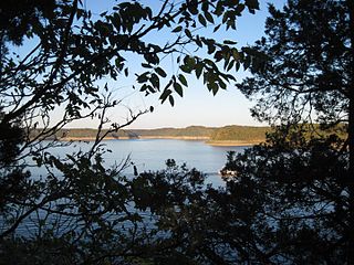
Lake Cumberland State Resort Park is a state park located on the northern shore of Lake Cumberland near Jamestown, Kentucky in Russell County. The park itself encompasses 3,117 acres (1,261 ha), while the lake, its major feature, covers approximately 50,250 acres (20,340 ha).
Paintsville Lake State Park is a park located just west of Paintsville, Kentucky in Johnson County. The park itself encompasses 242 acres (98 ha), while Paintsville Lake, its major feature, covers approximately 1,139 acres (461 ha) extending into parts of Morgan County.
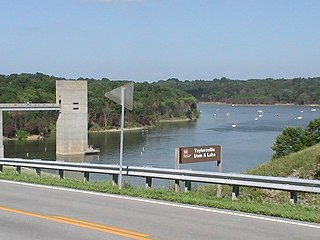
Taylorsville Lake State Park is a park encompassing 1,200 acres (490 ha) in Spencer County, Kentucky, roughly midway between Louisville and Lexington. Taylorsville Lake, its major feature, extends into parts of Anderson County and Nelson County.
East Fork State Park is 4,870-acre (1,970 ha) public recreation area located around the East Fork of the Little Miami River in Clermont County, twenty miles (32 km) southeast of central Cincinnati, Ohio, in the United States. It has camping, hiking, swimming, and boating opportunities. The state park has hosted junior and collegiate rowing races, including the US Rowing Youth National Championships. The park's main feature is William H. Harsha Lake, a 2,107-acre (853 ha) reservoir created in 1978. The lake's large earthen dam and smaller saddle dams are operated by the U.S. Army Corps of Engineers.
Fishtrap Lake State Park is a park located southeast of Pikeville, Kentucky in Pike County. The park opened to the public in 2003. Fishtrap Lake, the park's main feature, covers approximately 1,130 acres (460 ha).
Nolin Lake State Park is a park located in Edmonson County, Kentucky, United States. The park encompasses 333 acres (135 ha) while Nolin Lake, the park's main feature, covers 5,795 acres (2,345 ha). The park is located on the northern perimeter of Mammoth Cave National Park.


